Property Record
7360 Skidaway Rd, Savannah, GA 31406


NEARBY LISTINGS FOR SALE OR LEASE
Property Detail
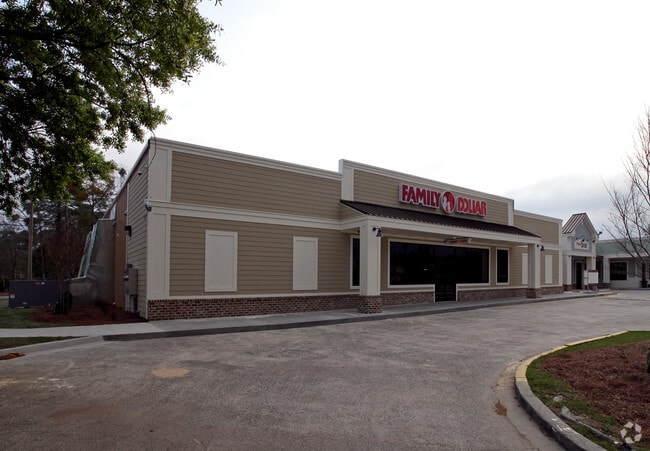
7360 Skidaway Rd
1037710002
Norwood Manor
Communitycenter
PHASE I RECOMBINATION OF THE SHO PS AT ISLE OF HOPE PRB 46P 14
X
Chatham
13051C0277G
Georgia
2024
2.82 AC
2025
Outlying Chatham County
010200
Savannah
22,760 SF
Savannah, GA
DEMOGRAPHICS near 7360 Skidaway Rd
1 Mile
3 Mile
5 Mile
2024 Total Population
5,229
32,040
111,487
2029 Population
5,358
32,944
115,038
Pop Growth 2024-2029
+ 2.47%
+ 2.82%
+ 3.19%
Average Age
42
41
41
2024 Total Households
2,019
12,451
45,777
HH Growth 2024-2029
+ 2.63%
+ 2.92%
+ 3.31%
Median Household Inc
$73,076
$62,229
$59,071
Avg Household Size
2.50
2.30
2.30
2024 Avg HH Vehicles
2.00
2.00
2.00
Median Home Value
$217,977
$246,575
$258,948
Median Year Built
1980
1973
1972
Nearby Places
Map Layers
Map Styles
 Street
 Aerial
- Restaurants
- Banks
- Shops
- Fitness
- Groceries
PUBLIC TRANSPORTATION
AIRPORT
Savannah/Hilton Head International
DRIVE
WALK
Distance
Savannah/Hilton Head International
30 min
17.4 mi
Hilton Head
DRIVE
WALK
Distance
Hilton Head
71 min
44.6 mi
Freight Ports
Georgia Ports - Savannah
DRIVE
WALK
Distance
Georgia Ports - Savannah
23 min
13.3 mi
Nearby Properties
Address
Land Use
TOTAL SIZE
Lot Size
Zoning
Address
Land Use
TOTAL SIZE
Lot Size
Zoning
559,705 SF
44.25 AC
BC
Address
Land Use
TOTAL SIZE
Lot Size
Zoning
6,245 SF
13.52 AC
PUDISB
Address
Land Use
TOTAL SIZE
Lot Size
Zoning
52,272 SF
82.59 AC
RIP
Address
Land Use
TOTAL SIZE
Lot Size
Zoning
100 SF
15.62 AC
RM25
Address
Land Use
TOTAL SIZE
Lot Size
Zoning
8,480 SF
16.50 AC
PUDM25
Address
Land Use
TOTAL SIZE
Lot Size
Zoning
14,249 SF
14.92 AC
BC
Address
Land Use
TOTAL SIZE
Lot Size
Zoning
59.65 AC
RIP
Address
Land Use
TOTAL SIZE
Lot Size
Zoning
85,606 SF
16.30 AC
BC
Address
Land Use
TOTAL SIZE
Lot Size
Zoning
2,226 SF
67.62 AC
IP
Address
Land Use
TOTAL SIZE
Lot Size
Zoning
100 SF
9.78 AC
R1
Address
Land Use
TOTAL SIZE
Lot Size
Zoning
34,945 SF
18.22 AC
I-P
Address
Land Use
TOTAL SIZE
Lot Size
Zoning
15,792 SF
10.50 AC
I-P
Address
Land Use
TOTAL SIZE
Lot Size
Zoning
99,599 SF
13.50 AC
R1
Address
Land Use
TOTAL SIZE
Lot Size
Zoning
5,052 SF
135 AC
I-P
Address
Land Use
TOTAL SIZE
Lot Size
Zoning
204,701 SF
28.91 AC
PUDBC
Address
Land Use
TOTAL SIZE
Lot Size
Zoning
74,016 SF
27.30 AC
RIP
Address
Land Use
TOTAL SIZE
Lot Size
Zoning
116,789 SF
10.37 AC
BC1
Address
Land Use
TOTAL SIZE
Lot Size
Zoning
6,882 SF
10.96 AC
BC1
Address
Land Use
TOTAL SIZE
Lot Size
Zoning
40,343 SF
16.41 AC
PUD
Address
Land Use
TOTAL SIZE
Lot Size
Zoning
94,080 SF
12.70 AC
PUDM
Address
Land Use
TOTAL SIZE
Lot Size
Zoning
86,660 SF
7.71 AC
R6
Address
Land Use
TOTAL SIZE
Lot Size
Zoning
97,902 SF
32.30 AC
R1
Address
Land Use
TOTAL SIZE
Lot Size
Zoning
6,960 SF
9.06 AC
C1
Address
Land Use
TOTAL SIZE
Lot Size
Zoning
54,550 SF
1.21 AC
Address
Land Use
TOTAL SIZE
Lot Size
Zoning
6,400 SF
12.30 AC
R1
Address
Land Use
TOTAL SIZE
Lot Size
Zoning
11,776 SF
5.20 AC
RIP
Address
Land Use
TOTAL SIZE
Lot Size
Zoning
3,047 SF
4.99 AC
RIP
Address
Land Use
TOTAL SIZE
Lot Size
Zoning
111,888 SF
10.08 AC
BC
Address
Land Use
TOTAL SIZE
Lot Size
Zoning
34,945 SF
9.12 AC
BC
Address
Land Use
TOTAL SIZE
Lot Size
Zoning
52,771 SF
7.67 AC
PUDBC
The World's #1 Commercial Real Estate Marketplace
Connect with us
© 2026 CoStar Group
The information above has been obtained from sources believed reliable. While we do not doubt its accuracy we have not verified it and make no guarantee, warranty or representation about it. It is your responsibility to independently confirm its accuracy and completeness. Any projections, opinions, assumptions, or estimates used are for example only and do not represent the current or future performance of the property. The value of this transaction to you depends on tax and other factors which should be evaluated by your tax, financial, and legal advisors. You and your advisors should conduct a careful, independent investigation of the property to determine to your satisfaction the suitability of the property for your needs.