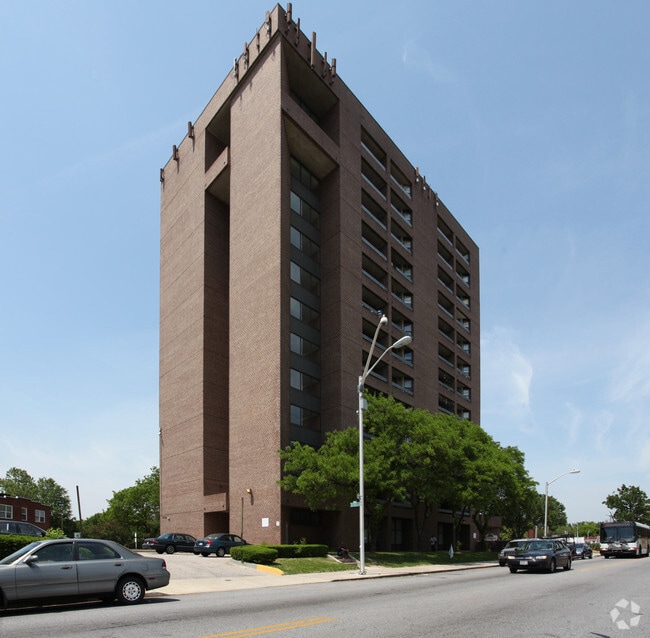
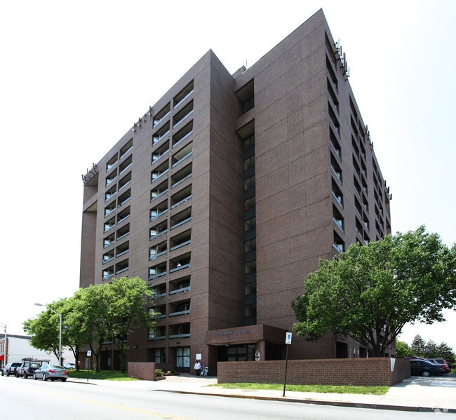
Property Record
740 Poplar Grove St, Baltimore, MD 21216
NEARBY LISTINGS FOR SALE OR LEASE
-
-
-
-
-
-
-
-
-
-
-
-
-
-
-
-
-
-
-
-
-
-
-
-
-
No Photo
-
View all Baltimore listings for sale on LoopNet.com
Property Detail
740 Poplar Grove St
2472-027
1.327 ACRES
Apartment
Baltimore City
X
Maryland
2400100395G
27
2023
1.33 AC
2025
Franklintown Road
160600
Baltimore
373,308 SF
Baltimore-Columbia-Towson, MD
DEMOGRAPHICS near 740 Poplar Grove St
1 Mile
3 Mile
5 Mile
2024 Total Population
32,473
219,448
516,224
2029 Population
32,536
215,108
503,848
Pop Growth 2024-2029
+ 0.19%
(1.98%)
(2.40%)
Average Age
41
40
39
2024 Total Households
12,613
98,315
219,989
HH Growth 2024-2029
0.00%
(2.39%)
(2.74%)
Median Household Inc
$38,271
$47,617
$55,360
Avg Household Size
2.50
2.10
2.20
2024 Avg HH Vehicles
1.00
1.00
1.00
Median Home Value
$84,379
$176,591
$226,832
Median Year Built
1947
1949
1950
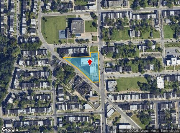
Nearby Places
Map Layers
Map Styles
 Street
 Aerial
- Restaurants
- Banks
- Shops
- Fitness
- Groceries
PUBLIC TRANSPORTATION
COMMUTER RAIL
West Baltimore (PENN - WASHINGTON - Maryland Area Regional Commuter Trains (The MARC), Penn Line - Maryland Area Regional Commuter Trains (The MARC))
DRIVE
WALK
Distance
West Baltimore (PENN - WASHINGTON - Maryland Area Regional Commuter Trains (The MARC), Penn Line - Maryland Area Regional Commuter Trains (The MARC))
2 min
0.9 mi
Camden Station (CAMDEN - WASHINGTON - Maryland Area Regional Commuter Trains (The MARC), Camden Line - Maryland Area Regional Commuter Trains (The MARC))
DRIVE
WALK
Distance
Camden Station (CAMDEN - WASHINGTON - Maryland Area Regional Commuter Trains (The MARC), Camden Line - Maryland Area Regional Commuter Trains (The MARC))
8 min
3.4 mi
AIRPORT
Baltimore/Washington International Thurgood Marshall
DRIVE
WALK
Distance
Baltimore/Washington International Thurgood Marshall
21 min
10.9 mi
Freight Ports
Port of Baltimore
DRIVE
WALK
Distance
Port of Baltimore
14 min
6.1 mi
Nearby Properties
Address
Land Use
TOTAL SIZE
Lot Size
Zoning
Address
Land Use
TOTAL SIZE
Lot Size
Zoning
1,871,691 SF
6.77 AC
C-5DC
Address
Land Use
TOTAL SIZE
Lot Size
Zoning
712,573 SF
1.32 AC
C-5DC
Address
Land Use
TOTAL SIZE
Lot Size
Zoning
20.26 AC
C-5DC
Address
Land Use
TOTAL SIZE
Lot Size
Zoning
308,887 SF
3.98 AC
C-5DC
Address
Land Use
TOTAL SIZE
Lot Size
Zoning
21.27 AC
C-5DC
Address
Land Use
TOTAL SIZE
Lot Size
Zoning
739,000 SF
2.79 AC
C-5DC
Address
Land Use
TOTAL SIZE
Lot Size
Zoning
1,396,807 SF
32.73 AC
R-6
Address
Land Use
TOTAL SIZE
Lot Size
Zoning
2,182,087 SF
95.52 AC
DR5.5
Address
Land Use
TOTAL SIZE
Lot Size
Zoning
400,000 SF
13.98 AC
0B051
Address
Land Use
TOTAL SIZE
Lot Size
Zoning
256,816 SF
1.27 AC
EC-2
Address
Land Use
TOTAL SIZE
Lot Size
Zoning
911,487 SF
5.27 AC
C-5DC
Address
Land Use
TOTAL SIZE
Lot Size
Zoning
381,152 SF
3.46 AC
C-5DC
Address
Land Use
TOTAL SIZE
Lot Size
Zoning
289,515 SF
1.10 AC
BSC
Address
Land Use
TOTAL SIZE
Lot Size
Zoning
10,386 SF
15.01 AC
C-5IH
Address
Land Use
TOTAL SIZE
Lot Size
Zoning
334,715 SF
1.77 AC
H
Address
Land Use
TOTAL SIZE
Lot Size
Zoning
656,306 SF
1.10 AC
C-5DC
Address
Land Use
TOTAL SIZE
Lot Size
Zoning
189,700 SF
0.71 AC
TOD-4
Address
Land Use
TOTAL SIZE
Lot Size
Zoning
538,988 SF
8.40 AC
I-MU
Address
Land Use
TOTAL SIZE
Lot Size
Zoning
625,217 SF
2.12 AC
C-5DC
Address
Land Use
TOTAL SIZE
Lot Size
Zoning
765,243 SF
0.69 AC
C-5DC
Address
Land Use
TOTAL SIZE
Lot Size
Zoning
743.89 AC
OS
Address
Land Use
TOTAL SIZE
Lot Size
Zoning
363,350 SF
3.22 AC
C-5DC
Address
Land Use
TOTAL SIZE
Lot Size
Zoning
465,042 SF
2.37 AC
OR-2
Address
Land Use
TOTAL SIZE
Lot Size
Zoning
22,912 SF
0.55 AC
C-5DC
Address
Land Use
TOTAL SIZE
Lot Size
Zoning
522,990 SF
2.31 AC
TOD-4
Address
Land Use
TOTAL SIZE
Lot Size
Zoning
344,199 SF
1 AC
C-5DC
Address
Land Use
TOTAL SIZE
Lot Size
Zoning
77,580 SF
1.68 AC
C-5DC
Address
Land Use
TOTAL SIZE
Lot Size
Zoning
208,941 SF
1.59 AC
C-5DC
Address
Land Use
TOTAL SIZE
Lot Size
Zoning
2.05 AC
C-5DC
Address
Land Use
TOTAL SIZE
Lot Size
Zoning
320,000 SF
4.56 AC
TOD-4
The World's #1 Commercial Real Estate Marketplace
Connect with us
© 2025 CoStar Group
The information above has been obtained from sources believed reliable. While we do not doubt its accuracy we have not verified it and make no guarantee, warranty or representation about it. It is your responsibility to independently confirm its accuracy and completeness. Any projections, opinions, assumptions, or estimates used are for example only and do not represent the current or future performance of the property. The value of this transaction to you depends on tax and other factors which should be evaluated by your tax, financial, and legal advisors. You and your advisors should conduct a careful, independent investigation of the property to determine to your satisfaction the suitability of the property for your needs.