Property Record
7400 N Orange Prairie Rd, Peoria, IL 61615
NEARBY LISTINGS FOR SALE OR LEASE
Property Detail
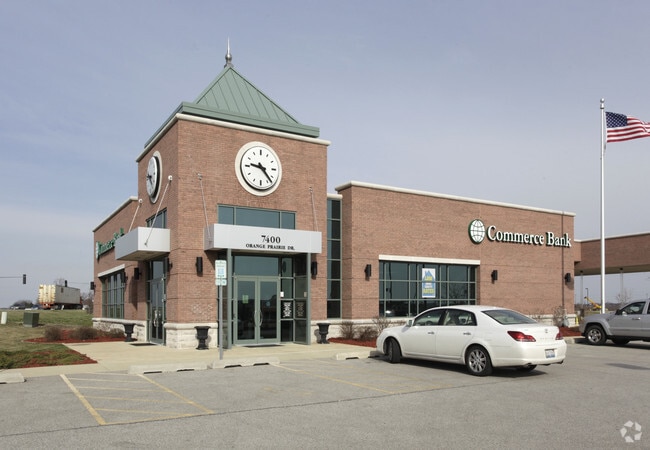
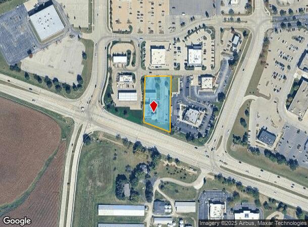
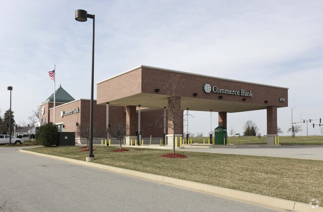
7400 N Orange Prairie Rd
Peoria
Plaza At Grand Prairie
Peoria, IL
PLAZA AT GRAND PRAIRIE PH II SW 1/4 SEC 11-9N-7E LOT 13
13-11-151-006
Peoria
Commercialnec
Illinois
2024
13
2024
1.04 AC
004101
North Peoria
DEMOGRAPHICS near 7400 N Orange Prairie Rd
1 Mile
3 Mile
5 Mile
2024 Total Population
3,782
19,995
63,131
2029 Population
3,670
19,371
61,286
Pop Growth 2024-2029
(2.96%)
(3.12%)
(2.92%)
Average Age
39
40
41
2024 Total Households
1,431
8,562
26,911
HH Growth 2024-2029
(3.21%)
(3.28%)
(3.08%)
Median Household Inc
$105,751
$71,829
$67,874
Avg Household Size
2.50
2.30
2.20
2024 Avg HH Vehicles
2.00
2.00
2.00
Median Home Value
$263,095
$190,186
$174,680
Median Year Built
2001
1984
1976
Nearby Places
Map Layers
Map Styles
 Street
 Aerial
- Restaurants
- Banks
- Shops
- Fitness
- Groceries
PUBLIC TRANSPORTATION
AIRPORT
General Downing - Peoria International
DRIVE
WALK
Distance
General Downing - Peoria International
16 min
10.2 mi
Freight Ports
Port Milwaukee
DRIVE
WALK
Distance
Port Milwaukee
265 min
223.0 mi
Nearby Properties
Address
Land Use
TOTAL SIZE
Lot Size
Zoning
Address
Land Use
TOTAL SIZE
Lot Size
Zoning
47.89 AC
Address
Land Use
TOTAL SIZE
Lot Size
Zoning
8.17 AC
Address
Land Use
TOTAL SIZE
Lot Size
Zoning
22.10 AC
Address
Land Use
TOTAL SIZE
Lot Size
Zoning
28.05 AC
Address
Land Use
TOTAL SIZE
Lot Size
Zoning
12.22 AC
Address
Land Use
TOTAL SIZE
Lot Size
Zoning
21.78 AC
Address
Land Use
TOTAL SIZE
Lot Size
Zoning
20.51 AC
Address
Land Use
TOTAL SIZE
Lot Size
Zoning
10.41 AC
Address
Land Use
TOTAL SIZE
Lot Size
Zoning
43.09 AC
Address
Land Use
TOTAL SIZE
Lot Size
Zoning
7.02 AC
Address
Land Use
TOTAL SIZE
Lot Size
Zoning
17.08 AC
Address
Land Use
TOTAL SIZE
Lot Size
Zoning
8.74 AC
Address
Land Use
TOTAL SIZE
Lot Size
Zoning
Address
Land Use
TOTAL SIZE
Lot Size
Zoning
Address
Land Use
TOTAL SIZE
Lot Size
Zoning
20.51 AC
Address
Land Use
TOTAL SIZE
Lot Size
Zoning
26.61 AC
Address
Land Use
TOTAL SIZE
Lot Size
Zoning
2.42 AC
Address
Land Use
TOTAL SIZE
Lot Size
Zoning
14.34 AC
Address
Land Use
TOTAL SIZE
Lot Size
Zoning
Address
Land Use
TOTAL SIZE
Lot Size
Zoning
19.50 AC
Address
Land Use
TOTAL SIZE
Lot Size
Zoning
16.70 AC
Address
Land Use
TOTAL SIZE
Lot Size
Zoning
7.31 AC
Address
Land Use
TOTAL SIZE
Lot Size
Zoning
Address
Land Use
TOTAL SIZE
Lot Size
Zoning
11.09 AC
Address
Land Use
TOTAL SIZE
Lot Size
Zoning
11.78 AC
Address
Land Use
TOTAL SIZE
Lot Size
Zoning
15.25 AC
Address
Land Use
TOTAL SIZE
Lot Size
Zoning
18.93 AC
Address
Land Use
TOTAL SIZE
Lot Size
Zoning
9.43 AC
Address
Land Use
TOTAL SIZE
Lot Size
Zoning
2.21 AC
Address
Land Use
TOTAL SIZE
Lot Size
Zoning
2.40 AC
The World's #1 Commercial Real Estate Marketplace
Connect with us
© 2026 CoStar Group
The information above has been obtained from sources believed reliable. While we do not doubt its accuracy we have not verified it and make no guarantee, warranty or representation about it. It is your responsibility to independently confirm its accuracy and completeness. Any projections, opinions, assumptions, or estimates used are for example only and do not represent the current or future performance of the property. The value of this transaction to you depends on tax and other factors which should be evaluated by your tax, financial, and legal advisors. You and your advisors should conduct a careful, independent investigation of the property to determine to your satisfaction the suitability of the property for your needs.