Property Record
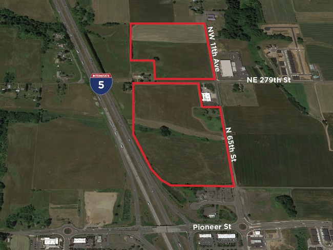
745 N 65Th Ave, Ridgefield, WA 98642
This Property Is For Sale
NEARBY LISTINGS FOR SALE OR LEASE
Property Detail
745 N 65Th Ave
Portland-Vancouver-Hillsboro, OR-WA
2-421;2-66
214053-015
ADJ LOT 4 SP 2-066 6.72 A FOR ASSESSOR USE ONLY COMMENCING AT THE NORTHEAST CORNER OF SAID SECTION 21, THENCE NORTH 884839 WEST, ALONG THE NORTH LINE OF SAID SECTION 21, FOR A DISTANCE OF 1323.86 FEET TO THE NORTHWEST CORNER; OF THE EAST HALF OF THE
Vacantlandnec
Clark
X
Washington
53015C1010G
4
2025
6.72 AC
2025
Clark County Outlying
040301
Portland
1,562 SF
DEMOGRAPHICS near 745 N 65Th Ave
1 Mile
3 Mile
5 Mile
2024 Total Population
794
18,857
31,528
2029 Population
864
21,093
34,830
Pop Growth 2024-2029
+ 8.82%
+ 11.86%
+ 10.47%
Average Age
42
39
40
2024 Total Households
268
6,337
10,767
HH Growth 2024-2029
+ 8.96%
+ 12.01%
+ 10.57%
Median Household Inc
$120,075
$102,332
$103,333
Avg Household Size
3.00
3.00
2.90
2024 Avg HH Vehicles
3.00
2.00
2.00
Median Home Value
$697,712
$604,408
$621,926
Median Year Built
1999
2010
2003
Nearby Places
- Restaurants
- Banks
- Shops
- Fitness
- Groceries
PUBLIC TRANSPORTATION
AIRPORT
Portland International
DRIVE
WALK
Distance
Portland International
31 min
22.3 mi
Freight Ports
Port of Vancouver
DRIVE
WALK
Distance
Port of Vancouver
23 min
15.4 mi
Nearby Properties
Address
Land Use
TOTAL SIZE
Lot Size
Zoning
Address
Land Use
TOTAL SIZE
Lot Size
Zoning
741,237 SF
42.05 AC
E
Address
Land Use
TOTAL SIZE
Lot Size
Zoning
299,106 SF
16.63 AC
RMD-16
Address
Land Use
TOTAL SIZE
Lot Size
Zoning
665,040 SF
57.82 AC
E
Address
Land Use
TOTAL SIZE
Lot Size
Zoning
468,420 SF
38.81 AC
E
Address
Land Use
TOTAL SIZE
Lot Size
Zoning
145,300 SF
31.34 AC
PF
Address
Land Use
TOTAL SIZE
Lot Size
Zoning
99,600 SF
4.38 AC
CCB
Address
Land Use
TOTAL SIZE
Lot Size
Zoning
343,528 SF
32.10 AC
PF
Address
Land Use
TOTAL SIZE
Lot Size
Zoning
113,250 SF
20.40 AC
E
Address
Land Use
TOTAL SIZE
Lot Size
Zoning
153,436 SF
17.03 AC
CRB
Address
Land Use
TOTAL SIZE
Lot Size
Zoning
104,246 SF
8.56 AC
PF
Address
Land Use
TOTAL SIZE
Lot Size
Zoning
76,536 SF
2.64 AC
RMD-16
Address
Land Use
TOTAL SIZE
Lot Size
Zoning
1,301 SF
69.17 AC
AG-20
Address
Land Use
TOTAL SIZE
Lot Size
Zoning
117,494 SF
9.08 AC
E
Address
Land Use
TOTAL SIZE
Lot Size
Zoning
181,560 SF
9 AC
E
Address
Land Use
TOTAL SIZE
Lot Size
Zoning
170,500 SF
16.83 AC
E
Address
Land Use
TOTAL SIZE
Lot Size
Zoning
191,022 SF
25.85 AC
UP
Address
Land Use
TOTAL SIZE
Lot Size
Zoning
112,220 SF
6.44 AC
E
Address
Land Use
TOTAL SIZE
Lot Size
Zoning
108,939 SF
6.32 AC
E
Address
Land Use
TOTAL SIZE
Lot Size
Zoning
49,840 SF
9.76 AC
CRB
Address
Land Use
TOTAL SIZE
Lot Size
Zoning
141,500 SF
11.71 AC
E
Address
Land Use
TOTAL SIZE
Lot Size
Zoning
74,640 SF
11.40 AC
E
Address
Land Use
TOTAL SIZE
Lot Size
Zoning
77,620 SF
7.95 AC
E
Address
Land Use
TOTAL SIZE
Lot Size
Zoning
83,660 SF
5.72 AC
E
Address
Land Use
TOTAL SIZE
Lot Size
Zoning
129,977 SF
6.02 AC
E
Address
Land Use
TOTAL SIZE
Lot Size
Zoning
52,000 SF
5.67 AC
E
Address
Land Use
TOTAL SIZE
Lot Size
Zoning
37,500 SF
10.90 AC
E
Address
Land Use
TOTAL SIZE
Lot Size
Zoning
55,184 SF
8.37 AC
PF
Address
Land Use
TOTAL SIZE
Lot Size
Zoning
1,600 SF
31.43 AC
JP
Address
Land Use
TOTAL SIZE
Lot Size
Zoning
52,853 SF
4.55 AC
CCB
Address
Land Use
TOTAL SIZE
Lot Size
Zoning
52,937 SF
3.93 AC
E
The World's #1 Commercial Real Estate Marketplace
Connect with us
© 2025 CoStar Group
The information above has been obtained from sources believed reliable. While we do not doubt its accuracy we have not verified it and make no guarantee, warranty or representation about it. It is your responsibility to independently confirm its accuracy and completeness. Any projections, opinions, assumptions, or estimates used are for example only and do not represent the current or future performance of the property. The value of this transaction to you depends on tax and other factors which should be evaluated by your tax, financial, and legal advisors. You and your advisors should conduct a careful, independent investigation of the property to determine to your satisfaction the suitability of the property for your needs.