Property Record
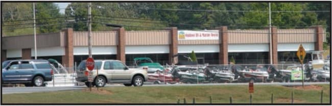
7454 Highway 76, Pendleton, SC 29670

Property Detail
7454 Highway 76
041-03-04-014
CP 091/043 F380 D398 PP 012/286 WALNUT AVE + HWY 76 3.00 AC
Warehouse
ANDERSON
B and X Area of moderate flood hazard, usually the area between the limits of the 100-year and 500-year floods.
South Carolina
2025
3 AC
2024
Anderson Cy N of I-85
010701
Greenville/Spartanburg
4,243 SF
Greenville-Anderson-Greer, SC
NEARBY LISTINGS FOR SALE OR LEASE
-
-
View all Pendleton listings for sale on LoopNet.com
DEMOGRAPHICS near 7454 Highway 76
1 mile
3 mile
5 mile
2024 Total Population
1,676
9,102
29,900
2029 Population
1,805
9,636
31,208
Pop Growth 2024-2029
+ 7.70%
+ 5.87%
+ 4.37%
Average Age
42
40
36
2024 Total Households
798
3,748
10,913
HH Growth 2024-2029
+ 8.02%
+ 6.59%
+ 5.19%
Median Household Inc
$67,602
$69,742
$64,571
Avg Household Size
2.10
2.30
2.30
2024 Avg HH Vehicles
2.00
2.00
2.00
Median Home Value
$240,330
$245,900
$292,281
Median Year Built
1993
1990
1992
Nearby Places
Map Layers
Map Styles
 Street
 Aerial
Transit
 Traffic
 Biking
Places
Listings with unknown addresses are not visible on the map
- Restaurants
- Banks
- Shops
- Fitness
- Groceries
PUBLIC TRANSPORTATION
COMMUTER RAIL
Clemson Amtrak Station (Crescent - Amtrak)
Drive
Walk
Distance
Clemson Amtrak Station (Crescent - Amtrak)
9 min
5.7 mi
Freight Ports
Georgia Ports - Savannah
Drive
Walk
Distance
Georgia Ports - Savannah
308 min
221.7 mi
Nearby Properties
Address
Land Use
TOTAL SIZE
Lot Size
Zoning
Address
Land Use
TOTAL SIZE
Lot Size
Zoning
254,000 SF
94.59 AC
Address
Land Use
TOTAL SIZE
Lot Size
Zoning
6,000 SF
0.99 AC
Address
Land Use
TOTAL SIZE
Lot Size
Zoning
11.42 AC
Address
Land Use
TOTAL SIZE
Lot Size
Zoning
5,484.32 AC
Address
Land Use
TOTAL SIZE
Lot Size
Zoning
75,260 SF
2.20 AC
Address
Land Use
TOTAL SIZE
Lot Size
Zoning
6,500 SF
7.41 AC
Address
Land Use
TOTAL SIZE
Lot Size
Zoning
1.52 AC
Address
Land Use
TOTAL SIZE
Lot Size
Zoning
14,706 SF
8.48 AC
Address
Land Use
TOTAL SIZE
Lot Size
Zoning
20,000 SF
14.18 AC
Address
Land Use
TOTAL SIZE
Lot Size
Zoning
27.50 AC
Address
Land Use
TOTAL SIZE
Lot Size
Zoning
69,208 SF
10.68 AC
Address
Land Use
TOTAL SIZE
Lot Size
Zoning
1,530 SF
41.37 AC
Address
Land Use
TOTAL SIZE
Lot Size
Zoning
38.90 AC
Address
Land Use
TOTAL SIZE
Lot Size
Zoning
14.58 AC
R 20 SINGL
Address
Land Use
TOTAL SIZE
Lot Size
Zoning
81.66 AC
Address
Land Use
TOTAL SIZE
Lot Size
Zoning
5,839 SF
5.45 AC
Address
Land Use
TOTAL SIZE
Lot Size
Zoning
3,730 SF
1.98 AC
Address
Land Use
TOTAL SIZE
Lot Size
Zoning
174.15 AC
Address
Land Use
TOTAL SIZE
Lot Size
Zoning
9,600 SF
1.79 AC
Address
Land Use
TOTAL SIZE
Lot Size
Zoning
6,282 SF
2.92 AC
Address
Land Use
TOTAL SIZE
Lot Size
Zoning
10,054 SF
1.20 AC
Address
Land Use
TOTAL SIZE
Lot Size
Zoning
6,375 SF
0.95 AC
Address
Land Use
TOTAL SIZE
Lot Size
Zoning
1.60 AC
Address
Land Use
TOTAL SIZE
Lot Size
Zoning
6,779 SF
3.82 AC
Address
Land Use
TOTAL SIZE
Lot Size
Zoning
9,042 SF
1.52 AC
Address
Land Use
TOTAL SIZE
Lot Size
Zoning
7,314 SF
114.43 AC
Address
Land Use
TOTAL SIZE
Lot Size
Zoning
3,471 SF
1.04 AC
Address
Land Use
TOTAL SIZE
Lot Size
Zoning
3,902 SF
0.98 AC
Address
Land Use
TOTAL SIZE
Lot Size
Zoning
5,547 SF
1.51 AC
The World's #1 Commercial Real Estate Marketplace
Connect with us
© 2026 CoStar Group
The information above has been obtained from sources believed reliable. While we do not doubt its accuracy we have not verified it and make no guarantee, warranty or representation about it. It is your responsibility to independently confirm its accuracy and completeness. Any projections, opinions, assumptions, or estimates used are for example only and do not represent the current or future performance of the property. The value of this transaction to you depends on tax and other factors which should be evaluated by your tax, financial, and legal advisors. You and your advisors should conduct a careful, independent investigation of the property to determine to your satisfaction the suitability of the property for your needs.