Property Record
75 W Valpico Rd, Tracy, CA 95376
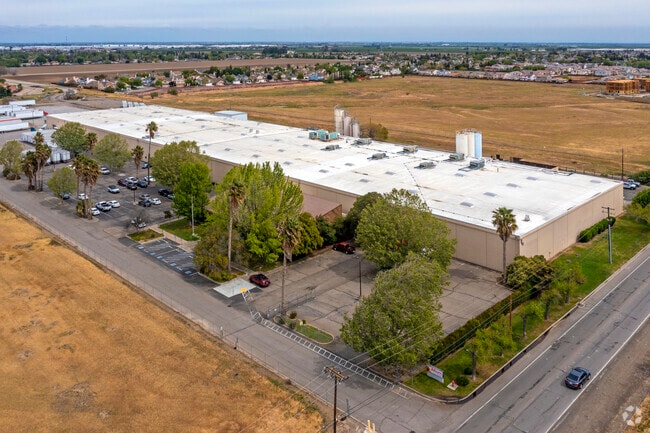
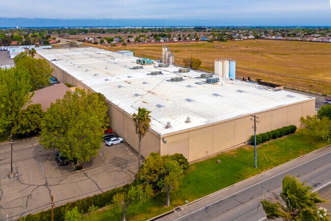

Property Detail
75 W Valpico Rd
Stockton-Lodi, CA
REDRAW 881025 FR ORIG APN 237180393
246-130-08
San Joaquin
Industrialacreage
California
B and X Area of moderate flood hazard, usually the area between the limits of the 100-year and 500-year floods.
4.99 AC
2025
Tracy
2025
Stockton/Modesto
005220
NEARBY LISTINGS FOR SALE OR LEASE
DEMOGRAPHICS near 75 W Valpico Rd
1 mile
3 mile
5 mile
2025 Total Population
20,624
81,518
107,051
2030 Population
21,585
85,271
112,317
Pop Growth 2025-2030
+ 4.66%
+ 4.60%
+ 4.92%
Average Age
38
38
38
2025 Total Households
6,120
24,418
31,976
HH Growth 2025-2030
+ 4.61%
+ 4.64%
+ 4.96%
Median Household Inc
$129,874
$123,338
$122,474
Avg Household Size
3.30
3.30
3.30
2025 Avg HH Vehicles
3.00
3.00
3.00
Median Home Value
$751,170
$737,004
$738,044
Median Year Built
1997
1995
1995
Nearby Places
Map Layers
Map Styles
 Street
 Aerial
Transit
 Traffic
 Biking
Places
Listings with unknown addresses are not visible on the map
- Restaurants
- Banks
- Shops
- Fitness
- Groceries
PUBLIC TRANSPORTATION
COMMUTER RAIL
Tracy Station (ACE Train - Altamont Corridor Express)
Drive
Walk
Distance
Tracy Station (ACE Train - Altamont Corridor Express)
3 min
1.5 mi
AIRPORT
Stockton Metro
Drive
Walk
Distance
Stockton Metro
28 min
20.5 mi
Freight Ports
Port of Stockton
Drive
Walk
Distance
Port of Stockton
31 min
23.8 mi
Nearby Properties
Address
Land Use
TOTAL SIZE
Lot Size
Zoning
Address
Land Use
TOTAL SIZE
Lot Size
Zoning
3.77 AC
Address
Land Use
TOTAL SIZE
Lot Size
Zoning
1,124,201 SF
53.72 AC
Address
Land Use
TOTAL SIZE
Lot Size
Zoning
22,926 SF
11.63 AC
Address
Land Use
TOTAL SIZE
Lot Size
Zoning
749,840 SF
37.96 AC
Address
Land Use
TOTAL SIZE
Lot Size
Zoning
115.53 AC
IG
Address
Land Use
TOTAL SIZE
Lot Size
Zoning
29,442 SF
6.52 AC
Address
Land Use
TOTAL SIZE
Lot Size
Zoning
827,280 SF
36.18 AC
Address
Land Use
TOTAL SIZE
Lot Size
Zoning
143,280 SF
20 AC
Address
Land Use
TOTAL SIZE
Lot Size
Zoning
382,260 SF
18.70 AC
Address
Land Use
TOTAL SIZE
Lot Size
Zoning
265,868 SF
11.99 AC
Address
Land Use
TOTAL SIZE
Lot Size
Zoning
265,000 SF
10.83 AC
Address
Land Use
TOTAL SIZE
Lot Size
Zoning
225,000 SF
11.13 AC
M
Address
Land Use
TOTAL SIZE
Lot Size
Zoning
258,520 SF
16.74 AC
Address
Land Use
TOTAL SIZE
Lot Size
Zoning
6,000 SF
22.88 AC
IL
Address
Land Use
TOTAL SIZE
Lot Size
Zoning
32.90 AC
Address
Land Use
TOTAL SIZE
Lot Size
Zoning
155,942 SF
11.90 AC
Address
Land Use
TOTAL SIZE
Lot Size
Zoning
65.83 AC
Address
Land Use
TOTAL SIZE
Lot Size
Zoning
95.54 AC
Address
Land Use
TOTAL SIZE
Lot Size
Zoning
398,400 SF
28.40 AC
Address
Land Use
TOTAL SIZE
Lot Size
Zoning
64,582 SF
3.10 AC
Address
Land Use
TOTAL SIZE
Lot Size
Zoning
10,202 SF
4.50 AC
Address
Land Use
TOTAL SIZE
Lot Size
Zoning
6,500 SF
86.80 AC
IG
Address
Land Use
TOTAL SIZE
Lot Size
Zoning
55,576 SF
2.65 AC
Address
Land Use
TOTAL SIZE
Lot Size
Zoning
158,064 SF
10.01 AC
Address
Land Use
TOTAL SIZE
Lot Size
Zoning
62,246 SF
5.82 AC
NS
Address
Land Use
TOTAL SIZE
Lot Size
Zoning
506,552 SF
22.01 AC
Address
Land Use
TOTAL SIZE
Lot Size
Zoning
204,641 SF
10.97 AC
Address
Land Use
TOTAL SIZE
Lot Size
Zoning
47,064 SF
2.36 AC
GC
The World's #1 Commercial Real Estate Marketplace
Connect with us
© 2026 CoStar Group
The information above has been obtained from sources believed reliable. While we do not doubt its accuracy we have not verified it and make no guarantee, warranty or representation about it. It is your responsibility to independently confirm its accuracy and completeness. Any projections, opinions, assumptions, or estimates used are for example only and do not represent the current or future performance of the property. The value of this transaction to you depends on tax and other factors which should be evaluated by your tax, financial, and legal advisors. You and your advisors should conduct a careful, independent investigation of the property to determine to your satisfaction the suitability of the property for your needs.