Property Record
750 Sw C Ave, Corvallis, OR 97333
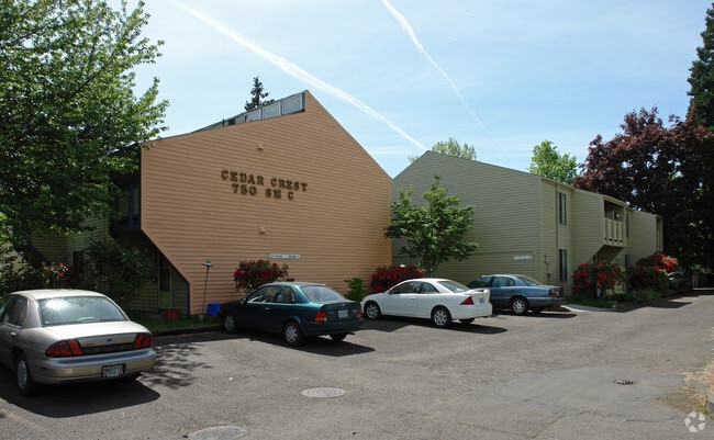


Property Detail
750 Sw C Ave
139380
ADDTNL MAILING ADDR: 922 NW CIRCLE BLVD STE 160 PMB 250, CORVALLIS OR 97330
Multifamilydwelling
Benton
RS-20
Oregon
B and X Area of moderate flood hazard, usually the area between the limits of the 100-year and 500-year floods.
1.41 AC
2024
Oregon West Area
2025
Other Market Areas
010601
Corvallis, OR
28,795 SF
NEARBY LISTINGS FOR SALE OR LEASE
DEMOGRAPHICS near 750 Sw C Ave
1 mile
3 mile
5 mile
2025 Total Population
21,338
64,262
76,502
2030 Population
23,011
67,000
79,443
Pop Growth 2025-2030
+ 7.84%
+ 4.26%
+ 3.84%
Average Age
28
36
37
2025 Total Households
7,775
25,720
30,669
HH Growth 2025-2030
+ 9.54%
+ 4.59%
+ 4.11%
Median Household Inc
$28,814
$61,917
$66,235
Avg Household Size
2.00
2.20
2.20
2025 Avg HH Vehicles
2.00
2.00
2.00
Median Home Value
$437,427
$503,227
$511,933
Median Year Built
1986
1980
1980
Nearby Places
Map Layers
Map Styles
 Street
 Aerial
Layers
 Traffic
 Biking
Places
Listings with unknown addresses are not visible on the map
- Restaurants
- Banks
- Shops
- Fitness
- Groceries
Nearby Properties
Address
Land Use
TOTAL SIZE
Lot Size
Zoning
Address
Land Use
TOTAL SIZE
Lot Size
Zoning
Address
Land Use
TOTAL SIZE
Lot Size
Zoning
Address
Land Use
TOTAL SIZE
Lot Size
Zoning
552,129 SF
25.99 AC
RS-12
Address
Land Use
TOTAL SIZE
Lot Size
Zoning
Address
Land Use
TOTAL SIZE
Lot Size
Zoning
339,006 SF
0.69 AC
RF
Address
Land Use
TOTAL SIZE
Lot Size
Zoning
330,693 SF
1.25 AC
MUE
Address
Land Use
TOTAL SIZE
Lot Size
Zoning
106,538 SF
4.38 AC
RS-12
Address
Land Use
TOTAL SIZE
Lot Size
Zoning
215,337 SF
16.20 AC
RS-20
Address
Land Use
TOTAL SIZE
Lot Size
Zoning
166,415 SF
3.04 AC
OSU
Address
Land Use
TOTAL SIZE
Lot Size
Zoning
81,113 SF
1.81 AC
PD(RS-20)
Address
Land Use
TOTAL SIZE
Lot Size
Zoning
Address
Land Use
TOTAL SIZE
Lot Size
Zoning
107,412 SF
9.16 AC
RTC
Address
Land Use
TOTAL SIZE
Lot Size
Zoning
129,103 SF
6.95 AC
PD(RS-12)
Address
Land Use
TOTAL SIZE
Lot Size
Zoning
146,932 SF
6.41 AC
MUCS
Address
Land Use
TOTAL SIZE
Lot Size
Zoning
235,104 SF
9.96 AC
PD(RS-20)
Address
Land Use
TOTAL SIZE
Lot Size
Zoning
67,925 SF
4.84 AC
RTC
Address
Land Use
TOTAL SIZE
Lot Size
Zoning
139,766 SF
6.41 AC
PD(RS-9)
Address
Land Use
TOTAL SIZE
Lot Size
Zoning
124,682 SF
10.62 AC
PD(RS-12)
Address
Land Use
TOTAL SIZE
Lot Size
Zoning
218,015 SF
11.69 AC
PD(RS-12)
Address
Land Use
TOTAL SIZE
Lot Size
Zoning
112,216 SF
11.30 AC
PD(NC-MAJO
Address
Land Use
TOTAL SIZE
Lot Size
Zoning
192,991 SF
10.19 AC
GI
Address
Land Use
TOTAL SIZE
Lot Size
Zoning
122,984 SF
2.56 AC
RS-20
Address
Land Use
TOTAL SIZE
Lot Size
Zoning
95,797 SF
6.03 AC
PD(P-AO)
Address
Land Use
TOTAL SIZE
Lot Size
Zoning
300,108 SF
11.08 AC
PD(GI)
Address
Land Use
TOTAL SIZE
Lot Size
Zoning
166,396 SF
4.96 AC
GI
Address
Land Use
TOTAL SIZE
Lot Size
Zoning
169.68 AC
PD(GI)
Address
Land Use
TOTAL SIZE
Lot Size
Zoning
165,589 SF
13.92 AC
RS-20
Address
Land Use
TOTAL SIZE
Lot Size
Zoning
139,752 SF
7.60 AC
RS-12
Address
Land Use
TOTAL SIZE
Lot Size
Zoning
94,542 SF
10.96 AC
PD(NC-MAJO
Address
Land Use
TOTAL SIZE
Lot Size
Zoning
117,960 SF
5.41 AC
RS-20
The World's #1 Commercial Real Estate Marketplace
Connect with us
© 2026 CoStar Group
The information above has been obtained from sources believed reliable. While we do not doubt its accuracy we have not verified it and make no guarantee, warranty or representation about it. It is your responsibility to independently confirm its accuracy and completeness. Any projections, opinions, assumptions, or estimates used are for example only and do not represent the current or future performance of the property. The value of this transaction to you depends on tax and other factors which should be evaluated by your tax, financial, and legal advisors. You and your advisors should conduct a careful, independent investigation of the property to determine to your satisfaction the suitability of the property for your needs.