Property Record
7569 W 72Nd Ave, Arvada, CO 80003


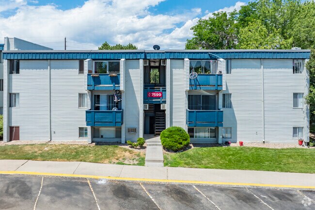
Property Detail
7569 W 72Nd Ave
29-354-00-008
SECTION 35 TOWNSHIP 02 RANGE 69 QTR SE SIZE: 205791 VALUE: 4.724 KEY=003
Multifamilydwelling
JEFFERSON
B and X Area of moderate flood hazard, usually the area between the limits of the 100-year and 500-year floods.
Colorado
2025
4.72 AC
2025
Country Club Highlands
010208
Denver
62,382 SF
Denver-Aurora-Centennial, CO
NEARBY LISTINGS FOR SALE OR LEASE
DEMOGRAPHICS near 7569 W 72Nd Ave
1 mile
3 mile
5 mile
2025 Total Population
12,825
126,810
314,053
2030 Population
12,657
126,968
317,572
Pop Growth 2025-2030
(1.31%)
+ 0.12%
+ 1.12%
Average Age
43
41
40
2025 Total Households
4,929
51,635
125,372
HH Growth 2025-2030
(1.34%)
+ 0.10%
+ 1.09%
Median Household Inc
$103,914
$90,868
$96,324
Avg Household Size
2.50
2.40
2.40
2025 Avg HH Vehicles
2.00
2.00
2.00
Median Home Value
$654,781
$596,404
$606,592
Median Year Built
1972
1975
1976
Nearby Places
Map Layers
Map Styles
 Street
 Aerial
Layers
 Traffic
 Biking
Places
Listings with unknown addresses are not visible on the map
- Restaurants
- Banks
- Shops
- Fitness
- Groceries
PUBLIC TRANSPORTATION
COMMUTER RAIL
Olde Town Arvada E-Bound (Union Station to Wheat Ridge Ward Station - Regional Transportation District)
Drive
Walk
Distance
Olde Town Arvada E-Bound (Union Station to Wheat Ridge Ward Station - Regional Transportation District)
5 min
2.4 mi
Olde Town Arvada W-Bound (Union Station to Wheat Ridge Ward Station - Regional Transportation District)
Drive
Walk
Distance
Olde Town Arvada W-Bound (Union Station to Wheat Ridge Ward Station - Regional Transportation District)
6 min
2.8 mi
AIRPORT
Denver International
Drive
Walk
Distance
Denver International
40 min
29.0 mi
Freight Ports
Tulsa Port Of Catoosa
Drive
Walk
Distance
Tulsa Port Of Catoosa
737 min
714.6 mi
Nearby Properties
Address
Land Use
TOTAL SIZE
Lot Size
Zoning
Address
Land Use
TOTAL SIZE
Lot Size
Zoning
559,786 SF
26.52 AC
Address
Land Use
TOTAL SIZE
Lot Size
Zoning
248,096 SF
19.67 AC
Address
Land Use
TOTAL SIZE
Lot Size
Zoning
208,500 SF
8.42 AC
Address
Land Use
TOTAL SIZE
Lot Size
Zoning
176,583 SF
Address
Land Use
TOTAL SIZE
Lot Size
Zoning
138,770 SF
4.64 AC
Address
Land Use
TOTAL SIZE
Lot Size
Zoning
117,774 SF
8.60 AC
Address
Land Use
TOTAL SIZE
Lot Size
Zoning
138,912 SF
8.71 AC
Address
Land Use
TOTAL SIZE
Lot Size
Zoning
103,174 SF
1.23 AC
Address
Land Use
TOTAL SIZE
Lot Size
Zoning
81,065 SF
4.51 AC
Address
Land Use
TOTAL SIZE
Lot Size
Zoning
93,699 SF
1.89 AC
Address
Land Use
TOTAL SIZE
Lot Size
Zoning
97,944 SF
6.34 AC
Address
Land Use
TOTAL SIZE
Lot Size
Zoning
113,385 SF
6.77 AC
Address
Land Use
TOTAL SIZE
Lot Size
Zoning
398,180 SF
33.31 AC
R1C
Address
Land Use
TOTAL SIZE
Lot Size
Zoning
56,854 SF
1.83 AC
Address
Land Use
TOTAL SIZE
Lot Size
Zoning
52,194 SF
5.33 AC
Address
Land Use
TOTAL SIZE
Lot Size
Zoning
72,252 SF
4.20 AC
Address
Land Use
TOTAL SIZE
Lot Size
Zoning
51,612 SF
1.76 AC
Address
Land Use
TOTAL SIZE
Lot Size
Zoning
50,490 SF
1.58 AC
Address
Land Use
TOTAL SIZE
Lot Size
Zoning
105,600 SF
1.31 AC
Address
Land Use
TOTAL SIZE
Lot Size
Zoning
298,366 SF
24.21 AC
Address
Land Use
TOTAL SIZE
Lot Size
Zoning
59,824 SF
0.96 AC
Address
Land Use
TOTAL SIZE
Lot Size
Zoning
42,474 SF
1.16 AC
Address
Land Use
TOTAL SIZE
Lot Size
Zoning
269,013 SF
31.89 AC
Address
Land Use
TOTAL SIZE
Lot Size
Zoning
65,336 SF
2.86 AC
Address
Land Use
TOTAL SIZE
Lot Size
Zoning
46,922 SF
2.35 AC
Address
Land Use
TOTAL SIZE
Lot Size
Zoning
48,252 SF
1.83 AC
Address
Land Use
TOTAL SIZE
Lot Size
Zoning
36,937 SF
0.88 AC
Address
Land Use
TOTAL SIZE
Lot Size
Zoning
69,537 SF
4.49 AC
Address
Land Use
TOTAL SIZE
Lot Size
Zoning
29,986 SF
2.88 AC
Address
Land Use
TOTAL SIZE
Lot Size
Zoning
75,062 SF
5.28 AC
A1
The World's #1 Commercial Real Estate Marketplace
Connect with us
© 2026 CoStar Group
The information above has been obtained from sources believed reliable. While we do not doubt its accuracy we have not verified it and make no guarantee, warranty or representation about it. It is your responsibility to independently confirm its accuracy and completeness. Any projections, opinions, assumptions, or estimates used are for example only and do not represent the current or future performance of the property. The value of this transaction to you depends on tax and other factors which should be evaluated by your tax, financial, and legal advisors. You and your advisors should conduct a careful, independent investigation of the property to determine to your satisfaction the suitability of the property for your needs.