Property Record
7570 Ridge Rd, Hanover, MD 21076


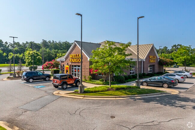
Property Detail
7570 Ridge Rd
04-005-90213974
LT 6 BLK H ARUNDEL MILLS
Financialbuilding
ANNE ARUNDEL
C3
Maryland
B and X Area of moderate flood hazard, usually the area between the limits of the 100-year and 500-year floods.
6
2024
1.62 AC
2025
BWI/Anne Arundel
740107
Baltimore
3,833 SF
Baltimore-Columbia-Towson, MD
NEARBY LISTINGS FOR SALE OR LEASE
DEMOGRAPHICS near 7570 Ridge Rd
1 mile
3 mile
5 mile
2025 Total Population
9,083
62,225
161,222
2030 Population
9,223
63,430
163,572
Pop Growth 2025-2030
+ 1.54%
+ 1.94%
+ 1.46%
Average Age
40
37
37
2025 Total Households
3,456
22,186
58,127
HH Growth 2025-2030
+ 1.82%
+ 1.94%
+ 1.40%
Median Household Inc
$124,334
$123,582
$117,833
Avg Household Size
2.60
2.70
2.70
2025 Avg HH Vehicles
2.00
2.00
2.00
Median Home Value
$473,882
$468,003
$444,094
Median Year Built
1996
1997
1994
Nearby Places
Map Layers
Map Styles
 Street
 Aerial
Layers
 Traffic
 Biking
Places
Listings with unknown addresses are not visible on the map
- Restaurants
- Banks
- Shops
- Fitness
- Groceries
PUBLIC TRANSPORTATION
COMMUTER RAIL
Dorsey Marc Sb (CAMDEN - WASHINGTON - Maryland Transit Administration)
Drive
Walk
Distance
Dorsey Marc Sb (CAMDEN - WASHINGTON - Maryland Transit Administration)
6 min
3.1 mi
Dorsey Marc Nb (CAMDEN - WASHINGTON - Maryland Transit Administration)
Drive
Walk
Distance
Dorsey Marc Nb (CAMDEN - WASHINGTON - Maryland Transit Administration)
6 min
3.1 mi
AIRPORT
Baltimore/Washington International Thurgood Marshall
Drive
Walk
Distance
Baltimore/Washington International Thurgood Marshall
11 min
5.2 mi
Ronald Reagan Washington Ntl
Drive
Walk
Distance
Ronald Reagan Washington Ntl
50 min
32.3 mi
Freight Ports
Port of Baltimore
Drive
Walk
Distance
Port of Baltimore
22 min
12.9 mi
Nearby Properties
Address
Land Use
TOTAL SIZE
Lot Size
Zoning
Address
Land Use
TOTAL SIZE
Lot Size
Zoning
1,593,623 SF
176.09 AC
W1
Address
Land Use
TOTAL SIZE
Lot Size
Zoning
2,583,263 SF
12.57 AC
W1
Address
Land Use
TOTAL SIZE
Lot Size
Zoning
732,668 SF
13.26 AC
MXDE
Address
Land Use
TOTAL SIZE
Lot Size
Zoning
500,970 SF
18.88 AC
MXD-E
Address
Land Use
TOTAL SIZE
Lot Size
Zoning
41.07 AC
R15
Address
Land Use
TOTAL SIZE
Lot Size
Zoning
14.68 AC
C2
Address
Land Use
TOTAL SIZE
Lot Size
Zoning
120,108 SF
28.23 AC
TOD
Address
Land Use
TOTAL SIZE
Lot Size
Zoning
312,489 SF
9.04 AC
C3
Address
Land Use
TOTAL SIZE
Lot Size
Zoning
560,407 SF
3.82 AC
Address
Land Use
TOTAL SIZE
Lot Size
Zoning
5.34 AC
Address
Land Use
TOTAL SIZE
Lot Size
Zoning
221,100 SF
1.75 AC
MXD-E
Address
Land Use
TOTAL SIZE
Lot Size
Zoning
11.09 AC
C2
Address
Land Use
TOTAL SIZE
Lot Size
Zoning
342,024 SF
30.72 AC
W1B
Address
Land Use
TOTAL SIZE
Lot Size
Zoning
490,875 SF
9.52 AC
MXD-E
Address
Land Use
TOTAL SIZE
Lot Size
Zoning
612,900 SF
37.43 AC
M2
Address
Land Use
TOTAL SIZE
Lot Size
Zoning
202,692 SF
4.28 AC
TOD
Address
Land Use
TOTAL SIZE
Lot Size
Zoning
359,185 SF
3.63 AC
TOD
Address
Land Use
TOTAL SIZE
Lot Size
Zoning
1,489,438 SF
74.22 AC
W2
Address
Land Use
TOTAL SIZE
Lot Size
Zoning
126,960 SF
13.72 AC
MXDR
Address
Land Use
TOTAL SIZE
Lot Size
Zoning
139,000 SF
4.81 AC
MXDR
Address
Land Use
TOTAL SIZE
Lot Size
Zoning
187,643 SF
7.96 AC
MXD-E
Address
Land Use
TOTAL SIZE
Lot Size
Zoning
116,160 SF
3.44 AC
MXDR
Address
Land Use
TOTAL SIZE
Lot Size
Zoning
79,448 SF
8.11 AC
TOD
Address
Land Use
TOTAL SIZE
Lot Size
Zoning
307,032 SF
4.35 AC
TOD
Address
Land Use
TOTAL SIZE
Lot Size
Zoning
153,697 SF
4.19 AC
MXD-E
Address
Land Use
TOTAL SIZE
Lot Size
Zoning
259,502 SF
16.17 AC
W1B
Address
Land Use
TOTAL SIZE
Lot Size
Zoning
118,272 SF
10.83 AC
MXD-E
Address
Land Use
TOTAL SIZE
Lot Size
Zoning
100,555 SF
5.23 AC
W2
Address
Land Use
TOTAL SIZE
Lot Size
Zoning
238,400 SF
8.06 AC
W1
Address
Land Use
TOTAL SIZE
Lot Size
Zoning
24.49 AC
C3
The World's #1 Commercial Real Estate Marketplace
Connect with us
© 2026 CoStar Group
The information above has been obtained from sources believed reliable. While we do not doubt its accuracy we have not verified it and make no guarantee, warranty or representation about it. It is your responsibility to independently confirm its accuracy and completeness. Any projections, opinions, assumptions, or estimates used are for example only and do not represent the current or future performance of the property. The value of this transaction to you depends on tax and other factors which should be evaluated by your tax, financial, and legal advisors. You and your advisors should conduct a careful, independent investigation of the property to determine to your satisfaction the suitability of the property for your needs.