Property Record
7602 Sw Jack James Dr, Stuart, FL 34997
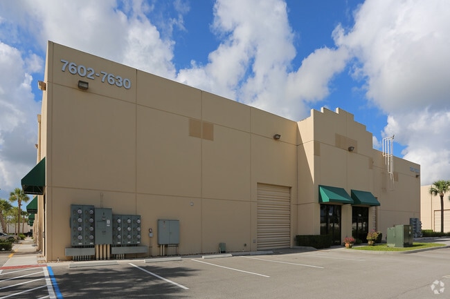
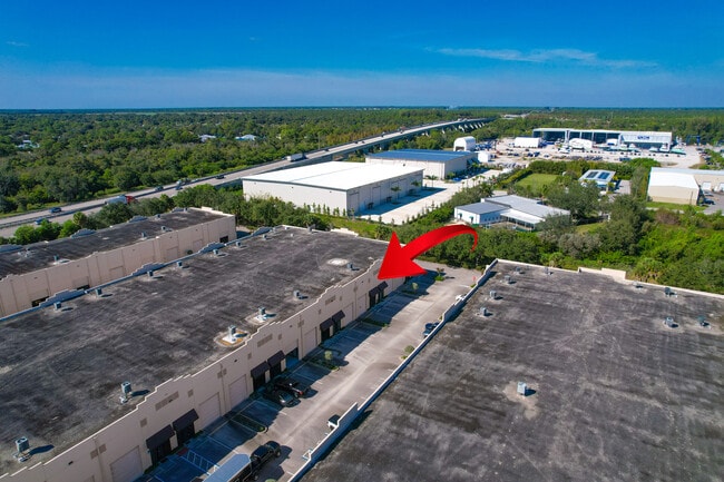
Property Detail
7602 Sw Jack James Dr
55-38-41-300-002-00040-0
UNIT B-5 BLDG B - TREASURE COAST II CONDO PER DOC IN OR 2280/2782
Warehouse
MARTIN
AE The base floodplain where base flood elevations are provided. AE Zones are now used on new format FIRMs instead of A1-A30 Zones.
Florida
2024
0.02 AC
2025
Martin
001103
Port St Lucie/Fort Pierce
997 SF
Port St. Lucie, FL
NEARBY LISTINGS FOR SALE OR LEASE
DEMOGRAPHICS near 7602 Sw Jack James Dr
1 mile
3 mile
5 mile
2025 Total Population
3,056
17,821
60,983
2030 Population
3,153
18,255
62,948
Pop Growth 2025-2030
+ 3.17%
+ 2.44%
+ 3.22%
Average Age
46
47
47
2025 Total Households
1,191
7,062
26,071
HH Growth 2025-2030
+ 2.94%
+ 2.28%
+ 3.15%
Median Household Inc
$94,831
$91,981
$76,845
Avg Household Size
2.40
2.40
2.20
2025 Avg HH Vehicles
2.00
2.00
2.00
Median Home Value
$531,646
$495,150
$424,284
Median Year Built
1998
1995
1989
Nearby Places
Map Layers
Map Styles
 Street
 Aerial
Layers
 Traffic
 Biking
Places
Listings with unknown addresses are not visible on the map
- Restaurants
- Banks
- Shops
- Fitness
- Groceries
SALE & LEASE HISTORY
LISTING DATE
SALE/LEASE

Sep 23, 2019
For Sale
Jun 20, 2025
For Lease
Dec 08, 2025
For Sale
Apr 21, 2025
For Sale
Apr 17, 2023
For Lease
Apr 04, 2025
For Lease
Nearby Properties
Address
Land Use
TOTAL SIZE
Lot Size
Zoning
Address
Land Use
TOTAL SIZE
Lot Size
Zoning
49.11 AC
Address
Land Use
TOTAL SIZE
Lot Size
Zoning
20.76 AC
Address
Land Use
TOTAL SIZE
Lot Size
Zoning
16.75 AC
Address
Land Use
TOTAL SIZE
Lot Size
Zoning
182,982 SF
28.90 AC
PUDR
Address
Land Use
TOTAL SIZE
Lot Size
Zoning
17.29 AC
Address
Land Use
TOTAL SIZE
Lot Size
Zoning
39,801 SF
8.50 AC
LI
Address
Land Use
TOTAL SIZE
Lot Size
Zoning
56,281 SF
28.86 AC
LI
Address
Land Use
TOTAL SIZE
Lot Size
Zoning
69,133 SF
6 AC
PUDC
Address
Land Use
TOTAL SIZE
Lot Size
Zoning
63,133 SF
19.65 AC
A1
Address
Land Use
TOTAL SIZE
Lot Size
Zoning
97,783 SF
6.34 AC
LI
Address
Land Use
TOTAL SIZE
Lot Size
Zoning
63,552 SF
17.36 AC
GC
Address
Land Use
TOTAL SIZE
Lot Size
Zoning
190,638 SF
147 AC
A1
Address
Land Use
TOTAL SIZE
Lot Size
Zoning
35,488 SF
9.10 AC
PS1
Address
Land Use
TOTAL SIZE
Lot Size
Zoning
8,630 SF
17.77 AC
PUDC
Address
Land Use
TOTAL SIZE
Lot Size
Zoning
91,356 SF
7.74 AC
PUDC
Address
Land Use
TOTAL SIZE
Lot Size
Zoning
5.52 AC
LI
Address
Land Use
TOTAL SIZE
Lot Size
Zoning
44,712 SF
15.18 AC
PS2
Address
Land Use
TOTAL SIZE
Lot Size
Zoning
47,906 SF
21.36 AC
RE2A
Address
Land Use
TOTAL SIZE
Lot Size
Zoning
39,555 SF
2.47 AC
PUDC
Address
Land Use
TOTAL SIZE
Lot Size
Zoning
54,508 SF
10.97 AC
A1A
Address
Land Use
TOTAL SIZE
Lot Size
Zoning
248.21 AC
A1
Address
Land Use
TOTAL SIZE
Lot Size
Zoning
51,969 SF
16.19 AC
GI
Address
Land Use
TOTAL SIZE
Lot Size
Zoning
2.99 AC
LI
Address
Land Use
TOTAL SIZE
Lot Size
Zoning
28,488 SF
181.84 AC
PR
Address
Land Use
TOTAL SIZE
Lot Size
Zoning
53,801 SF
7.30 AC
WGC
Address
Land Use
TOTAL SIZE
Lot Size
Zoning
80,989 SF
31.75 AC
A1
Address
Land Use
TOTAL SIZE
Lot Size
Zoning
17,769 SF
18.22 AC
A1
Address
Land Use
TOTAL SIZE
Lot Size
Zoning
52,800 SF
3.78 AC
LI
Address
Land Use
TOTAL SIZE
Lot Size
Zoning
18,017 SF
1.38 AC
WGC
Address
Land Use
TOTAL SIZE
Lot Size
Zoning
29,700 SF
2.01 AC
LI
The World's #1 Commercial Real Estate Marketplace
Connect with us
© 2026 CoStar Group
The information above has been obtained from sources believed reliable. While we do not doubt its accuracy we have not verified it and make no guarantee, warranty or representation about it. It is your responsibility to independently confirm its accuracy and completeness. Any projections, opinions, assumptions, or estimates used are for example only and do not represent the current or future performance of the property. The value of this transaction to you depends on tax and other factors which should be evaluated by your tax, financial, and legal advisors. You and your advisors should conduct a careful, independent investigation of the property to determine to your satisfaction the suitability of the property for your needs.