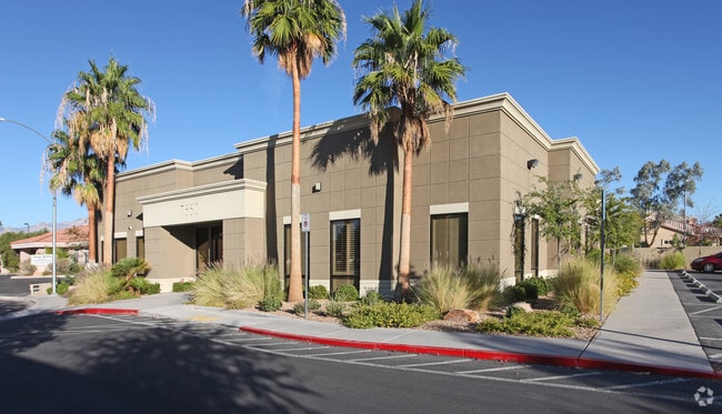
Property Record
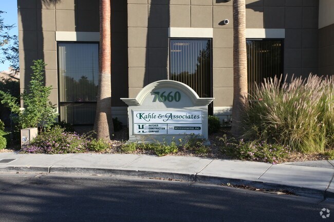
7660 W Sahara Ave, Las Vegas, NV 89117
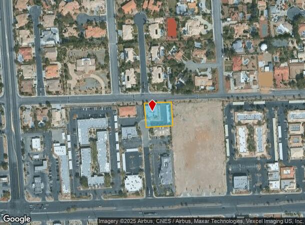

NEARBY LISTINGS FOR SALE OR LEASE
Property Detail
7660 W Sahara Ave
Las Vegas-Henderson-Paradise, NV
Cumorah Center
163-03-415-007
CUMORAH CENTER PLAT BOOK 80 PAGE 32 PT LOT 1 BLOCK 1
Commercialnec
Clark
X
Nevada
32003C2145F
1
2025
0.58 AC
2025
West Las Vegas
002916
Las Vegas
6,266 SF
DEMOGRAPHICS near 7660 W Sahara Ave
1 Mile
3 Mile
5 Mile
2024 Total Population
8,501
183,079
487,665
2029 Population
9,079
196,067
524,407
Pop Growth 2024-2029
+ 6.80%
+ 7.09%
+ 7.53%
Average Age
45
41
41
2024 Total Households
3,568
71,453
195,018
HH Growth 2024-2029
+ 6.70%
+ 7.06%
+ 7.56%
Median Household Inc
$63,301
$57,006
$58,269
Avg Household Size
2.30
2.50
2.40
2024 Avg HH Vehicles
2.00
2.00
2.00
Median Home Value
$693,384
$340,663
$362,268
Median Year Built
1992
1989
1992
Nearby Places
Map Layers
Map Styles
 Street
 Aerial
- Restaurants
- Banks
- Shops
- Fitness
- Groceries
PUBLIC TRANSPORTATION
AIRPORT
Harry Reid International
DRIVE
WALK
Distance
Harry Reid International
20 min
10.4 mi
Boulder City Municipal
DRIVE
WALK
Distance
Boulder City Municipal
46 min
30.9 mi
SALE & LEASE HISTORY
LISTING DATE
SALE/LEASE

Sep 24, 2016
For Sale
Aug 20, 2024
For Sale
Apr 02, 2024
For Lease
Nearby Properties
Address
Land Use
TOTAL SIZE
Lot Size
Zoning
Address
Land Use
TOTAL SIZE
Lot Size
Zoning
336,142 SF
39.99 AC
PC
Address
Land Use
TOTAL SIZE
Lot Size
Zoning
338,051 SF
49.13 AC
C1
Address
Land Use
TOTAL SIZE
Lot Size
Zoning
974,131 SF
19.93 AC
Address
Land Use
TOTAL SIZE
Lot Size
Zoning
40 AC
PF
Address
Land Use
TOTAL SIZE
Lot Size
Zoning
157.50 AC
Address
Land Use
TOTAL SIZE
Lot Size
Zoning
408,908 SF
15.60 AC
Address
Land Use
TOTAL SIZE
Lot Size
Zoning
Address
Land Use
TOTAL SIZE
Lot Size
Zoning
Address
Land Use
TOTAL SIZE
Lot Size
Zoning
7,292 SF
24.24 AC
R3
Address
Land Use
TOTAL SIZE
Lot Size
Zoning
5,427 SF
17.57 AC
Address
Land Use
TOTAL SIZE
Lot Size
Zoning
11,942 SF
17.01 AC
R3
Address
Land Use
TOTAL SIZE
Lot Size
Zoning
12.23 AC
PF
Address
Land Use
TOTAL SIZE
Lot Size
Zoning
2,754 SF
17.17 AC
RPD20
Address
Land Use
TOTAL SIZE
Lot Size
Zoning
28,956 SF
75.82 AC
CV
Address
Land Use
TOTAL SIZE
Lot Size
Zoning
4,872 SF
18.22 AC
R3
Address
Land Use
TOTAL SIZE
Lot Size
Zoning
3.61 AC
PF
Address
Land Use
TOTAL SIZE
Lot Size
Zoning
5,979 SF
17.27 AC
RPD21
Address
Land Use
TOTAL SIZE
Lot Size
Zoning
322,005 SF
29.37 AC
C1
Address
Land Use
TOTAL SIZE
Lot Size
Zoning
3,020 SF
19.68 AC
L:R-PD23
Address
Land Use
TOTAL SIZE
Lot Size
Zoning
5,396 SF
13.95 AC
R3
Address
Land Use
TOTAL SIZE
Lot Size
Zoning
181,262 SF
16.63 AC
L:C-2
Address
Land Use
TOTAL SIZE
Lot Size
Zoning
52,058 SF
6.44 AC
C1
Address
Land Use
TOTAL SIZE
Lot Size
Zoning
66.57 AC
CV
Address
Land Use
TOTAL SIZE
Lot Size
Zoning
285,929 SF
5.06 AC
C1
Address
Land Use
TOTAL SIZE
Lot Size
Zoning
211,331 SF
6.70 AC
USC
Address
Land Use
TOTAL SIZE
Lot Size
Zoning
2,694 SF
14.11 AC
L:R-PD23
Address
Land Use
TOTAL SIZE
Lot Size
Zoning
6,037 SF
15.12 AC
R3
Address
Land Use
TOTAL SIZE
Lot Size
Zoning
10 AC
PF
Address
Land Use
TOTAL SIZE
Lot Size
Zoning
5,466 SF
13.59 AC
RPD20
Address
Land Use
TOTAL SIZE
Lot Size
Zoning
16,491 SF
25.25 AC
C1
The World's #1 Commercial Real Estate Marketplace
Connect with us
© 2025 CoStar Group
The information above has been obtained from sources believed reliable. While we do not doubt its accuracy we have not verified it and make no guarantee, warranty or representation about it. It is your responsibility to independently confirm its accuracy and completeness. Any projections, opinions, assumptions, or estimates used are for example only and do not represent the current or future performance of the property. The value of this transaction to you depends on tax and other factors which should be evaluated by your tax, financial, and legal advisors. You and your advisors should conduct a careful, independent investigation of the property to determine to your satisfaction the suitability of the property for your needs.