Property Record
767 Eustis St, Saint Paul, MN 55114


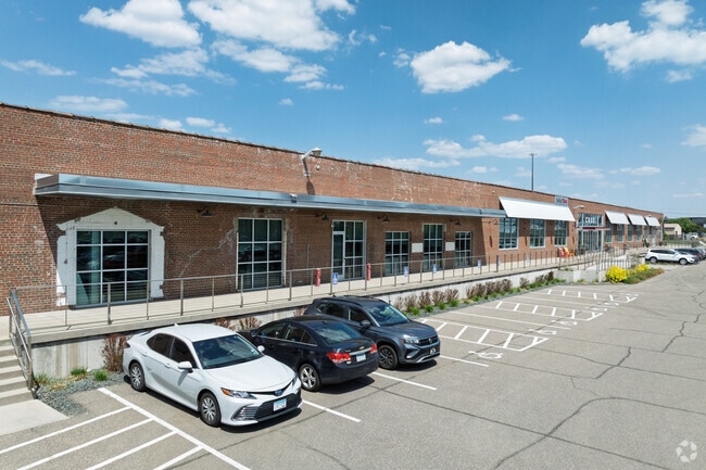
Property Detail
767 Eustis St
Minneapolis-St. Paul-Bloomington, MN-WI
CIC NO 800 EUSTIS CIC UNIT 1
32-29-23-22-0007
Ramsey
Officebuilding
Minnesota
B and X Area of moderate flood hazard, usually the area between the limits of the 100-year and 500-year floods.
unit
2024
6.96 AC
2025
Midway
033200
Minneapolis/St Paul
173,400 SF
NEARBY LISTINGS FOR SALE OR LEASE
DEMOGRAPHICS near 767 Eustis St
1 mile
3 mile
5 mile
2025 Total Population
14,604
192,776
508,121
2030 Population
14,790
193,591
509,095
Pop Growth 2025-2030
+ 1.27%
+ 0.42%
+ 0.19%
Average Age
34
36
37
2025 Total Households
6,762
79,539
226,241
HH Growth 2025-2030
+ 1.33%
+ 0.45%
+ 0.26%
Median Household Inc
$63,000
$68,989
$76,462
Avg Household Size
2.00
2.10
2.10
2025 Avg HH Vehicles
1.00
1.00
1.00
Median Home Value
$389,017
$365,371
$356,130
Median Year Built
1989
1957
1955
Nearby Places
Map Layers
Map Styles
 Street
 Aerial
Layers
 Traffic
 Biking
Places
Listings with unknown addresses are not visible on the map
- Restaurants
- Banks
- Shops
- Fitness
- Groceries
PUBLIC TRANSPORTATION
COMMUTER RAIL
Target Field Station (Northstar Corridor - Northstar Commuter Rail)
Drive
Walk
Distance
Target Field Station (Northstar Corridor - Northstar Commuter Rail)
12 min
5.1 mi
Drive
Walk
Distance
11 min
6.7 mi
AIRPORT
Minneapolis-St Paul International/Wold-Chamberlain
Drive
Walk
Distance
Minneapolis-St Paul International/Wold-Chamberlain
20 min
9.6 mi
SALE & LEASE HISTORY
LISTING DATE
SALE/LEASE

Jun 13, 2017
For Lease
Jun 13, 2017
For Sale
Nearby Properties
Address
Land Use
TOTAL SIZE
Lot Size
Zoning
Address
Land Use
TOTAL SIZE
Lot Size
Zoning
36,300 SF
223.37 AC
Address
Land Use
TOTAL SIZE
Lot Size
Zoning
141,277 SF
44.78 AC
Address
Land Use
TOTAL SIZE
Lot Size
Zoning
84,316 SF
40.83 AC
Address
Land Use
TOTAL SIZE
Lot Size
Zoning
504,049 SF
75.43 AC
Address
Land Use
TOTAL SIZE
Lot Size
Zoning
Address
Land Use
TOTAL SIZE
Lot Size
Zoning
124,932 SF
9.68 AC
Address
Land Use
TOTAL SIZE
Lot Size
Zoning
495,632 SF
1.72 AC
C1
Address
Land Use
TOTAL SIZE
Lot Size
Zoning
176,108 SF
27.45 AC
Address
Land Use
TOTAL SIZE
Lot Size
Zoning
458,470 SF
1.18 AC
OR3
Address
Land Use
TOTAL SIZE
Lot Size
Zoning
695,624 SF
3.67 AC
C2
Address
Land Use
TOTAL SIZE
Lot Size
Zoning
615,172 SF
1.98 AC
I1
Address
Land Use
TOTAL SIZE
Lot Size
Zoning
577,656 SF
2.92 AC
C3A
Address
Land Use
TOTAL SIZE
Lot Size
Zoning
403,792 SF
2.51 AC
B4N
Address
Land Use
TOTAL SIZE
Lot Size
Zoning
18.24 AC
Address
Land Use
TOTAL SIZE
Lot Size
Zoning
618,841 SF
1.53 AC
B4N
Address
Land Use
TOTAL SIZE
Lot Size
Zoning
401,175 SF
0.75 AC
B4N
Address
Land Use
TOTAL SIZE
Lot Size
Zoning
267,530 SF
28.60 AC
Address
Land Use
TOTAL SIZE
Lot Size
Zoning
546,882 SF
2.64 AC
R6
Address
Land Use
TOTAL SIZE
Lot Size
Zoning
395,419 SF
2.73 AC
Address
Land Use
TOTAL SIZE
Lot Size
Zoning
344,458 SF
1.64 AC
C3A
Address
Land Use
TOTAL SIZE
Lot Size
Zoning
321,828 SF
0.77 AC
I1
Address
Land Use
TOTAL SIZE
Lot Size
Zoning
423,037 SF
0.28 AC
C3A
Address
Land Use
TOTAL SIZE
Lot Size
Zoning
3,200 SF
0.14 AC
Address
Land Use
TOTAL SIZE
Lot Size
Zoning
4,808 SF
269.81 AC
Address
Land Use
TOTAL SIZE
Lot Size
Zoning
68,748 SF
21.59 AC
Address
Land Use
TOTAL SIZE
Lot Size
Zoning
295,982 SF
2.51 AC
B4S-2
Address
Land Use
TOTAL SIZE
Lot Size
Zoning
18,630 SF
22.02 AC
Address
Land Use
TOTAL SIZE
Lot Size
Zoning
518,750 SF
3.58 AC
Address
Land Use
TOTAL SIZE
Lot Size
Zoning
291,264 SF
1.61 AC
C3A
Address
Land Use
TOTAL SIZE
Lot Size
Zoning
276,144 SF
347.68 AC
The World's #1 Commercial Real Estate Marketplace
Connect with us
© 2026 CoStar Group
The information above has been obtained from sources believed reliable. While we do not doubt its accuracy we have not verified it and make no guarantee, warranty or representation about it. It is your responsibility to independently confirm its accuracy and completeness. Any projections, opinions, assumptions, or estimates used are for example only and do not represent the current or future performance of the property. The value of this transaction to you depends on tax and other factors which should be evaluated by your tax, financial, and legal advisors. You and your advisors should conduct a careful, independent investigation of the property to determine to your satisfaction the suitability of the property for your needs.