Property Record
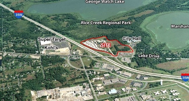
7690 Village Dr, Circle Pines, MN 55014

NEARBY LISTINGS FOR SALE OR LEASE
Property Detail
7690 Village Dr
Minneapolis-St. Paul-Bloomington, MN-WI
The Village No 3
17-31-22-13-0048
THAT PRT OF LOT 1 BLK 1 THE VILLAGE NO 3 LYG WITHIN SW1/4 OF NE1/4 OF SEC 17 TWP 31 RGE 22, SUBJ TO EASE OF REC
Taxexempt
Anoka
X
Minnesota
27003C0365E
1
2025
5.17 AC
2025
Suburban St Paul
050237
Minneapolis/St Paul
32,342 SF
DEMOGRAPHICS near 7690 Village Dr
1 Mile
3 Mile
5 Mile
2024 Total Population
1,937
24,661
70,898
2029 Population
2,007
25,664
73,749
Pop Growth 2024-2029
+ 3.61%
+ 4.07%
+ 4.02%
Average Age
39
39
39
2024 Total Households
684
8,298
25,035
HH Growth 2024-2029
+ 3.80%
+ 4.03%
+ 3.90%
Median Household Inc
$88,141
$107,553
$111,839
Avg Household Size
2.70
2.80
2.80
2024 Avg HH Vehicles
2.00
2.00
2.00
Median Home Value
$312,295
$346,093
$370,173
Median Year Built
1995
1989
1995
Nearby Places
Map Layers
Map Styles
 Street
 Aerial
- Restaurants
- Banks
- Shops
- Fitness
- Groceries
PUBLIC TRANSPORTATION
AIRPORT
Minneapolis-St Paul International/Wold-Chamberlain
DRIVE
WALK
Distance
Minneapolis-St Paul International/Wold-Chamberlain
41 min
27.8 mi
Freight Ports
Port Milwaukee
DRIVE
WALK
Distance
Port Milwaukee
386 min
349.9 mi
SALE & LEASE HISTORY
LISTING DATE
SALE/LEASE

Oct 18, 2016
For Sale
Nov 29, 2016
For Sale
Nearby Properties
Address
Land Use
TOTAL SIZE
Lot Size
Zoning
Address
Land Use
TOTAL SIZE
Lot Size
Zoning
226,201 SF
70.59 AC
Address
Land Use
TOTAL SIZE
Lot Size
Zoning
156,499 SF
81.20 AC
Address
Land Use
TOTAL SIZE
Lot Size
Zoning
Address
Land Use
TOTAL SIZE
Lot Size
Zoning
152,721 SF
Address
Land Use
TOTAL SIZE
Lot Size
Zoning
265,400 SF
13.53 AC
Address
Land Use
TOTAL SIZE
Lot Size
Zoning
74,366 SF
10 AC
Address
Land Use
TOTAL SIZE
Lot Size
Zoning
46,557 SF
9.27 AC
Address
Land Use
TOTAL SIZE
Lot Size
Zoning
223,763 SF
24.89 AC
Address
Land Use
TOTAL SIZE
Lot Size
Zoning
48,260 SF
10.38 AC
Address
Land Use
TOTAL SIZE
Lot Size
Zoning
43,132 SF
37.89 AC
Address
Land Use
TOTAL SIZE
Lot Size
Zoning
180,712 SF
15.95 AC
Address
Land Use
TOTAL SIZE
Lot Size
Zoning
185,498 SF
25.01 AC
Address
Land Use
TOTAL SIZE
Lot Size
Zoning
243,028 SF
24.35 AC
Address
Land Use
TOTAL SIZE
Lot Size
Zoning
52,981 SF
5.27 AC
Address
Land Use
TOTAL SIZE
Lot Size
Zoning
32,314 SF
4.37 AC
Address
Land Use
TOTAL SIZE
Lot Size
Zoning
Address
Land Use
TOTAL SIZE
Lot Size
Zoning
109,470 SF
12.67 AC
Address
Land Use
TOTAL SIZE
Lot Size
Zoning
6,316 SF
28.25 AC
Address
Land Use
TOTAL SIZE
Lot Size
Zoning
79,827 SF
2.81 AC
Address
Land Use
TOTAL SIZE
Lot Size
Zoning
120,680 SF
11.46 AC
Address
Land Use
TOTAL SIZE
Lot Size
Zoning
75,440 SF
5.98 AC
Address
Land Use
TOTAL SIZE
Lot Size
Zoning
67,688 SF
40 AC
Address
Land Use
TOTAL SIZE
Lot Size
Zoning
21,671 SF
4.40 AC
Address
Land Use
TOTAL SIZE
Lot Size
Zoning
881 SF
8.96 AC
Address
Land Use
TOTAL SIZE
Lot Size
Zoning
83,351 SF
Address
Land Use
TOTAL SIZE
Lot Size
Zoning
51,042 SF
8.73 AC
Address
Land Use
TOTAL SIZE
Lot Size
Zoning
140,684 SF
3.65 AC
Address
Land Use
TOTAL SIZE
Lot Size
Zoning
3,947 SF
40 AC
Address
Land Use
TOTAL SIZE
Lot Size
Zoning
83,252 SF
7.75 AC
Address
Land Use
TOTAL SIZE
Lot Size
Zoning
2,265 SF
17.81 AC
The World's #1 Commercial Real Estate Marketplace
Connect with us
© 2025 CoStar Group
The information above has been obtained from sources believed reliable. While we do not doubt its accuracy we have not verified it and make no guarantee, warranty or representation about it. It is your responsibility to independently confirm its accuracy and completeness. Any projections, opinions, assumptions, or estimates used are for example only and do not represent the current or future performance of the property. The value of this transaction to you depends on tax and other factors which should be evaluated by your tax, financial, and legal advisors. You and your advisors should conduct a careful, independent investigation of the property to determine to your satisfaction the suitability of the property for your needs.