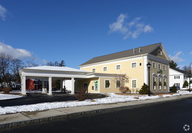
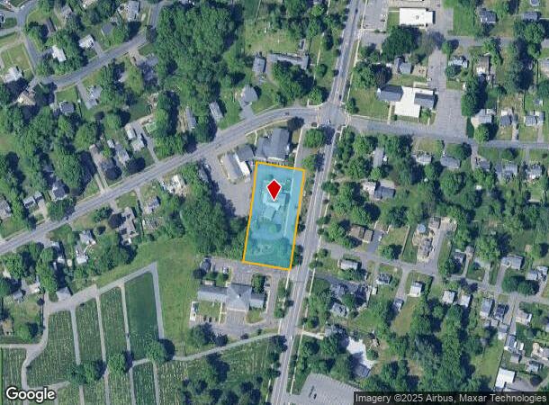
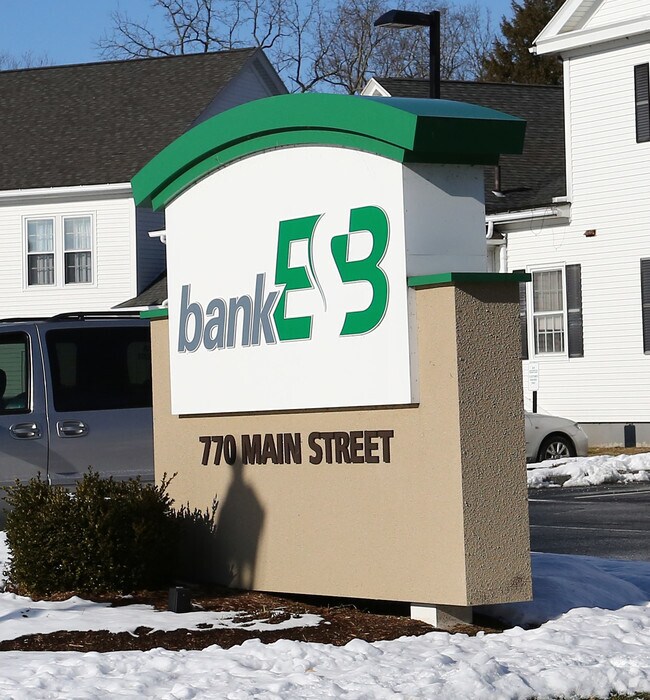
Property Record
770 Main St, Agawam, MA 01001
NEARBY LISTINGS FOR SALE OR LEASE
Property Detail
770 Main St
K9 2 19
Hampden
Financialbuilding
Massachusetts
X
20
25013C0403E
1.14 AC
2025
Hampden County
2025
Hartford
813205
Springfield, MA
3,577 SF
DEMOGRAPHICS near 770 Main St
1 Mile
3 Mile
5 Mile
2024 Total Population
6,526
52,357
187,740
2029 Population
6,318
51,258
184,360
Pop Growth 2024-2029
(3.19%)
(2.10%)
(1.80%)
Average Age
46
40
39
2024 Total Households
2,679
21,801
72,477
HH Growth 2024-2029
(3.40%)
(2.15%)
(1.85%)
Median Household Inc
$76,007
$58,322
$57,982
Avg Household Size
2.30
2.30
2.40
2024 Avg HH Vehicles
2.00
2.00
2.00
Median Home Value
$272,718
$276,116
$256,121
Median Year Built
1969
1955
1953
Nearby Places
Map Layers
Map Styles
 Street
 Aerial
- Restaurants
- Banks
- Shops
- Fitness
- Groceries
PUBLIC TRANSPORTATION
COMMUTER RAIL
DRIVE
WALK
Distance
8 min
4.4 mi
AIRPORT
Bradley International
DRIVE
WALK
Distance
Bradley International
24 min
10.4 mi
Nearby Properties
Address
Land Use
TOTAL SIZE
Lot Size
Zoning
Address
Land Use
TOTAL SIZE
Lot Size
Zoning
236,616 SF
31.07 AC
RA1
Address
Land Use
TOTAL SIZE
Lot Size
Zoning
162,232 SF
3.06 AC
R2
Address
Land Use
TOTAL SIZE
Lot Size
Zoning
227,072 SF
4.37 AC
B3
Address
Land Use
TOTAL SIZE
Lot Size
Zoning
839,347 SF
2.05 AC
B3
Address
Land Use
TOTAL SIZE
Lot Size
Zoning
36.53 AC
IB
Address
Land Use
TOTAL SIZE
Lot Size
Zoning
100,000 SF
17.80 AC
WC
Address
Land Use
TOTAL SIZE
Lot Size
Zoning
236,032 SF
41.65 AC
RA2
Address
Land Use
TOTAL SIZE
Lot Size
Zoning
8,712 SF
25.08 AC
RA1
Address
Land Use
TOTAL SIZE
Lot Size
Zoning
42,412 SF
2.22 AC
SR2B1
Address
Land Use
TOTAL SIZE
Lot Size
Zoning
24,835 SF
2.16 AC
B3
Address
Land Use
TOTAL SIZE
Lot Size
Zoning
335,105 SF
1.28 AC
B3
Address
Land Use
TOTAL SIZE
Lot Size
Zoning
1,840 SF
148.78 AC
BB
Address
Land Use
TOTAL SIZE
Lot Size
Zoning
77,012 SF
1.29 AC
B3
Address
Land Use
TOTAL SIZE
Lot Size
Zoning
137,450 SF
16 AC
Address
Land Use
TOTAL SIZE
Lot Size
Zoning
57,593 SF
2.15 AC
SR3C1
Address
Land Use
TOTAL SIZE
Lot Size
Zoning
184,850 SF
2.39 AC
B3
Address
Land Use
TOTAL SIZE
Lot Size
Zoning
426,795 SF
3.99 AC
B3
Address
Land Use
TOTAL SIZE
Lot Size
Zoning
133,822 SF
40.51 AC
RA2
Address
Land Use
TOTAL SIZE
Lot Size
Zoning
171,105 SF
14.21 AC
Address
Land Use
TOTAL SIZE
Lot Size
Zoning
155,803 SF
0.87 AC
B3
Address
Land Use
TOTAL SIZE
Lot Size
Zoning
51,400 SF
0.59 AC
B3
Address
Land Use
TOTAL SIZE
Lot Size
Zoning
80,144 SF
CR
Address
Land Use
TOTAL SIZE
Lot Size
Zoning
84,420 SF
0.71 AC
B3
Address
Land Use
TOTAL SIZE
Lot Size
Zoning
198,606 SF
B3
Address
Land Use
TOTAL SIZE
Lot Size
Zoning
32,084 SF
0.48 AC
Address
Land Use
TOTAL SIZE
Lot Size
Zoning
18.51 AC
BA
Address
Land Use
TOTAL SIZE
Lot Size
Zoning
125,510 SF
0.96 AC
B3
Address
Land Use
TOTAL SIZE
Lot Size
Zoning
51,555 SF
4.11 AC
Address
Land Use
TOTAL SIZE
Lot Size
Zoning
56,700 SF
1.74 AC
R3
Address
Land Use
TOTAL SIZE
Lot Size
Zoning
15,696 SF
0.47 AC
The World's #1 Commercial Real Estate Marketplace
Connect with us
© 2026 CoStar Group
The information above has been obtained from sources believed reliable. While we do not doubt its accuracy we have not verified it and make no guarantee, warranty or representation about it. It is your responsibility to independently confirm its accuracy and completeness. Any projections, opinions, assumptions, or estimates used are for example only and do not represent the current or future performance of the property. The value of this transaction to you depends on tax and other factors which should be evaluated by your tax, financial, and legal advisors. You and your advisors should conduct a careful, independent investigation of the property to determine to your satisfaction the suitability of the property for your needs.