Property Record
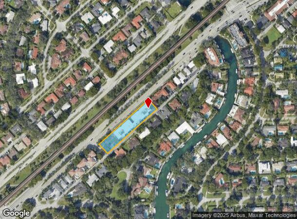
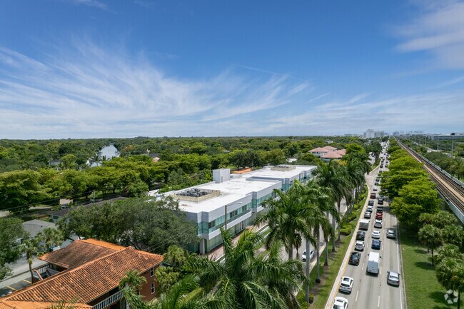
770 S Dixie Hwy, Coral Gables, FL 33146

NEARBY LISTINGS FOR SALE OR LEASE
Property Detail
770 S Dixie Hwy
Miami-Miami Beach-Kendall, FL
Coral Gables Riviera
03-4119-004-2880
19-20-30 54 41 CORAL GABLES RIVIERA SEC 3 REV PB 28-44 LOTS 1 THRU 19 BLK 91 LOT SIZE 475.000 X 100 OR 17194-2993 0396 5
Officebuilding
Miami/Dade
X
Florida
12086C0457L
1-19
2024
1.09 AC
2025
Coral Gables
007401
South Florida
58,514 SF
DEMOGRAPHICS near 770 S Dixie Hwy
1 Mile
3 Mile
5 Mile
2024 Total Population
14,500
132,609
366,372
2029 Population
14,516
130,634
356,894
Pop Growth 2024-2029
+ 0.11%
(1.49%)
(2.59%)
Average Age
38
42
43
2024 Total Households
5,086
53,658
142,496
HH Growth 2024-2029
+ 1.12%
(1.54%)
(2.72%)
Median Household Inc
$118,005
$85,944
$62,242
Avg Household Size
2.40
2.30
2.50
2024 Avg HH Vehicles
2.00
2.00
2.00
Median Home Value
$961,736
$684,772
$491,253
Median Year Built
1966
1970
1968
Nearby Places
Map Layers
Map Styles
 Street
 Aerial
- Restaurants
- Banks
- Shops
- Fitness
- Groceries
PUBLIC TRANSPORTATION
COMMUTER RAIL
University (Metrorail Green Line - Miami-Dade Transit (Metrorail/Metromover))
DRIVE
WALK
Distance
University (Metrorail Green Line - Miami-Dade Transit (Metrorail/Metromover))
1 min
15 min
0.8 mi
Douglas Road (Metrorail Green Line - Miami-Dade Transit (Metrorail/Metromover))
DRIVE
WALK
Distance
Douglas Road (Metrorail Green Line - Miami-Dade Transit (Metrorail/Metromover))
3 min
1.4 mi
AIRPORT
Miami International
DRIVE
WALK
Distance
Miami International
23 min
10.7 mi
Fort Lauderdale/Hollywood International
DRIVE
WALK
Distance
Fort Lauderdale/Hollywood International
42 min
29.2 mi
Freight Ports
Port of Miami
DRIVE
WALK
Distance
Port of Miami
18 min
8.9 mi
Nearby Properties
Address
Land Use
TOTAL SIZE
Lot Size
Zoning
Address
Land Use
TOTAL SIZE
Lot Size
Zoning
870,720 SF
1.90 AC
4800
Address
Land Use
TOTAL SIZE
Lot Size
Zoning
883,561 SF
5.63 AC
8200
Address
Land Use
TOTAL SIZE
Lot Size
Zoning
1,101,032 SF
5.18 AC
8000
Address
Land Use
TOTAL SIZE
Lot Size
Zoning
1,647,481 SF
23.04 AC
5000
Address
Land Use
TOTAL SIZE
Lot Size
Zoning
715,755 SF
2.66 AC
5005
Address
Land Use
TOTAL SIZE
Lot Size
Zoning
973,728 SF
76.18 AC
8200
Address
Land Use
TOTAL SIZE
Lot Size
Zoning
759,863 SF
7.02 AC
6506
Address
Land Use
TOTAL SIZE
Lot Size
Zoning
345,178 SF
6.73 AC
5005
Address
Land Use
TOTAL SIZE
Lot Size
Zoning
1,168,390 SF
0.04 AC
7100
Address
Land Use
TOTAL SIZE
Lot Size
Zoning
423,104 SF
2.58 AC
6200
Address
Land Use
TOTAL SIZE
Lot Size
Zoning
482,246 SF
0.83 AC
5005
Address
Land Use
TOTAL SIZE
Lot Size
Zoning
408,292 SF
0.88 AC
6110
Address
Land Use
TOTAL SIZE
Lot Size
Zoning
247,488 SF
4.25 AC
5005
Address
Land Use
TOTAL SIZE
Lot Size
Zoning
275,755 SF
6.73 AC
5005
Address
Land Use
TOTAL SIZE
Lot Size
Zoning
688,104 SF
3.16 AC
6101
Address
Land Use
TOTAL SIZE
Lot Size
Zoning
500,332 SF
3.46 AC
6000
Address
Land Use
TOTAL SIZE
Lot Size
Zoning
365,003 SF
15.05 AC
8200
Address
Land Use
TOTAL SIZE
Lot Size
Zoning
299,785 SF
0.55 AC
6110
Address
Land Use
TOTAL SIZE
Lot Size
Zoning
431,941 SF
2.06 AC
6110
Address
Land Use
TOTAL SIZE
Lot Size
Zoning
407,265 SF
1.59 AC
6100
Address
Land Use
TOTAL SIZE
Lot Size
Zoning
518,244 SF
1.06 AC
5005
Address
Land Use
TOTAL SIZE
Lot Size
Zoning
535,679 SF
2.73 AC
6000
Address
Land Use
TOTAL SIZE
Lot Size
Zoning
668,569 SF
2.33 AC
5004
Address
Land Use
TOTAL SIZE
Lot Size
Zoning
449,572 SF
1.74 AC
6110
Address
Land Use
TOTAL SIZE
Lot Size
Zoning
473,214 SF
2.51 AC
5005
Address
Land Use
TOTAL SIZE
Lot Size
Zoning
540,267 SF
1.74 AC
5005
Address
Land Use
TOTAL SIZE
Lot Size
Zoning
14.30 AC
0700
Address
Land Use
TOTAL SIZE
Lot Size
Zoning
516,656 SF
9.65 AC
6300
Address
Land Use
TOTAL SIZE
Lot Size
Zoning
498,294 SF
1.19 AC
5005
Address
Land Use
TOTAL SIZE
Lot Size
Zoning
221,047 SF
9.79 AC
0100
The World's #1 Commercial Real Estate Marketplace
Connect with us
© 2025 CoStar Group
The information above has been obtained from sources believed reliable. While we do not doubt its accuracy we have not verified it and make no guarantee, warranty or representation about it. It is your responsibility to independently confirm its accuracy and completeness. Any projections, opinions, assumptions, or estimates used are for example only and do not represent the current or future performance of the property. The value of this transaction to you depends on tax and other factors which should be evaluated by your tax, financial, and legal advisors. You and your advisors should conduct a careful, independent investigation of the property to determine to your satisfaction the suitability of the property for your needs.