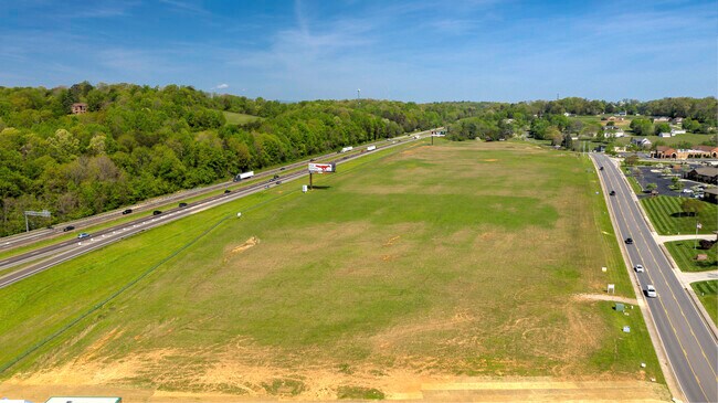
Property Record
7713 Conner Rd, Powell, TN 37849


NEARBY LISTINGS FOR SALE OR LEASE
Property Detail
7713 Conner Rd
Knoxville, TN
Greenbelt App #A-3880
047-032
SUBDIVISIONNAME GREENBELT APP #A-3880 LOWLOT 1 HIGHLOT LOWBLOCK HIGHBLOCK DIMENSIONS
Agriculturalland
Knox
X
Tennessee
47093C0120F
1
2025
25.35 AC
2025
North/Emory Road
006104
Knoxville
7,685 SF
DEMOGRAPHICS near 7713 Conner Rd
1 mile
3 mile
5 mile
2024 Total Population
5,642
30,280
93,093
2029 Population
6,069
32,716
100,898
Pop Growth 2024-2029
+ 7.57%
+ 8.04%
+ 8.38%
Average Age
42
40
40
2024 Total Households
2,365
11,907
38,551
HH Growth 2024-2029
+ 7.61%
+ 8.10%
+ 8.46%
Median Household Inc
$70,994
$74,717
$60,216
Avg Household Size
2.40
2.50
2.40
2024 Avg HH Vehicles
2.00
2.00
2.00
Median Home Value
$247,559
$246,888
$214,959
Median Year Built
1993
1992
1982
Nearby Places
Map Layers
Map Styles
 Street
 Aerial
Transit
 Traffic
 Biking
Places
Listings with unknown addresses are not visible on the map
- Restaurants
- Banks
- Shops
- Fitness
- Groceries
PUBLIC TRANSPORTATION
AIRPORT
McGhee Tyson
Drive
Walk
Distance
McGhee Tyson
42 min
24.1 mi
Freight Ports
North Charleston Terminal
Drive
Walk
Distance
North Charleston Terminal
428 min
370.6 mi
SALE & LEASE HISTORY
LISTING DATE
SALE/LEASE

Sep 25, 2016
For Lease
Nearby Properties
Address
Land Use
TOTAL SIZE
Lot Size
Zoning
Address
Land Use
TOTAL SIZE
Lot Size
Zoning
44,435 SF
34.87 AC
Address
Land Use
TOTAL SIZE
Lot Size
Zoning
4,922 SF
46.42 AC
Address
Land Use
TOTAL SIZE
Lot Size
Zoning
3,697 SF
16.71 AC
Address
Land Use
TOTAL SIZE
Lot Size
Zoning
111,570 SF
7.15 AC
Address
Land Use
TOTAL SIZE
Lot Size
Zoning
3,046 SF
13.43 AC
Address
Land Use
TOTAL SIZE
Lot Size
Zoning
80,708 SF
0.04 AC
Address
Land Use
TOTAL SIZE
Lot Size
Zoning
122,198 SF
12.92 AC
Address
Land Use
TOTAL SIZE
Lot Size
Zoning
70,506 SF
0.04 AC
Address
Land Use
TOTAL SIZE
Lot Size
Zoning
14,601 SF
15.03 AC
Address
Land Use
TOTAL SIZE
Lot Size
Zoning
9,924 SF
10.20 AC
Address
Land Use
TOTAL SIZE
Lot Size
Zoning
50,857 SF
37.82 AC
Address
Land Use
TOTAL SIZE
Lot Size
Zoning
34,022 SF
3.85 AC
Address
Land Use
TOTAL SIZE
Lot Size
Zoning
14,270 SF
46.96 AC
Address
Land Use
TOTAL SIZE
Lot Size
Zoning
90,717 SF
31.69 AC
Address
Land Use
TOTAL SIZE
Lot Size
Zoning
25,302 SF
10.67 AC
Address
Land Use
TOTAL SIZE
Lot Size
Zoning
62,732 SF
5.90 AC
Address
Land Use
TOTAL SIZE
Lot Size
Zoning
3,150 SF
22.75 AC
Address
Land Use
TOTAL SIZE
Lot Size
Zoning
23,306 SF
10.08 AC
Address
Land Use
TOTAL SIZE
Lot Size
Zoning
57,900 SF
9.97 AC
Address
Land Use
TOTAL SIZE
Lot Size
Zoning
18,212 SF
3.06 AC
Address
Land Use
TOTAL SIZE
Lot Size
Zoning
92,010 SF
1.44 AC
Address
Land Use
TOTAL SIZE
Lot Size
Zoning
37,688 SF
5.81 AC
Address
Land Use
TOTAL SIZE
Lot Size
Zoning
315,369 SF
20.31 AC
Address
Land Use
TOTAL SIZE
Lot Size
Zoning
32,767 SF
3.04 AC
Address
Land Use
TOTAL SIZE
Lot Size
Zoning
54,417 SF
5.38 AC
Address
Land Use
TOTAL SIZE
Lot Size
Zoning
21,100 SF
3.32 AC
Address
Land Use
TOTAL SIZE
Lot Size
Zoning
14,192 SF
2.50 AC
Address
Land Use
TOTAL SIZE
Lot Size
Zoning
37,161 SF
1.75 AC
Address
Land Use
TOTAL SIZE
Lot Size
Zoning
15,280 SF
5.02 AC
Address
Land Use
TOTAL SIZE
Lot Size
Zoning
12,871 SF
1.75 AC
The World's #1 Commercial Real Estate Marketplace
Connect with us
© 2026 CoStar Group
The information above has been obtained from sources believed reliable. While we do not doubt its accuracy we have not verified it and make no guarantee, warranty or representation about it. It is your responsibility to independently confirm its accuracy and completeness. Any projections, opinions, assumptions, or estimates used are for example only and do not represent the current or future performance of the property. The value of this transaction to you depends on tax and other factors which should be evaluated by your tax, financial, and legal advisors. You and your advisors should conduct a careful, independent investigation of the property to determine to your satisfaction the suitability of the property for your needs.