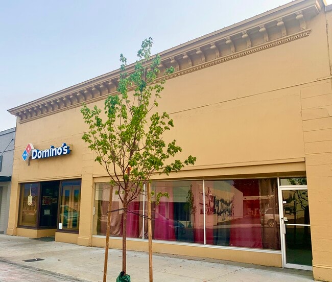
Property Record
772 Main St, Dallas, OR 97338

NEARBY LISTINGS FOR SALE OR LEASE
Property Detail
772 Main St
Salem, OR
The Original City Of Dallas
145417
RETAIL STORE - COMMERCIAL
Officebuilding
Polk
X
Oregon
41053C0237F
3,4
2024
0.19 AC
2025
Polk County
020203
Portland
3,986 SF
DEMOGRAPHICS near 772 Main St
1 Mile
3 Mile
5 Mile
2024 Total Population
12,804
20,898
23,129
2029 Population
13,958
22,787
25,218
Pop Growth 2024-2029
+ 9.01%
+ 9.04%
+ 9.03%
Average Age
42
43
43
2024 Total Households
4,961
8,160
8,952
HH Growth 2024-2029
+ 9.43%
+ 9.44%
+ 9.44%
Median Household Inc
$61,756
$69,661
$71,483
Avg Household Size
2.50
2.50
2.50
2024 Avg HH Vehicles
2.00
2.00
2.00
Median Home Value
$323,207
$354,493
$364,891
Median Year Built
1985
1987
1987
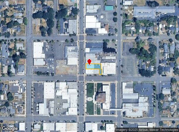
Nearby Places
Map Layers
Map Styles
 Street
 Aerial
- Restaurants
- Banks
- Shops
- Fitness
- Groceries
SALE & LEASE HISTORY
LISTING DATE
SALE/LEASE

Oct 14, 2020
For Sale
Oct 01, 2021
For Lease
Jan 31, 2024
For Sale
Nearby Properties
Address
Land Use
TOTAL SIZE
Lot Size
Zoning
Address
Land Use
TOTAL SIZE
Lot Size
Zoning
100,487 SF
5.54 AC
RL
Address
Land Use
TOTAL SIZE
Lot Size
Zoning
176,218 SF
17 AC
RL
Address
Land Use
TOTAL SIZE
Lot Size
Zoning
44,119 SF
2.83 AC
CN
Address
Land Use
TOTAL SIZE
Lot Size
Zoning
104,010 SF
5.93 AC
RL
Address
Land Use
TOTAL SIZE
Lot Size
Zoning
957 SF
32.74 AC
PS
Address
Land Use
TOTAL SIZE
Lot Size
Zoning
54,200 SF
1.66 AC
RH
Address
Land Use
TOTAL SIZE
Lot Size
Zoning
156,232 SF
2.36 AC
RM
Address
Land Use
TOTAL SIZE
Lot Size
Zoning
55,200 SF
1.99 AC
CBD
Address
Land Use
TOTAL SIZE
Lot Size
Zoning
42,996 SF
10.95 AC
PA
Address
Land Use
TOTAL SIZE
Lot Size
Zoning
53,217 SF
2.90 AC
RL
Address
Land Use
TOTAL SIZE
Lot Size
Zoning
54,911 SF
14.47 AC
RL
Address
Land Use
TOTAL SIZE
Lot Size
Zoning
83,766 SF
4.96 AC
CG
Address
Land Use
TOTAL SIZE
Lot Size
Zoning
28,463 SF
2.29 AC
POS
Address
Land Use
TOTAL SIZE
Lot Size
Zoning
52,605 SF
20.30 AC
RL
Address
Land Use
TOTAL SIZE
Lot Size
Zoning
45,809 SF
2.02 AC
RL
Address
Land Use
TOTAL SIZE
Lot Size
Zoning
135,796 SF
8.84 AC
I
Address
Land Use
TOTAL SIZE
Lot Size
Zoning
31,618 SF
1.86 AC
CG
Address
Land Use
TOTAL SIZE
Lot Size
Zoning
33,598 SF
2.02 AC
RL
Address
Land Use
TOTAL SIZE
Lot Size
Zoning
97,115 SF
6.71 AC
I
Address
Land Use
TOTAL SIZE
Lot Size
Zoning
58,924 SF
0.75 AC
RH
Address
Land Use
TOTAL SIZE
Lot Size
Zoning
50,814 SF
2.88 AC
RM
Address
Land Use
TOTAL SIZE
Lot Size
Zoning
30,224 SF
6.05 AC
SR
Address
Land Use
TOTAL SIZE
Lot Size
Zoning
64,416 SF
1.24 AC
RL
Address
Land Use
TOTAL SIZE
Lot Size
Zoning
10 SF
2.67 AC
SR
Address
Land Use
TOTAL SIZE
Lot Size
Zoning
46,088 SF
2.70 AC
RM
Address
Land Use
TOTAL SIZE
Lot Size
Zoning
54,100 SF
3.71 AC
RM
Address
Land Use
TOTAL SIZE
Lot Size
Zoning
54,905 SF
5.23 AC
CG
Address
Land Use
TOTAL SIZE
Lot Size
Zoning
28,096 SF
1.62 AC
RM
Address
Land Use
TOTAL SIZE
Lot Size
Zoning
24,120 SF
2.90 AC
CG
Address
Land Use
TOTAL SIZE
Lot Size
Zoning
51,469 SF
1.80 AC
RH
The World's #1 Commercial Real Estate Marketplace
Connect with us
© 2025 CoStar Group
The information above has been obtained from sources believed reliable. While we do not doubt its accuracy we have not verified it and make no guarantee, warranty or representation about it. It is your responsibility to independently confirm its accuracy and completeness. Any projections, opinions, assumptions, or estimates used are for example only and do not represent the current or future performance of the property. The value of this transaction to you depends on tax and other factors which should be evaluated by your tax, financial, and legal advisors. You and your advisors should conduct a careful, independent investigation of the property to determine to your satisfaction the suitability of the property for your needs.