Property Record
7726 Wards Rd, Rustburg, VA 24588

Property Detail
7726 Wards Rd
0430-07000-007-0
PT LOT 7 - BOWLING EST
Commercialnec
CAMPBELL
IGC
Virginia
B and X Area of moderate flood hazard, usually the area between the limits of the 100-year and 500-year floods.
7
2025
44.36 AC
2025
Lynchburg
020500
Other Market Areas
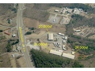
20,000 SF
Lynchburg, VA
NEARBY LISTINGS FOR SALE OR LEASE
DEMOGRAPHICS near 7726 Wards Rd
1 mile
3 mile
5 mile
2025 Total Population
314
3,617
9,191
2030 Population
315
3,621
9,225
Pop Growth 2025-2030
+ 0.32%
+ 0.11%
+ 0.37%
Average Age
43
44
43
2025 Total Households
126
1,493
3,746
HH Growth 2025-2030
+ 0.79%
+ 0.13%
+ 0.37%
Median Household Inc
$76,087
$70,585
$66,193
Avg Household Size
2.50
2.40
2.40
2025 Avg HH Vehicles
2.00
2.00
2.00
Median Home Value
$195,121
$188,403
$189,639
Median Year Built
1979
1983
1985
Nearby Places
Map Layers
Map Styles
 Street
 Aerial
Layers
 Traffic
 Biking
Places
Listings with unknown addresses are not visible on the map
- Restaurants
- Banks
- Shops
- Fitness
- Groceries
PUBLIC TRANSPORTATION
AIRPORT
Lynchburg Regional/Preston Glenn Field
Drive
Walk
Distance
Lynchburg Regional/Preston Glenn Field
16 min
9.0 mi
Nearby Properties
Address
Land Use
TOTAL SIZE
Lot Size
Zoning
Address
Land Use
TOTAL SIZE
Lot Size
Zoning
71,400 SF
46.21 AC
Address
Land Use
TOTAL SIZE
Lot Size
Zoning
33,365 SF
13.30 AC
IHC
Address
Land Use
TOTAL SIZE
Lot Size
Zoning
20,250 SF
3.29 AC
Address
Land Use
TOTAL SIZE
Lot Size
Zoning
21,780 SF
4.17 AC
BGC
Address
Land Use
TOTAL SIZE
Lot Size
Zoning
9,540 SF
6.66 AC
IH
Address
Land Use
TOTAL SIZE
Lot Size
Zoning
5,153 SF
2.36 AC
BGC
Address
Land Use
TOTAL SIZE
Lot Size
Zoning
8,753 SF
3.15 AC
BGC
Address
Land Use
TOTAL SIZE
Lot Size
Zoning
10,000 SF
5.20 AC
IH
Address
Land Use
TOTAL SIZE
Lot Size
Zoning
320 SF
3.41 AC
BGC
Address
Land Use
TOTAL SIZE
Lot Size
Zoning
3,775 SF
6.95 AC
A1
Address
Land Use
TOTAL SIZE
Lot Size
Zoning
3,020 SF
231.41 AC
A1
Address
Land Use
TOTAL SIZE
Lot Size
Zoning
12,000 SF
8 AC
IG
Address
Land Use
TOTAL SIZE
Lot Size
Zoning
7,284 SF
9.91 AC
BGC
Address
Land Use
TOTAL SIZE
Lot Size
Zoning
11,250 SF
5.85 AC
Address
Land Use
TOTAL SIZE
Lot Size
Zoning
12,640 SF
4.40 AC
BGC
Address
Land Use
TOTAL SIZE
Lot Size
Zoning
4,750 SF
1.96 AC
BGC
Address
Land Use
TOTAL SIZE
Lot Size
Zoning
4,500 SF
4.53 AC
IGC
Address
Land Use
TOTAL SIZE
Lot Size
Zoning
4,596 SF
8 AC
Address
Land Use
TOTAL SIZE
Lot Size
Zoning
2,833 SF
107.27 AC
A1
Address
Land Use
TOTAL SIZE
Lot Size
Zoning
1,000 SF
25.15 AC
A1
Address
Land Use
TOTAL SIZE
Lot Size
Zoning
6,500 SF
3 AC
IGC
Address
Land Use
TOTAL SIZE
Lot Size
Zoning
25,410 SF
8.62 AC
Address
Land Use
TOTAL SIZE
Lot Size
Zoning
1,914 SF
39.75 AC
BGC
Address
Land Use
TOTAL SIZE
Lot Size
Zoning
2,326 SF
104.16 AC
A1
Address
Land Use
TOTAL SIZE
Lot Size
Zoning
3,061 SF
195.67 AC
A1
Address
Land Use
TOTAL SIZE
Lot Size
Zoning
4,800 SF
11.46 AC
IHC
Address
Land Use
TOTAL SIZE
Lot Size
Zoning
1,914 SF
113.26 AC
A1
Address
Land Use
TOTAL SIZE
Lot Size
Zoning
902 SF
1.53 AC
The World's #1 Commercial Real Estate Marketplace
Connect with us
© 2026 CoStar Group
The information above has been obtained from sources believed reliable. While we do not doubt its accuracy we have not verified it and make no guarantee, warranty or representation about it. It is your responsibility to independently confirm its accuracy and completeness. Any projections, opinions, assumptions, or estimates used are for example only and do not represent the current or future performance of the property. The value of this transaction to you depends on tax and other factors which should be evaluated by your tax, financial, and legal advisors. You and your advisors should conduct a careful, independent investigation of the property to determine to your satisfaction the suitability of the property for your needs.