Property Record
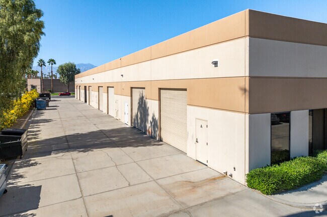
77971 Wildcat St, Indio, CA 92201


Property Detail
77971 Wildcat St
626-330-030
1.29 ACRES IN PAR 30 PM 154/086 TR 23118
Lightindustrial
RIVERSIDE
IP
California
AO River or stream flood hazard areas, and areas with a 1% or greater chance of shallow flooding each year. These areas have a 26% chance of flooding over the life of a 30-year mortgage.
30
2024
1.29 AC
2025
Coachella Valley
045501
Inland Empire (California)
17,280 SF
Riverside-San Bernardino-Ontario, CA
NEARBY LISTINGS FOR SALE OR LEASE
DEMOGRAPHICS near 77971 Wildcat St
1 mile
3 mile
5 mile
2025 Total Population
7,040
53,743
136,323
2030 Population
7,513
57,671
145,046
Pop Growth 2025-2030
+ 6.72%
+ 7.31%
+ 6.40%
Average Age
55
52
49
2025 Total Households
3,502
24,748
58,193
HH Growth 2025-2030
+ 6.45%
+ 7.33%
+ 6.64%
Median Household Inc
$77,916
$93,589
$90,852
Avg Household Size
2.00
2.10
2.30
2025 Avg HH Vehicles
2.00
2.00
2.00
Median Home Value
$606,390
$669,278
$629,446
Median Year Built
1993
1994
1993
Nearby Places
Map Layers
Map Styles
 Street
 Aerial
Transit
 Traffic
 Biking
Places
Listings with unknown addresses are not visible on the map
- Restaurants
- Banks
- Shops
- Fitness
- Groceries
PUBLIC TRANSPORTATION
AIRPORT
Palm Springs International
Drive
Walk
Distance
Palm Springs International
21 min
15.3 mi
SALE & LEASE HISTORY
LISTING DATE
SALE/LEASE

Sep 25, 2016
For Lease
Oct 09, 2018
For Lease
Jun 02, 2017
For Lease
Nearby Properties
Address
Land Use
TOTAL SIZE
Lot Size
Zoning
Address
Land Use
TOTAL SIZE
Lot Size
Zoning
51.81 AC
Address
Land Use
TOTAL SIZE
Lot Size
Zoning
110,000 SF
39.46 AC
Address
Land Use
TOTAL SIZE
Lot Size
Zoning
32,576 SF
19.40 AC
CBOOK
Address
Land Use
TOTAL SIZE
Lot Size
Zoning
160,365 SF
6.98 AC
PC2
Address
Land Use
TOTAL SIZE
Lot Size
Zoning
110,354 SF
14.15 AC
RH
Address
Land Use
TOTAL SIZE
Lot Size
Zoning
284,977 SF
23.95 AC
Address
Land Use
TOTAL SIZE
Lot Size
Zoning
139,456 SF
8.02 AC
R-3
Address
Land Use
TOTAL SIZE
Lot Size
Zoning
208,171 SF
16.83 AC
CBOOK
Address
Land Use
TOTAL SIZE
Lot Size
Zoning
96,384 SF
9.90 AC
SPZONE
Address
Land Use
TOTAL SIZE
Lot Size
Zoning
131,298 SF
10.06 AC
CPS
Address
Land Use
TOTAL SIZE
Lot Size
Zoning
158,234 SF
7.38 AC
IP
Address
Land Use
TOTAL SIZE
Lot Size
Zoning
70,397 SF
3.20 AC
M
Address
Land Use
TOTAL SIZE
Lot Size
Zoning
38,644 SF
18.57 AC
Address
Land Use
TOTAL SIZE
Lot Size
Zoning
53,250 SF
6.62 AC
Address
Land Use
TOTAL SIZE
Lot Size
Zoning
45,962 SF
5.62 AC
Address
Land Use
TOTAL SIZE
Lot Size
Zoning
110,235 SF
8.42 AC
Address
Land Use
TOTAL SIZE
Lot Size
Zoning
106,160 SF
9.02 AC
MIX
Address
Land Use
TOTAL SIZE
Lot Size
Zoning
85,102 SF
61.12 AC
Address
Land Use
TOTAL SIZE
Lot Size
Zoning
59,416 SF
3.38 AC
W2
Address
Land Use
TOTAL SIZE
Lot Size
Zoning
16,588 SF
3.80 AC
R2A3500
Address
Land Use
TOTAL SIZE
Lot Size
Zoning
18,348 SF
5.92 AC
R3
Address
Land Use
TOTAL SIZE
Lot Size
Zoning
58,771 SF
3.41 AC
Address
Land Use
TOTAL SIZE
Lot Size
Zoning
35,324 SF
4.06 AC
Address
Land Use
TOTAL SIZE
Lot Size
Zoning
20,222 SF
9.18 AC
Address
Land Use
TOTAL SIZE
Lot Size
Zoning
31,059 SF
2.84 AC
A1
Address
Land Use
TOTAL SIZE
Lot Size
Zoning
8,151 SF
2.05 AC
Address
Land Use
TOTAL SIZE
Lot Size
Zoning
60,131 SF
3.55 AC
CPS
Address
Land Use
TOTAL SIZE
Lot Size
Zoning
23,149 SF
1.43 AC
C1CP
The World's #1 Commercial Real Estate Marketplace
Connect with us
© 2026 CoStar Group
The information above has been obtained from sources believed reliable. While we do not doubt its accuracy we have not verified it and make no guarantee, warranty or representation about it. It is your responsibility to independently confirm its accuracy and completeness. Any projections, opinions, assumptions, or estimates used are for example only and do not represent the current or future performance of the property. The value of this transaction to you depends on tax and other factors which should be evaluated by your tax, financial, and legal advisors. You and your advisors should conduct a careful, independent investigation of the property to determine to your satisfaction the suitability of the property for your needs.