Property Record
800 Haunted Ln, Bensalem, PA 19020


Save to a Folder
{{folder.Name}}
{{folder.ListingIds.length}} Properties
{{folder.ListingIds.length}} Property
Create a New Folder
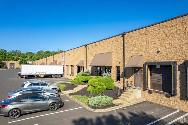
Property Detail
800 Haunted Ln
02-076-140
LOT # 6 SEC 2 10.431 7ACEXPRESSWAY 95 INDUSTRI AL CTR
Warehouse
Bucks
M2
Pennsylvania
B and X Area of moderate flood hazard, usually the area between the limits of the 100-year and 500-year floods.
6
2025
10.43 AC
2026
Bucks
100102
Philadelphia
139,918 SF
Philadelphia-Camden-Wilmington, PA-NJ-DE-MD
NEARBY LISTINGS FOR SALE OR LEASE
DEMOGRAPHICS near 800 Haunted Ln
1 mile
3 mile
5 mile
2025 Total Population
8,682
80,724
256,607
2030 Population
8,722
81,594
258,184
Pop Growth 2025-2030
+ 0.46%
+ 1.08%
+ 0.61%
Average Age
42
42
42
2025 Total Households
3,216
30,865
98,565
HH Growth 2025-2030
+ 0.34%
+ 1.14%
+ 0.52%
Median Household Inc
$76,348
$77,651
$82,963
Avg Household Size
2.60
2.50
2.50
2025 Avg HH Vehicles
2.00
2.00
2.00
Median Home Value
$304,144
$311,600
$308,473
Median Year Built
1966
1969
1966
Nearby Places
Map Layers
Map Styles
 Street
 Aerial
Layers
 Traffic
 Biking
Places
Listings with unknown addresses are not visible on the map
- Restaurants
- Banks
- Shops
- Fitness
- Groceries
PUBLIC TRANSPORTATION
COMMUTER RAIL
Croydon (R7 - Southeastern Pennsylvania Transportation Authority Regional Rail (SEPTA Regional Rail))
Drive
Walk
Distance
Croydon (R7 - Southeastern Pennsylvania Transportation Authority Regional Rail (SEPTA Regional Rail))
3 min
15 min
0.8 mi
Eddington (R7 - Southeastern Pennsylvania Transportation Authority Regional Rail (SEPTA Regional Rail))
Drive
Walk
Distance
Eddington (R7 - Southeastern Pennsylvania Transportation Authority Regional Rail (SEPTA Regional Rail))
5 min
2.1 mi
AIRPORT
Trenton Mercer
Drive
Walk
Distance
Trenton Mercer
30 min
17.1 mi
Philadelphia International
Drive
Walk
Distance
Philadelphia International
43 min
27.9 mi
Freight Ports
Port of Philadelphia
Drive
Walk
Distance
Port of Philadelphia
23 min
14.3 mi
SALE & LEASE HISTORY
LISTING DATE
SALE/LEASE

Sep 26, 2017
For Lease
Sep 25, 2016
For Lease
Oct 16, 2018
For Lease
Nov 26, 2025
For Lease
Aug 06, 2019
For Lease
Aug 06, 2019
For Lease
Nearby Properties
Address
Land Use
TOTAL SIZE
Lot Size
Zoning
Address
Land Use
TOTAL SIZE
Lot Size
Zoning
34,350 SF
336 AC
SPPOA
Address
Land Use
TOTAL SIZE
Lot Size
Zoning
1,615,457 SF
119.41 AC
CA2
Address
Land Use
TOTAL SIZE
Lot Size
Zoning
410.98 AC
R2
Address
Land Use
TOTAL SIZE
Lot Size
Zoning
39.18 AC
Address
Land Use
TOTAL SIZE
Lot Size
Zoning
179,868 SF
11.70 AC
CA2
Address
Land Use
TOTAL SIZE
Lot Size
Zoning
32.72 AC
Address
Land Use
TOTAL SIZE
Lot Size
Zoning
136,315 SF
11.38 AC
CA1
Address
Land Use
TOTAL SIZE
Lot Size
Zoning
234,965 SF
18.36 AC
CA1
Address
Land Use
TOTAL SIZE
Lot Size
Zoning
74,878 SF
8.45 AC
CA1
Address
Land Use
TOTAL SIZE
Lot Size
Zoning
1,325 SF
18.73 AC
Address
Land Use
TOTAL SIZE
Lot Size
Zoning
153,644 SF
10.08 AC
CA1
Address
Land Use
TOTAL SIZE
Lot Size
Zoning
105,000 SF
RSA1
Address
Land Use
TOTAL SIZE
Lot Size
Zoning
372,324 SF
17 AC
Address
Land Use
TOTAL SIZE
Lot Size
Zoning
72,715 SF
46.60 AC
RSD2
Address
Land Use
TOTAL SIZE
Lot Size
Zoning
11.06 AC
SPPOA
Address
Land Use
TOTAL SIZE
Lot Size
Zoning
15.09 AC
I-1
Address
Land Use
TOTAL SIZE
Lot Size
Zoning
8.96 AC
SPPOA
Address
Land Use
TOTAL SIZE
Lot Size
Zoning
155,000 SF
10.17 AC
CA1
Address
Land Use
TOTAL SIZE
Lot Size
Zoning
153,644 SF
10.08 AC
CA1
Address
Land Use
TOTAL SIZE
Lot Size
Zoning
7.68 AC
SPPOA
Address
Land Use
TOTAL SIZE
Lot Size
Zoning
287,866 SF
47.54 AC
I-1
Address
Land Use
TOTAL SIZE
Lot Size
Zoning
8.60 AC
R-1
Address
Land Use
TOTAL SIZE
Lot Size
Zoning
30,624 SF
1.73 AC
CA1
Address
Land Use
TOTAL SIZE
Lot Size
Zoning
8.40 AC
Address
Land Use
TOTAL SIZE
Lot Size
Zoning
4.01 AC
Address
Land Use
TOTAL SIZE
Lot Size
Zoning
14,720 SF
1.83 AC
CA1
Address
Land Use
TOTAL SIZE
Lot Size
Zoning
9.15 AC
B2
Address
Land Use
TOTAL SIZE
Lot Size
Zoning
63,708 SF
2.02 AC
RM2
Address
Land Use
TOTAL SIZE
Lot Size
Zoning
21,000 SF
3.42 AC
CA1
Address
Land Use
TOTAL SIZE
Lot Size
Zoning
49.16 AC
I-2
The World's #1 Commercial Real Estate Marketplace
Connect with us
© 2026 CoStar Group
The information above has been obtained from sources believed reliable. While we do not doubt its accuracy we have not verified it and make no guarantee, warranty or representation about it. It is your responsibility to independently confirm its accuracy and completeness. Any projections, opinions, assumptions, or estimates used are for example only and do not represent the current or future performance of the property. The value of this transaction to you depends on tax and other factors which should be evaluated by your tax, financial, and legal advisors. You and your advisors should conduct a careful, independent investigation of the property to determine to your satisfaction the suitability of the property for your needs.