Property Record
7800 S Scepter Dr, Franklin, WI 53132

Save to a Folder
{{folder.Name}}
{{folder.ListingIds.length}} Properties
{{folder.ListingIds.length}} Property
Create a New Folder
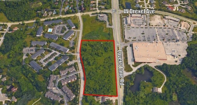
Property Detail
7800 S Scepter Dr
Milwaukee-Waukesha, WI
COM SE COR OF SW 8 5 21 TH WLY 375 FT NWLY 101.17 FT
795-9999-008
MILWAUKEE
Commercialnec
Wisconsin
B and X Area of moderate flood hazard, usually the area between the limits of the 100-year and 500-year floods.
5.72 AC
2024
SW Outlying Milwaukee
2025
Milwaukee/Madison
150301
NEARBY LISTINGS FOR SALE OR LEASE
DEMOGRAPHICS near 7800 S Scepter Dr
1 mile
3 mile
5 mile
2025 Total Population
5,124
35,017
105,262
2030 Population
5,144
35,110
105,597
Pop Growth 2025-2030
+ 0.39%
+ 0.27%
+ 0.32%
Average Age
45
44
44
2025 Total Households
2,209
14,534
43,663
HH Growth 2025-2030
+ 0.18%
+ 0.17%
+ 0.22%
Median Household Inc
$104,881
$111,127
$99,318
Avg Household Size
2.30
2.40
2.40
2025 Avg HH Vehicles
2.00
2.00
2.00
Median Home Value
$346,811
$361,868
$350,896
Median Year Built
1987
1983
1979
Nearby Places
Map Layers
Map Styles
 Street
 Aerial
Layers
 Traffic
 Biking
Places
Listings with unknown addresses are not visible on the map
- Restaurants
- Banks
- Shops
- Fitness
- Groceries
PUBLIC TRANSPORTATION
COMMUTER RAIL
General Mitchell Intl. Airport Amtrak Station (Hiawatha Service - Amtrak)
Drive
Walk
Distance
General Mitchell Intl. Airport Amtrak Station (Hiawatha Service - Amtrak)
19 min
8.4 mi
AIRPORT
General Mitchell International
Drive
Walk
Distance
General Mitchell International
19 min
9.4 mi
Freight Ports
Port Milwaukee
Drive
Walk
Distance
Port Milwaukee
20 min
12.2 mi
SALE & LEASE HISTORY
LISTING DATE
SALE/LEASE

Sep 24, 2016
For Sale
Nearby Properties
Address
Land Use
TOTAL SIZE
Lot Size
Zoning
Address
Land Use
TOTAL SIZE
Lot Size
Zoning
27.11 AC
Address
Land Use
TOTAL SIZE
Lot Size
Zoning
Address
Land Use
TOTAL SIZE
Lot Size
Zoning
17.46 AC
Address
Land Use
TOTAL SIZE
Lot Size
Zoning
370,169 SF
23.69 AC
RM1
Address
Land Use
TOTAL SIZE
Lot Size
Zoning
5.74 AC
Address
Land Use
TOTAL SIZE
Lot Size
Zoning
174,869 SF
17.40 AC
RM1
Address
Land Use
TOTAL SIZE
Lot Size
Zoning
33.48 AC
Address
Land Use
TOTAL SIZE
Lot Size
Zoning
15.78 AC
Address
Land Use
TOTAL SIZE
Lot Size
Zoning
Address
Land Use
TOTAL SIZE
Lot Size
Zoning
14.95 AC
Address
Land Use
TOTAL SIZE
Lot Size
Zoning
Address
Land Use
TOTAL SIZE
Lot Size
Zoning
Address
Land Use
TOTAL SIZE
Lot Size
Zoning
65,227 SF
4.29 AC
Address
Land Use
TOTAL SIZE
Lot Size
Zoning
Address
Land Use
TOTAL SIZE
Lot Size
Zoning
10.98 AC
Address
Land Use
TOTAL SIZE
Lot Size
Zoning
Address
Land Use
TOTAL SIZE
Lot Size
Zoning
Address
Land Use
TOTAL SIZE
Lot Size
Zoning
Address
Land Use
TOTAL SIZE
Lot Size
Zoning
Address
Land Use
TOTAL SIZE
Lot Size
Zoning
9.13 AC
Address
Land Use
TOTAL SIZE
Lot Size
Zoning
1.57 AC
Address
Land Use
TOTAL SIZE
Lot Size
Zoning
8.83 AC
Address
Land Use
TOTAL SIZE
Lot Size
Zoning
3.49 AC
Address
Land Use
TOTAL SIZE
Lot Size
Zoning
2.84 AC
Address
Land Use
TOTAL SIZE
Lot Size
Zoning
125,028 SF
9.69 AC
Address
Land Use
TOTAL SIZE
Lot Size
Zoning
Address
Land Use
TOTAL SIZE
Lot Size
Zoning
162,366 SF
18.99 AC
Address
Land Use
TOTAL SIZE
Lot Size
Zoning
100,386 SF
14.57 AC
Address
Land Use
TOTAL SIZE
Lot Size
Zoning
0.98 AC
Address
Land Use
TOTAL SIZE
Lot Size
Zoning
6.93 AC
The World's #1 Commercial Real Estate Marketplace
Connect with us
© 2026 CoStar Group
The information above has been obtained from sources believed reliable. While we do not doubt its accuracy we have not verified it and make no guarantee, warranty or representation about it. It is your responsibility to independently confirm its accuracy and completeness. Any projections, opinions, assumptions, or estimates used are for example only and do not represent the current or future performance of the property. The value of this transaction to you depends on tax and other factors which should be evaluated by your tax, financial, and legal advisors. You and your advisors should conduct a careful, independent investigation of the property to determine to your satisfaction the suitability of the property for your needs.