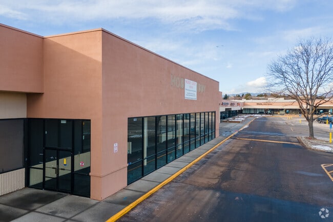
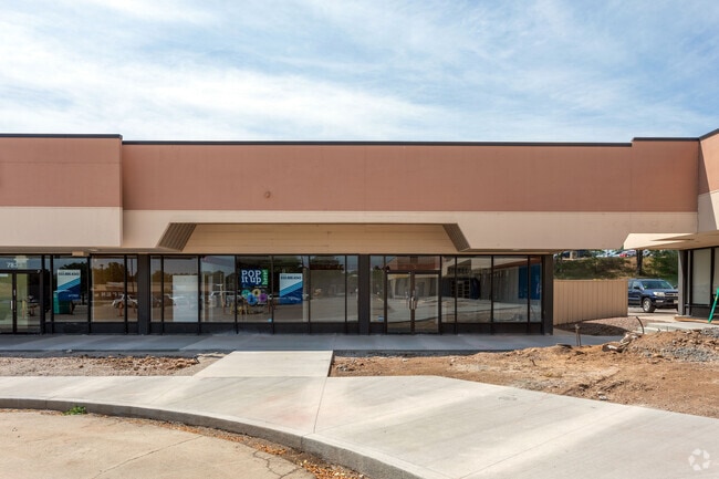
Property Record
7819 Wadsworth Blvd, Arvada, CO 80003


Property Detail
7819 Wadsworth Blvd
29-352-01-024
SECTION 35 TOWNSHIP 02 RANGE 69 QTR NW SUBDIVISIONCD 559435 SUBDIVISIONNAME NORTHRIDGE SHOPPING CENTER 4TH AMENDMENT BLOCK 08A LOT SIZE: 328000 TRACT 001 VALUE: 7.530
Commercialnec
JEFFERSON
B and X Area of moderate flood hazard, usually the area between the limits of the 100-year and 500-year floods.
Colorado
2025
7.53 AC
2025
Northwest
010209
Denver
45,446 SF
Denver-Aurora-Centennial, CO
NEARBY LISTINGS FOR SALE OR LEASE
DEMOGRAPHICS near 7819 Wadsworth Blvd
1 mile
3 mile
5 mile
2025 Total Population
13,111
122,413
311,148
2030 Population
12,916
122,438
315,007
Pop Growth 2025-2030
(1.49%)
+ 0.02%
+ 1.24%
Average Age
42
41
40
2025 Total Households
5,151
49,252
122,873
HH Growth 2025-2030
(1.61%)
+ 0.01%
+ 1.25%
Median Household Inc
$107,065
$95,653
$95,124
Avg Household Size
2.40
2.40
2.50
2025 Avg HH Vehicles
2.00
2.00
2.00
Median Home Value
$612,037
$604,319
$584,132
Median Year Built
1975
1976
1978
Nearby Places
Map Layers
Map Styles
 Street
 Aerial
Layers
 Traffic
 Biking
Places
Listings with unknown addresses are not visible on the map
- Restaurants
- Banks
- Shops
- Fitness
- Groceries
PUBLIC TRANSPORTATION
COMMUTER RAIL
Olde Town Arvada E-Bound (Union Station to Wheat Ridge Ward Station - Regional Transportation District)
Drive
Walk
Distance
Olde Town Arvada E-Bound (Union Station to Wheat Ridge Ward Station - Regional Transportation District)
6 min
3.2 mi
Olde Town Arvada W-Bound (Union Station to Wheat Ridge Ward Station - Regional Transportation District)
Drive
Walk
Distance
Olde Town Arvada W-Bound (Union Station to Wheat Ridge Ward Station - Regional Transportation District)
7 min
3.6 mi
AIRPORT
Denver International
Drive
Walk
Distance
Denver International
42 min
31.0 mi
Freight Ports
Tulsa Port Of Catoosa
Drive
Walk
Distance
Tulsa Port Of Catoosa
739 min
716.5 mi
SALE & LEASE HISTORY
LISTING DATE
SALE/LEASE

Sep 25, 2016
For Lease
Oct 27, 2017
For Lease
Feb 04, 2025
For Lease
Nearby Properties
Address
Land Use
TOTAL SIZE
Lot Size
Zoning
Address
Land Use
TOTAL SIZE
Lot Size
Zoning
559,786 SF
26.52 AC
Address
Land Use
TOTAL SIZE
Lot Size
Zoning
248,096 SF
19.67 AC
Address
Land Use
TOTAL SIZE
Lot Size
Zoning
224,600 SF
6.22 AC
Address
Land Use
TOTAL SIZE
Lot Size
Zoning
208,500 SF
8.42 AC
Address
Land Use
TOTAL SIZE
Lot Size
Zoning
176,583 SF
Address
Land Use
TOTAL SIZE
Lot Size
Zoning
117,774 SF
8.60 AC
Address
Land Use
TOTAL SIZE
Lot Size
Zoning
138,912 SF
8.71 AC
Address
Land Use
TOTAL SIZE
Lot Size
Zoning
103,174 SF
1.23 AC
Address
Land Use
TOTAL SIZE
Lot Size
Zoning
81,065 SF
4.51 AC
Address
Land Use
TOTAL SIZE
Lot Size
Zoning
97,944 SF
6.34 AC
Address
Land Use
TOTAL SIZE
Lot Size
Zoning
113,385 SF
6.77 AC
Address
Land Use
TOTAL SIZE
Lot Size
Zoning
398,180 SF
33.31 AC
R1C
Address
Land Use
TOTAL SIZE
Lot Size
Zoning
52,194 SF
5.33 AC
Address
Land Use
TOTAL SIZE
Lot Size
Zoning
59,824 SF
0.96 AC
Address
Land Use
TOTAL SIZE
Lot Size
Zoning
42,474 SF
1.16 AC
Address
Land Use
TOTAL SIZE
Lot Size
Zoning
46,922 SF
2.35 AC
Address
Land Use
TOTAL SIZE
Lot Size
Zoning
69,537 SF
4.49 AC
Address
Land Use
TOTAL SIZE
Lot Size
Zoning
29,986 SF
2.88 AC
Address
Land Use
TOTAL SIZE
Lot Size
Zoning
75,062 SF
5.28 AC
A1
Address
Land Use
TOTAL SIZE
Lot Size
Zoning
674,481 SF
21.06 AC
Address
Land Use
TOTAL SIZE
Lot Size
Zoning
71,682 SF
4.14 AC
Address
Land Use
TOTAL SIZE
Lot Size
Zoning
62,025 SF
2.49 AC
R4
Address
Land Use
TOTAL SIZE
Lot Size
Zoning
25,016 SF
3.10 AC
Address
Land Use
TOTAL SIZE
Lot Size
Zoning
436,238 SF
13.94 AC
Address
Land Use
TOTAL SIZE
Lot Size
Zoning
310,000 SF
26.51 AC
Address
Land Use
TOTAL SIZE
Lot Size
Zoning
121,639 SF
25.99 AC
Address
Land Use
TOTAL SIZE
Lot Size
Zoning
155,081 SF
7.42 AC
Address
Land Use
TOTAL SIZE
Lot Size
Zoning
361,013 SF
2.88 AC
Address
Land Use
TOTAL SIZE
Lot Size
Zoning
54,191 SF
2.37 AC
Address
Land Use
TOTAL SIZE
Lot Size
Zoning
25,711 SF
2.57 AC
The World's #1 Commercial Real Estate Marketplace
Connect with us
© 2026 CoStar Group
The information above has been obtained from sources believed reliable. While we do not doubt its accuracy we have not verified it and make no guarantee, warranty or representation about it. It is your responsibility to independently confirm its accuracy and completeness. Any projections, opinions, assumptions, or estimates used are for example only and do not represent the current or future performance of the property. The value of this transaction to you depends on tax and other factors which should be evaluated by your tax, financial, and legal advisors. You and your advisors should conduct a careful, independent investigation of the property to determine to your satisfaction the suitability of the property for your needs.