Property Record
7820 N Loop Dr, El Paso, TX 79915


Property Detail
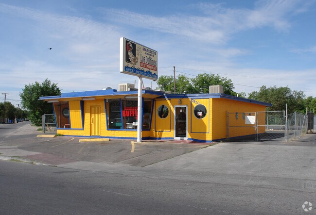
7820 N Loop Dr
R745-999-001A-2350
ROSEDALE FARMS #2 PT OF 4 (39.09 FT ON N LOOP DR- 157.81 FT ON ROSEMARY LN- 128.44 FT ON SLY- IRREG ON WLY)
Commercialnec
El Paso
C3
Texas
AE The base floodplain where base flood elevations are provided. AE Zones are now used on new format FIRMs instead of A1-A30 Zones.
0.35 AC
2024
East
2025
El Paso
003502
El Paso, TX
1,403 SF
NEARBY LISTINGS FOR SALE OR LEASE
DEMOGRAPHICS near 7820 N Loop Dr
1 mile
3 mile
5 mile
2024 Total Population
15,316
82,748
215,933
2029 Population
15,359
82,949
216,174
Pop Growth 2024-2029
+ 0.28%
+ 0.24%
+ 0.11%
Average Age
40
40
40
2024 Total Households
5,561
31,147
79,451
HH Growth 2024-2029
+ 0.32%
+ 0.31%
+ 0.17%
Median Household Inc
$35,021
$44,757
$50,594
Avg Household Size
2.70
2.60
2.70
2024 Avg HH Vehicles
2.00
2.00
2.00
Median Home Value
$150,667
$157,481
$167,513
Median Year Built
1965
1972
1976
Nearby Places
Map Layers
Map Styles
 Street
 Aerial
Transit
 Traffic
 Biking
Places
Listings with unknown addresses are not visible on the map
- Restaurants
- Banks
- Shops
- Fitness
- Groceries
PUBLIC TRANSPORTATION
AIRPORT
El Paso International
Drive
Walk
Distance
El Paso International
20 min
9.6 mi
Freight Ports
Port of Corpus Christi
Drive
Walk
Distance
Port of Corpus Christi
1 min
602.4 mi
SALE & LEASE HISTORY
LISTING DATE
SALE/LEASE

May 31, 2017
For Sale
Feb 23, 2022
For Sale
Nearby Properties
Address
Land Use
TOTAL SIZE
Lot Size
Zoning
Address
Land Use
TOTAL SIZE
Lot Size
Zoning
600,211 SF
114.73 AC
RF
Address
Land Use
TOTAL SIZE
Lot Size
Zoning
753,996 SF
23.50 AC
C4
Address
Land Use
TOTAL SIZE
Lot Size
Zoning
1,122,782 SF
55.24 AC
C4
Address
Land Use
TOTAL SIZE
Lot Size
Zoning
1 SF
M1
Address
Land Use
TOTAL SIZE
Lot Size
Zoning
1 SF
214 AC
M3
Address
Land Use
TOTAL SIZE
Lot Size
Zoning
380,811 SF
22.75 AC
M1
Address
Land Use
TOTAL SIZE
Lot Size
Zoning
1 SF
Address
Land Use
TOTAL SIZE
Lot Size
Zoning
377,168 SF
8.40 AC
C1
Address
Land Use
TOTAL SIZE
Lot Size
Zoning
166,671 SF
24.61 AC
C4S
Address
Land Use
TOTAL SIZE
Lot Size
Zoning
125,896 SF
8.67 AC
R3
Address
Land Use
TOTAL SIZE
Lot Size
Zoning
206,726 SF
24.42 AC
M1S
Address
Land Use
TOTAL SIZE
Lot Size
Zoning
272,601 SF
14.97 AC
AO
Address
Land Use
TOTAL SIZE
Lot Size
Zoning
259,968 SF
10.54 AC
AO
Address
Land Use
TOTAL SIZE
Lot Size
Zoning
269,974 SF
15.87 AC
A2S
Address
Land Use
TOTAL SIZE
Lot Size
Zoning
235,213 SF
11.98 AC
A3O
Address
Land Use
TOTAL SIZE
Lot Size
Zoning
109,578 SF
17.84 AC
RF
Address
Land Use
TOTAL SIZE
Lot Size
Zoning
186,950 SF
14.30 AC
C1
Address
Land Use
TOTAL SIZE
Lot Size
Zoning
144,211 SF
17.20 AC
C4
Address
Land Use
TOTAL SIZE
Lot Size
Zoning
341,541 SF
22.51 AC
A2
Address
Land Use
TOTAL SIZE
Lot Size
Zoning
226,736 SF
12 AC
A2
Address
Land Use
TOTAL SIZE
Lot Size
Zoning
307,575 SF
37.26 AC
Address
Land Use
TOTAL SIZE
Lot Size
Zoning
92,263 SF
14.37 AC
C4
Address
Land Use
TOTAL SIZE
Lot Size
Zoning
139,470 SF
11.33 AC
C3
Address
Land Use
TOTAL SIZE
Lot Size
Zoning
147,393 SF
11.28 AC
C4
Address
Land Use
TOTAL SIZE
Lot Size
Zoning
153,159 SF
11.86 AC
C1
Address
Land Use
TOTAL SIZE
Lot Size
Zoning
136,526 SF
10.97 AC
C3
Address
Land Use
TOTAL SIZE
Lot Size
Zoning
132,336 SF
12.12 AC
A2
Address
Land Use
TOTAL SIZE
Lot Size
Zoning
76,300 SF
9.42 AC
C4
Address
Land Use
TOTAL SIZE
Lot Size
Zoning
174,320 SF
11.86 AC
A2
Address
Land Use
TOTAL SIZE
Lot Size
Zoning
103,116 SF
7.44 AC
C3
The World's #1 Commercial Real Estate Marketplace
Connect with us
© 2026 CoStar Group
The information above has been obtained from sources believed reliable. While we do not doubt its accuracy we have not verified it and make no guarantee, warranty or representation about it. It is your responsibility to independently confirm its accuracy and completeness. Any projections, opinions, assumptions, or estimates used are for example only and do not represent the current or future performance of the property. The value of this transaction to you depends on tax and other factors which should be evaluated by your tax, financial, and legal advisors. You and your advisors should conduct a careful, independent investigation of the property to determine to your satisfaction the suitability of the property for your needs.