Property Record
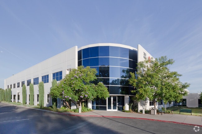
7821 Orion Ave, Van Nuys, CA 91406


Property Detail
7821 Orion Ave
2222-037-006
TRACT NO 25221, 15.14 MORE OR LESS ACS COM AT SW COR OF LOT 1 TH N ON W LINE OF SD LOT 1027.455 FT TH N 89 5909 E TO E LINE OF SD LOT TH S AND FOLLOWING BDRY LINE OF SD LOT TO BEG PART OF LOT 1
Lightindustrial
Los Angeles
LAM2
California
B and X Area of moderate flood hazard, usually the area between the limits of the 100-year and 500-year floods.
1,102
2025
15.16 AC
2025
East San Ferndo Vlly
127300
Los Angeles
275,083 SF
Los Angeles-Long Beach-Glendale, CA
NEARBY LISTINGS FOR SALE OR LEASE
DEMOGRAPHICS near 7821 Orion Ave
1 mile
3 mile
5 mile
2025 Total Population
33,735
313,100
753,645
2030 Population
34,097
313,233
750,761
Pop Growth 2025-2030
+ 1.07%
+ 0.04%
(0.38%)
Average Age
38
39
40
2025 Total Households
10,747
95,988
245,977
HH Growth 2025-2030
+ 1.00%
(0.16%)
(0.55%)
Median Household Inc
$63,799
$70,173
$80,281
Avg Household Size
3.00
3.10
2.90
2025 Avg HH Vehicles
2.00
2.00
2.00
Median Home Value
$706,702
$748,099
$799,433
Median Year Built
1974
1969
1967
Nearby Places
Map Layers
Map Styles
 Street
 Aerial
Layers
 Traffic
 Biking
Places
Listings with unknown addresses are not visible on the map
- Restaurants
- Banks
- Shops
- Fitness
- Groceries
PUBLIC TRANSPORTATION
COMMUTER RAIL
Van Nuys (Ventura County Line - Southern California Regional Rail Authority (Metrolink))
Drive
Walk
Distance
Van Nuys (Ventura County Line - Southern California Regional Rail Authority (Metrolink))
5 min
2.1 mi
Northridge (Ventura County Line - Southern California Regional Rail Authority (Metrolink))
Drive
Walk
Distance
Northridge (Ventura County Line - Southern California Regional Rail Authority (Metrolink))
12 min
6.1 mi
AIRPORT
Bob Hope
Drive
Walk
Distance
Bob Hope
14 min
7.2 mi
Los Angeles International
Drive
Walk
Distance
Los Angeles International
30 min
21.7 mi
Freight Ports
Port of Long Beach
Drive
Walk
Distance
Port of Long Beach
51 min
41.0 mi
SALE & LEASE HISTORY
LISTING DATE
SALE/LEASE

Sep 25, 2016
For Lease
Jul 11, 2022
For Lease
Nearby Properties
Address
Land Use
TOTAL SIZE
Lot Size
Zoning
Address
Land Use
TOTAL SIZE
Lot Size
Zoning
393,032 SF
70.93 AC
LAM2
Address
Land Use
TOTAL SIZE
Lot Size
Zoning
838,226 SF
11.23 AC
LARA
Address
Land Use
TOTAL SIZE
Lot Size
Zoning
580,686 SF
8.46 AC
LAR1
Address
Land Use
TOTAL SIZE
Lot Size
Zoning
439,930 SF
22.16 AC
LAM2
Address
Land Use
TOTAL SIZE
Lot Size
Zoning
72,420 SF
17.08 AC
LAP
Address
Land Use
TOTAL SIZE
Lot Size
Zoning
333,677 SF
3.89 AC
LARAS3
Address
Land Use
TOTAL SIZE
Lot Size
Zoning
204,387 SF
8.46 AC
LAM2
Address
Land Use
TOTAL SIZE
Lot Size
Zoning
396,109 SF
3.45 AC
LAM1
Address
Land Use
TOTAL SIZE
Lot Size
Zoning
768,483 SF
6.87 AC
LAC1
Address
Land Use
TOTAL SIZE
Lot Size
Zoning
149,385 SF
1.29 AC
LAR3
Address
Land Use
TOTAL SIZE
Lot Size
Zoning
168,271 SF
1.23 AC
LAR4
Address
Land Use
TOTAL SIZE
Lot Size
Zoning
290,244 SF
5.77 AC
LAR3
Address
Land Use
TOTAL SIZE
Lot Size
Zoning
370,138 SF
9.84 AC
LAM2
Address
Land Use
TOTAL SIZE
Lot Size
Zoning
116,961 SF
3.60 AC
LAR3
Address
Land Use
TOTAL SIZE
Lot Size
Zoning
290,254 SF
11.53 AC
LAM2
Address
Land Use
TOTAL SIZE
Lot Size
Zoning
408,735 SF
LAC2
Address
Land Use
TOTAL SIZE
Lot Size
Zoning
160,858 SF
2.40 AC
LAR3
Address
Land Use
TOTAL SIZE
Lot Size
Zoning
138,260 SF
1.29 AC
LAC2
Address
Land Use
TOTAL SIZE
Lot Size
Zoning
124,534 SF
7.47 AC
LAC2
Address
Land Use
TOTAL SIZE
Lot Size
Zoning
98,782 SF
0.66 AC
LAC2
Address
Land Use
TOTAL SIZE
Lot Size
Zoning
61,315 SF
0.84 AC
LARAS4
Address
Land Use
TOTAL SIZE
Lot Size
Zoning
428,845 SF
4.15 AC
LACM
Address
Land Use
TOTAL SIZE
Lot Size
Zoning
211,654 SF
2.20 AC
LAM1
Address
Land Use
TOTAL SIZE
Lot Size
Zoning
180,277 SF
4.13 AC
LAM1, LAC2
Address
Land Use
TOTAL SIZE
Lot Size
Zoning
155,748 SF
1.33 AC
LAR3
Address
Land Use
TOTAL SIZE
Lot Size
Zoning
143,203 SF
1.52 AC
LAR4
Address
Land Use
TOTAL SIZE
Lot Size
Zoning
155,788 SF
4.58 AC
LAR1
Address
Land Use
TOTAL SIZE
Lot Size
Zoning
56,396 SF
0.74 AC
LARAS4
Address
Land Use
TOTAL SIZE
Lot Size
Zoning
202,218 SF
2.72 AC
LAC2
The World's #1 Commercial Real Estate Marketplace
Connect with us
© 2026 CoStar Group
The information above has been obtained from sources believed reliable. While we do not doubt its accuracy we have not verified it and make no guarantee, warranty or representation about it. It is your responsibility to independently confirm its accuracy and completeness. Any projections, opinions, assumptions, or estimates used are for example only and do not represent the current or future performance of the property. The value of this transaction to you depends on tax and other factors which should be evaluated by your tax, financial, and legal advisors. You and your advisors should conduct a careful, independent investigation of the property to determine to your satisfaction the suitability of the property for your needs.