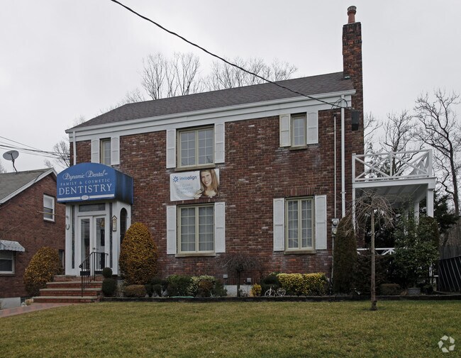
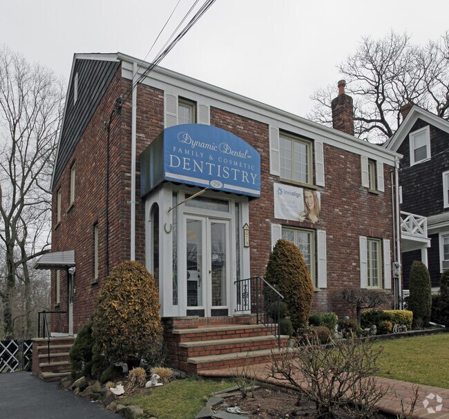
Property Record
79 Nelson Ave, Staten Island, NY 10308

Property Detail
79 Nelson Ave
05146-0004
Richmond
Commercialofficeresidentialmixeduse
New York
R3X
4
B and X Area of moderate flood hazard, usually the area between the limits of the 100-year and 500-year floods.
0.16 AC
2025
Staten Island
2026
Long Island (New York)
013203
New York-Jersey City-White Plains, NY-NJ
2,004 SF
NEARBY LISTINGS FOR SALE OR LEASE
DEMOGRAPHICS near 79 Nelson Ave
1 mile
3 mile
5 mile
2025 Total Population
38,590
154,829
312,867
2030 Population
38,887
155,688
314,920
Pop Growth 2025-2030
+ 0.77%
+ 0.55%
+ 0.66%
Average Age
43
43
42
2025 Total Households
14,117
55,794
110,408
HH Growth 2025-2030
+ 0.74%
+ 0.55%
+ 0.62%
Median Household Inc
$112,471
$109,833
$107,314
Avg Household Size
2.70
2.70
2.80
2025 Avg HH Vehicles
2.00
2.00
2.00
Median Home Value
$730,515
$735,518
$729,418
Median Year Built
1972
1977
1976
Nearby Places
Map Layers
Map Styles
 Street
 Aerial
Layers
 Traffic
 Biking
Places
Listings with unknown addresses are not visible on the map
- Restaurants
- Banks
- Shops
- Fitness
- Groceries
PUBLIC TRANSPORTATION
TRANSIT/SUBWAY
Great Kills (Staten Island Railway - New York MTA Subway (The Subway))
Drive
Walk
Distance
Great Kills (Staten Island Railway - New York MTA Subway (The Subway))
1 min
5 min
0.2 mi
COMMUTER RAIL
Great Kills (Staten Island Railway - New York MTA Subway (The Subway))
Drive
Walk
Distance
Great Kills (Staten Island Railway - New York MTA Subway (The Subway))
1 min
6 min
0.2 mi
Eltingville (Staten Island Railway - New York MTA Subway (The Subway))
Drive
Walk
Distance
Eltingville (Staten Island Railway - New York MTA Subway (The Subway))
4 min
1.1 mi
AIRPORT
Newark Liberty International
Drive
Walk
Distance
Newark Liberty International
33 min
17.8 mi
LaGuardia
Drive
Walk
Distance
LaGuardia
51 min
26.2 mi
John F Kennedy International
Drive
Walk
Distance
John F Kennedy International
54 min
28.7 mi
Freight Ports
New York Container Terminal
Drive
Walk
Distance
New York Container Terminal
19 min
8.2 mi
Nearby Properties
Address
Land Use
TOTAL SIZE
Lot Size
Zoning
Address
Land Use
TOTAL SIZE
Lot Size
Zoning
3,600 SF
731.18 AC
PARK
Address
Land Use
TOTAL SIZE
Lot Size
Zoning
237 AC
M1-1
Address
Land Use
TOTAL SIZE
Lot Size
Zoning
146 AC
PARK
Address
Land Use
TOTAL SIZE
Lot Size
Zoning
1,258,042 SF
14.47 AC
C4-1
Address
Land Use
TOTAL SIZE
Lot Size
Zoning
411,000 SF
18.54 AC
R3X
Address
Land Use
TOTAL SIZE
Lot Size
Zoning
310,560 SF
15.90 AC
C4-1
Address
Land Use
TOTAL SIZE
Lot Size
Zoning
195,395 SF
12.04 AC
R3-2
Address
Land Use
TOTAL SIZE
Lot Size
Zoning
421,275 SF
18.95 AC
R3-2
Address
Land Use
TOTAL SIZE
Lot Size
Zoning
11,140 SF
170.60 AC
PARK
Address
Land Use
TOTAL SIZE
Lot Size
Zoning
294,320 SF
15 AC
R3-2
Address
Land Use
TOTAL SIZE
Lot Size
Zoning
505,000 SF
3.79 AC
R3A
Address
Land Use
TOTAL SIZE
Lot Size
Zoning
33.36 AC
PARK
Address
Land Use
TOTAL SIZE
Lot Size
Zoning
74,000 SF
523.69 AC
R3-2
Address
Land Use
TOTAL SIZE
Lot Size
Zoning
377,678 SF
25.40 AC
C4-1
Address
Land Use
TOTAL SIZE
Lot Size
Zoning
319,000 SF
18.76 AC
C4-1
Address
Land Use
TOTAL SIZE
Lot Size
Zoning
28.97 AC
PARK
Address
Land Use
TOTAL SIZE
Lot Size
Zoning
192,000 SF
5.47 AC
R3X
Address
Land Use
TOTAL SIZE
Lot Size
Zoning
168,050 SF
9.66 AC
R3-2
Address
Land Use
TOTAL SIZE
Lot Size
Zoning
151,637 SF
7.41 AC
C4-1
Address
Land Use
TOTAL SIZE
Lot Size
Zoning
45,570 SF
206.38 AC
PARKUS
Address
Land Use
TOTAL SIZE
Lot Size
Zoning
26.08 AC
PARK
Address
Land Use
TOTAL SIZE
Lot Size
Zoning
80,875 SF
283.97 AC
M3-1
Address
Land Use
TOTAL SIZE
Lot Size
Zoning
26.45 AC
PARK
Address
Land Use
TOTAL SIZE
Lot Size
Zoning
180,000 SF
2.28 AC
R2
Address
Land Use
TOTAL SIZE
Lot Size
Zoning
126,000 SF
6.36 AC
R3-2
Address
Land Use
TOTAL SIZE
Lot Size
Zoning
21.58 AC
PARK
Address
Land Use
TOTAL SIZE
Lot Size
Zoning
24,000 SF
7.46 AC
C8-1
Address
Land Use
TOTAL SIZE
Lot Size
Zoning
18.79 AC
C4-1
Address
Land Use
TOTAL SIZE
Lot Size
Zoning
2,750 SF
53.95 AC
R3-2
Address
Land Use
TOTAL SIZE
Lot Size
Zoning
185,000 SF
18.83 AC
R1-2
The World's #1 Commercial Real Estate Marketplace
Connect with us
© 2026 CoStar Group
The information above has been obtained from sources believed reliable. While we do not doubt its accuracy we have not verified it and make no guarantee, warranty or representation about it. It is your responsibility to independently confirm its accuracy and completeness. Any projections, opinions, assumptions, or estimates used are for example only and do not represent the current or future performance of the property. The value of this transaction to you depends on tax and other factors which should be evaluated by your tax, financial, and legal advisors. You and your advisors should conduct a careful, independent investigation of the property to determine to your satisfaction the suitability of the property for your needs.