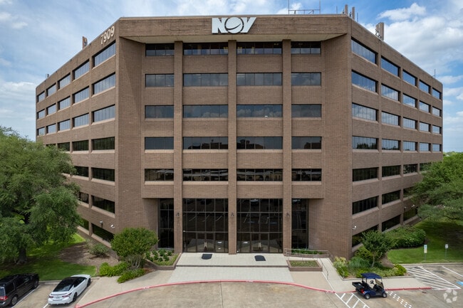
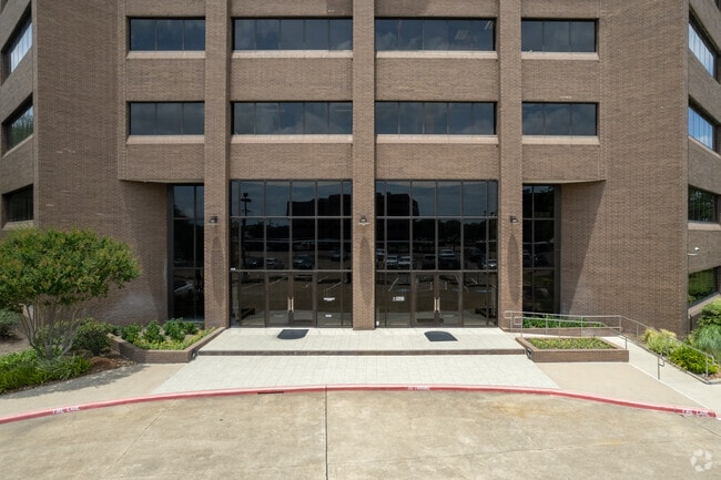
Property Record
7909 Parkwood Circle Dr, Houston, TX 77036

Current Lease Availabilities
NEARBY LISTINGS FOR SALE OR LEASE
Property Detail
7909 Parkwood Circle Dr
1148950020006
Westwood Center Sec 5
Officebuilding
RES B3 WESTWOOD CENTER SEC 5
AE
Harris
48157C0175L
Texas
2024
7.23 AC
2025
Southwest Beltway 8
433100
Houston
265,134 SF
Houston-The Woodlands-Sugar Land, TX
DEMOGRAPHICS near 7909 Parkwood Circle Dr
1 Mile
3 Mile
5 Mile
2024 Total Population
38,048
232,761
571,831
2029 Population
38,891
237,819
590,270
Pop Growth 2024-2029
+ 2.22%
+ 2.17%
+ 3.22%
Average Age
33
35
36
2024 Total Households
13,239
84,077
215,433
HH Growth 2024-2029
+ 2.09%
+ 2.13%
+ 3.22%
Median Household Inc
$32,284
$38,304
$44,147
Avg Household Size
2.80
2.70
2.60
2024 Avg HH Vehicles
1.00
1.00
2.00
Median Home Value
$182,943
$167,349
$223,096
Median Year Built
1978
1979
1979
Nearby Places
Map Layers
Map Styles
 Street
 Aerial
- Restaurants
- Banks
- Shops
- Fitness
- Groceries
PUBLIC TRANSPORTATION
AIRPORT
William P Hobby
DRIVE
WALK
Distance
William P Hobby
36 min
23.8 mi
George Bush Intcntl/Houston
DRIVE
WALK
Distance
George Bush Intcntl/Houston
41 min
33.8 mi
Nearby Properties
Address
Land Use
TOTAL SIZE
Lot Size
Zoning
Address
Land Use
TOTAL SIZE
Lot Size
Zoning
1,020,766 SF
3.08 AC
Address
Land Use
TOTAL SIZE
Lot Size
Zoning
878,129 SF
11.69 AC
Address
Land Use
TOTAL SIZE
Lot Size
Zoning
627,632 SF
24.12 AC
Address
Land Use
TOTAL SIZE
Lot Size
Zoning
816,006 SF
40.26 AC
Address
Land Use
TOTAL SIZE
Lot Size
Zoning
380,423 SF
15.14 AC
Address
Land Use
TOTAL SIZE
Lot Size
Zoning
188,178 SF
18.49 AC
Address
Land Use
TOTAL SIZE
Lot Size
Zoning
771,720 SF
19.28 AC
Address
Land Use
TOTAL SIZE
Lot Size
Zoning
598,127 SF
4.14 AC
Address
Land Use
TOTAL SIZE
Lot Size
Zoning
362,473 SF
15.65 AC
Address
Land Use
TOTAL SIZE
Lot Size
Zoning
539,308 SF
21 AC
Address
Land Use
TOTAL SIZE
Lot Size
Zoning
351,042 SF
5 AC
Address
Land Use
TOTAL SIZE
Lot Size
Zoning
700,828 SF
3.82 AC
Address
Land Use
TOTAL SIZE
Lot Size
Zoning
379,078 SF
14.83 AC
Address
Land Use
TOTAL SIZE
Lot Size
Zoning
394,544 SF
2.62 AC
Address
Land Use
TOTAL SIZE
Lot Size
Zoning
183,015 SF
9.91 AC
Address
Land Use
TOTAL SIZE
Lot Size
Zoning
697,180 SF
2.90 AC
Address
Land Use
TOTAL SIZE
Lot Size
Zoning
843,830 SF
28.57 AC
Address
Land Use
TOTAL SIZE
Lot Size
Zoning
665,550 SF
3.58 AC
Address
Land Use
TOTAL SIZE
Lot Size
Zoning
340,944 SF
12.88 AC
Address
Land Use
TOTAL SIZE
Lot Size
Zoning
872,548 SF
8.85 AC
Address
Land Use
TOTAL SIZE
Lot Size
Zoning
485,845 SF
23.48 AC
Address
Land Use
TOTAL SIZE
Lot Size
Zoning
322,894 SF
17.51 AC
Address
Land Use
TOTAL SIZE
Lot Size
Zoning
287,569 SF
12 AC
Address
Land Use
TOTAL SIZE
Lot Size
Zoning
623,343 SF
22.89 AC
Address
Land Use
TOTAL SIZE
Lot Size
Zoning
725,466 SF
9.69 AC
Address
Land Use
TOTAL SIZE
Lot Size
Zoning
574,191 SF
8.32 AC
Address
Land Use
TOTAL SIZE
Lot Size
Zoning
355,887 SF
13.89 AC
Address
Land Use
TOTAL SIZE
Lot Size
Zoning
572,305 SF
16.98 AC
Address
Land Use
TOTAL SIZE
Lot Size
Zoning
237,987 SF
12.18 AC
Address
Land Use
TOTAL SIZE
Lot Size
Zoning
373,844 SF
17.05 AC
The World's #1 Commercial Real Estate Marketplace
Connect with us
© 2025 CoStar Group
The information above has been obtained from sources believed reliable. While we do not doubt its accuracy we have not verified it and make no guarantee, warranty or representation about it. It is your responsibility to independently confirm its accuracy and completeness. Any projections, opinions, assumptions, or estimates used are for example only and do not represent the current or future performance of the property. The value of this transaction to you depends on tax and other factors which should be evaluated by your tax, financial, and legal advisors. You and your advisors should conduct a careful, independent investigation of the property to determine to your satisfaction the suitability of the property for your needs.