Property Record
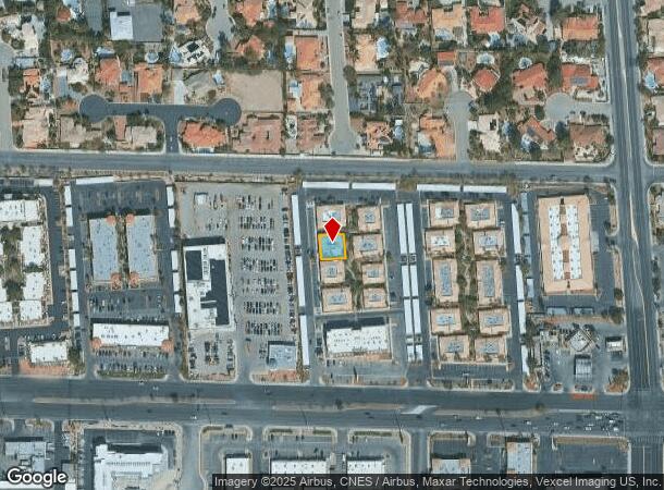
7930 W Sahara Ave, Las Vegas, NV 89117
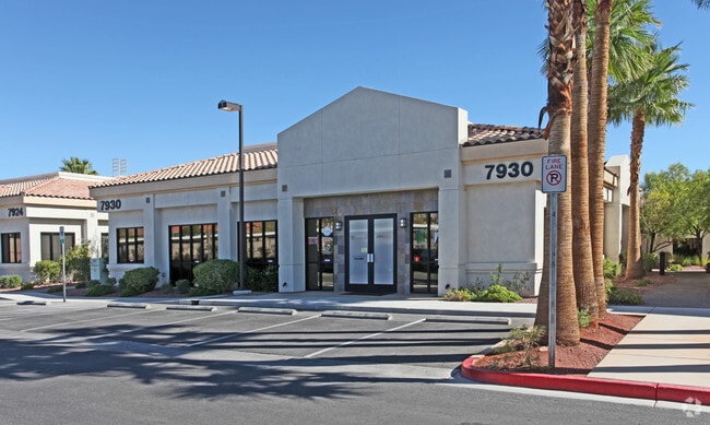
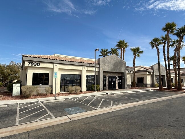

This Property Is For Sale
NEARBY LISTINGS FOR SALE OR LEASE
Property Detail
7930 W Sahara Ave
Las Vegas-Henderson-Paradise, NV
Coronado Bay Phase 2
163-04-815-004
CORONADO BAY PHASE 2 PLAT BOOK 115 PAGE 78 PT LOT 1
Commercialnec
Clark
X
Nevada
32003C2145F
1
2025
0.11 AC
2025
West Las Vegas
002915
Las Vegas
3,600 SF
DEMOGRAPHICS near 7930 W Sahara Ave
1 Mile
3 Mile
5 Mile
2024 Total Population
13,154
174,995
490,534
2029 Population
14,044
187,236
527,318
Pop Growth 2024-2029
+ 6.77%
+ 7.00%
+ 7.50%
Average Age
44
41
41
2024 Total Households
5,531
68,941
196,044
HH Growth 2024-2029
+ 6.67%
+ 6.97%
+ 7.49%
Median Household Inc
$59,549
$59,330
$58,860
Avg Household Size
2.30
2.50
2.40
2024 Avg HH Vehicles
2.00
2.00
2.00
Median Home Value
$628,944
$355,464
$366,521
Median Year Built
1993
1990
1992
Nearby Places
Map Layers
Map Styles
 Street
 Aerial
- Restaurants
- Banks
- Shops
- Fitness
- Groceries
PUBLIC TRANSPORTATION
AIRPORT
Harry Reid International
DRIVE
WALK
Distance
Harry Reid International
21 min
10.8 mi
Boulder City Municipal
DRIVE
WALK
Distance
Boulder City Municipal
46 min
31.4 mi
Nearby Properties
Address
Land Use
TOTAL SIZE
Lot Size
Zoning
Address
Land Use
TOTAL SIZE
Lot Size
Zoning
336,142 SF
39.99 AC
PC
Address
Land Use
TOTAL SIZE
Lot Size
Zoning
338,051 SF
49.13 AC
C1
Address
Land Use
TOTAL SIZE
Lot Size
Zoning
974,131 SF
19.93 AC
Address
Land Use
TOTAL SIZE
Lot Size
Zoning
40 AC
PF
Address
Land Use
TOTAL SIZE
Lot Size
Zoning
157.50 AC
Address
Land Use
TOTAL SIZE
Lot Size
Zoning
408,908 SF
15.60 AC
Address
Land Use
TOTAL SIZE
Lot Size
Zoning
Address
Land Use
TOTAL SIZE
Lot Size
Zoning
Address
Land Use
TOTAL SIZE
Lot Size
Zoning
7,292 SF
24.24 AC
R3
Address
Land Use
TOTAL SIZE
Lot Size
Zoning
5,427 SF
17.57 AC
Address
Land Use
TOTAL SIZE
Lot Size
Zoning
11,942 SF
17.01 AC
R3
Address
Land Use
TOTAL SIZE
Lot Size
Zoning
12.23 AC
PF
Address
Land Use
TOTAL SIZE
Lot Size
Zoning
2,754 SF
17.17 AC
RPD20
Address
Land Use
TOTAL SIZE
Lot Size
Zoning
223,030 SF
18.11 AC
C1
Address
Land Use
TOTAL SIZE
Lot Size
Zoning
28,956 SF
75.82 AC
CV
Address
Land Use
TOTAL SIZE
Lot Size
Zoning
4,872 SF
18.22 AC
R3
Address
Land Use
TOTAL SIZE
Lot Size
Zoning
3.61 AC
PF
Address
Land Use
TOTAL SIZE
Lot Size
Zoning
5,979 SF
17.27 AC
RPD21
Address
Land Use
TOTAL SIZE
Lot Size
Zoning
3,020 SF
19.68 AC
L:R-PD23
Address
Land Use
TOTAL SIZE
Lot Size
Zoning
8,849 SF
16.80 AC
RPD20
Address
Land Use
TOTAL SIZE
Lot Size
Zoning
5,396 SF
13.95 AC
R3
Address
Land Use
TOTAL SIZE
Lot Size
Zoning
181,262 SF
16.63 AC
L:C-2
Address
Land Use
TOTAL SIZE
Lot Size
Zoning
52,058 SF
6.44 AC
C1
Address
Land Use
TOTAL SIZE
Lot Size
Zoning
66.57 AC
CV
Address
Land Use
TOTAL SIZE
Lot Size
Zoning
285,929 SF
5.06 AC
C1
Address
Land Use
TOTAL SIZE
Lot Size
Zoning
2,694 SF
14.11 AC
L:R-PD23
Address
Land Use
TOTAL SIZE
Lot Size
Zoning
6,037 SF
15.12 AC
R3
Address
Land Use
TOTAL SIZE
Lot Size
Zoning
10 AC
PF
Address
Land Use
TOTAL SIZE
Lot Size
Zoning
5,466 SF
13.59 AC
RPD20
Address
Land Use
TOTAL SIZE
Lot Size
Zoning
16,491 SF
25.25 AC
C1
The World's #1 Commercial Real Estate Marketplace
Connect with us
© 2026 CoStar Group
The information above has been obtained from sources believed reliable. While we do not doubt its accuracy we have not verified it and make no guarantee, warranty or representation about it. It is your responsibility to independently confirm its accuracy and completeness. Any projections, opinions, assumptions, or estimates used are for example only and do not represent the current or future performance of the property. The value of this transaction to you depends on tax and other factors which should be evaluated by your tax, financial, and legal advisors. You and your advisors should conduct a careful, independent investigation of the property to determine to your satisfaction the suitability of the property for your needs.