Property Record
7947 Mesa Dr, Houston, TX 77028


Property Detail
7947 Mesa Dr
Houston-Pasadena-The Woodlands, TX
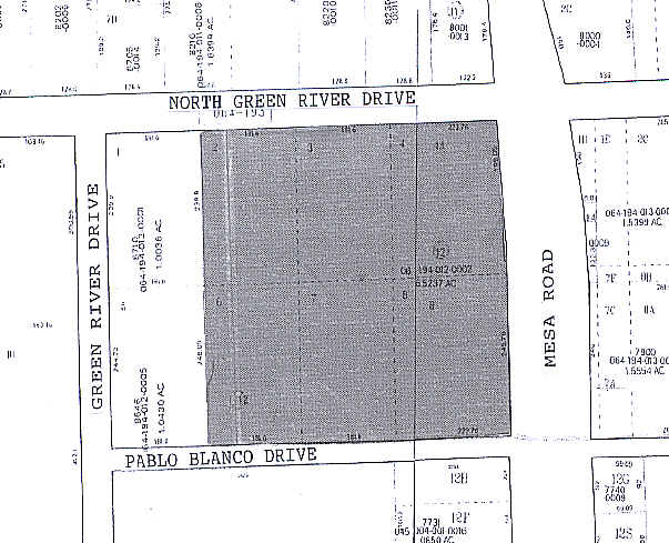
LTS 2 3 6 7 & 8 & TR 4A BLK 12 GREEN RIVER GARDENS
0641940120002
HARRIS
Warehouse
Texas
B and X Area of moderate flood hazard, usually the area between the limits of the 100-year and 500-year floods.
2
2024
6.54 AC
2025
Northeast Hwy 90
231100
Houston
53,792 SF
NEARBY LISTINGS FOR SALE OR LEASE
DEMOGRAPHICS near 7947 Mesa Dr
1 mile
3 mile
5 mile
2025 Total Population
8,297
55,502
204,603
2030 Population
8,903
60,019
220,113
Pop Growth 2025-2030
+ 7.30%
+ 8.14%
+ 7.58%
Average Age
36
37
36
2025 Total Households
2,467
17,811
65,615
HH Growth 2025-2030
+ 7.50%
+ 8.32%
+ 7.83%
Median Household Inc
$37,535
$39,963
$46,554
Avg Household Size
3.20
3.00
3.00
2025 Avg HH Vehicles
2.00
2.00
2.00
Median Home Value
$145,413
$133,277
$159,311
Median Year Built
1964
1972
1975
Nearby Places
Map Layers
Map Styles
 Street
 Aerial
Transit
 Traffic
 Biking
Places
Listings with unknown addresses are not visible on the map
- Restaurants
- Banks
- Shops
- Fitness
- Groceries
PUBLIC TRANSPORTATION
AIRPORT
George Bush Intcntl/Houston
Drive
Walk
Distance
George Bush Intcntl/Houston
24 min
14.4 mi
William P Hobby
Drive
Walk
Distance
William P Hobby
29 min
16.3 mi
Freight Ports
Port of Houston
Drive
Walk
Distance
Port of Houston
16 min
8.3 mi
Nearby Properties
Address
Land Use
TOTAL SIZE
Lot Size
Zoning
Address
Land Use
TOTAL SIZE
Lot Size
Zoning
602,940 SF
30.90 AC
Address
Land Use
TOTAL SIZE
Lot Size
Zoning
663,147 SF
40.63 AC
Address
Land Use
TOTAL SIZE
Lot Size
Zoning
228,576 SF
11.46 AC
Address
Land Use
TOTAL SIZE
Lot Size
Zoning
357,510 SF
29.15 AC
Address
Land Use
TOTAL SIZE
Lot Size
Zoning
438,196 SF
89.88 AC
Address
Land Use
TOTAL SIZE
Lot Size
Zoning
214,200 SF
12.92 AC
Address
Land Use
TOTAL SIZE
Lot Size
Zoning
144,823 SF
80 AC
Address
Land Use
TOTAL SIZE
Lot Size
Zoning
215,705 SF
39.58 AC
Address
Land Use
TOTAL SIZE
Lot Size
Zoning
311,550 SF
12.49 AC
Address
Land Use
TOTAL SIZE
Lot Size
Zoning
150,632 SF
36.03 AC
Address
Land Use
TOTAL SIZE
Lot Size
Zoning
300,000 SF
12.83 AC
Address
Land Use
TOTAL SIZE
Lot Size
Zoning
264,866 SF
10.46 AC
Address
Land Use
TOTAL SIZE
Lot Size
Zoning
261,327 SF
19.31 AC
Address
Land Use
TOTAL SIZE
Lot Size
Zoning
296,850 SF
20.04 AC
Address
Land Use
TOTAL SIZE
Lot Size
Zoning
411,028 SF
34.67 AC
Address
Land Use
TOTAL SIZE
Lot Size
Zoning
304,925 SF
10.91 AC
Address
Land Use
TOTAL SIZE
Lot Size
Zoning
210,220 SF
15.38 AC
Address
Land Use
TOTAL SIZE
Lot Size
Zoning
254,904 SF
9.27 AC
Address
Land Use
TOTAL SIZE
Lot Size
Zoning
346,320 SF
12.55 AC
Address
Land Use
TOTAL SIZE
Lot Size
Zoning
199,340 SF
13.27 AC
Address
Land Use
TOTAL SIZE
Lot Size
Zoning
229,050 SF
8.13 AC
Address
Land Use
TOTAL SIZE
Lot Size
Zoning
138,600 SF
12.29 AC
Address
Land Use
TOTAL SIZE
Lot Size
Zoning
264,022 SF
12.81 AC
Address
Land Use
TOTAL SIZE
Lot Size
Zoning
219,230 SF
9.92 AC
Address
Land Use
TOTAL SIZE
Lot Size
Zoning
75,598 SF
27.98 AC
Address
Land Use
TOTAL SIZE
Lot Size
Zoning
254,496 SF
18.22 AC
Address
Land Use
TOTAL SIZE
Lot Size
Zoning
191,567 SF
7.06 AC
Address
Land Use
TOTAL SIZE
Lot Size
Zoning
55,517 SF
13 AC
Address
Land Use
TOTAL SIZE
Lot Size
Zoning
132,800 SF
8 AC
Address
Land Use
TOTAL SIZE
Lot Size
Zoning
201,128 SF
8.11 AC
The World's #1 Commercial Real Estate Marketplace
Connect with us
© 2026 CoStar Group
The information above has been obtained from sources believed reliable. While we do not doubt its accuracy we have not verified it and make no guarantee, warranty or representation about it. It is your responsibility to independently confirm its accuracy and completeness. Any projections, opinions, assumptions, or estimates used are for example only and do not represent the current or future performance of the property. The value of this transaction to you depends on tax and other factors which should be evaluated by your tax, financial, and legal advisors. You and your advisors should conduct a careful, independent investigation of the property to determine to your satisfaction the suitability of the property for your needs.