Property Record
7978 Rockbridge Rd, Lithonia, GA 30058


NEARBY LISTINGS FOR SALE OR LEASE
Property Detail
7978 Rockbridge Rd
16-193-04-006
191 X 181 X 172 X 143 X 72 X 55 X 113 X 30 X 59 X 170 X 17 231 X 1454 X 382 X 362 X 167 X 100 X 100 X 78 X 117 X 401 22.44AC
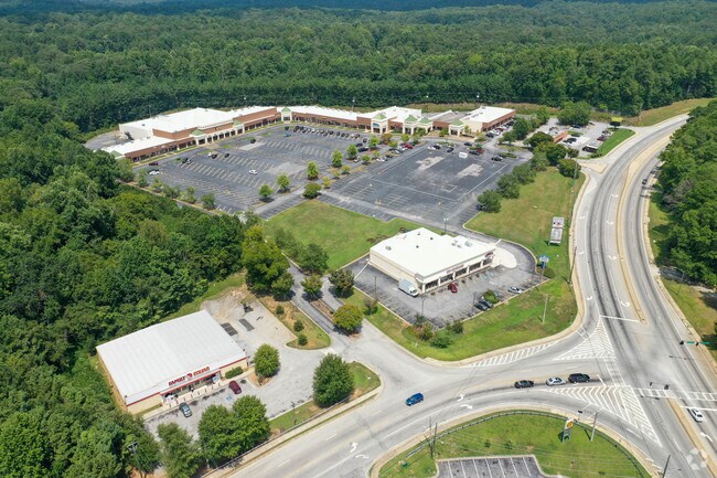
Regionalshoppingcenterormallwithanchorstore
DeKalb
X
Georgia
13089C0114K
6
2025
17.75 AC
2025
Lithonia/Conyers
023313
Atlanta
98,676 SF
Atlanta-Sandy Springs-Roswell, GA
DEMOGRAPHICS near 7978 Rockbridge Rd
1 Mile
3 Mile
5 Mile
2024 Total Population
4,897
48,198
123,548
2029 Population
4,875
48,918
125,936
Pop Growth 2024-2029
(0.45%)
+ 1.49%
+ 1.93%
Average Age
40
38
39
2024 Total Households
1,715
15,830
41,389
HH Growth 2024-2029
(0.58%)
+ 1.40%
+ 1.89%
Median Household Inc
$78,320
$80,547
$75,718
Avg Household Size
2.80
3.00
2.90
2024 Avg HH Vehicles
2.00
2.00
2.00
Median Home Value
$252,705
$247,380
$246,795
Median Year Built
1991
1993
1991
Nearby Places
Map Layers
Map Styles
 Street
 Aerial
- Restaurants
- Banks
- Shops
- Fitness
- Groceries
PUBLIC TRANSPORTATION
AIRPORT
Hartsfield - Jackson Atlanta International
DRIVE
WALK
Distance
Hartsfield - Jackson Atlanta International
42 min
27.4 mi
Freight Ports
Georgia Ports - Savannah
DRIVE
WALK
Distance
Georgia Ports - Savannah
291 min
247.8 mi
SALE & LEASE HISTORY
LISTING DATE
SALE/LEASE

Sep 24, 2016
For Lease
Jan 18, 2023
For Lease
Dec 31, 2018
For Lease
Dec 29, 2018
For Sale
Nearby Properties
Address
Land Use
TOTAL SIZE
Lot Size
Zoning
Address
Land Use
TOTAL SIZE
Lot Size
Zoning
240,744 SF
23.93 AC
RM100
Address
Land Use
TOTAL SIZE
Lot Size
Zoning
3,500 SF
391.26 AC
R100
Address
Land Use
TOTAL SIZE
Lot Size
Zoning
129,843 SF
30.97 AC
R100
Address
Land Use
TOTAL SIZE
Lot Size
Zoning
175,045 SF
13.01 AC
RM
Address
Land Use
TOTAL SIZE
Lot Size
Zoning
215,422 SF
33.84 AC
M
Address
Land Use
TOTAL SIZE
Lot Size
Zoning
492 SF
208.14 AC
R100
Address
Land Use
TOTAL SIZE
Lot Size
Zoning
217,730 SF
29.68 AC
C2
Address
Land Use
TOTAL SIZE
Lot Size
Zoning
18,099 SF
1,412.45 AC
M2
Address
Land Use
TOTAL SIZE
Lot Size
Zoning
54.06 AC
R100
Address
Land Use
TOTAL SIZE
Lot Size
Zoning
100,427 SF
22.60 AC
RA200
Address
Land Use
TOTAL SIZE
Lot Size
Zoning
80,310 SF
4.92 AC
C2
Address
Land Use
TOTAL SIZE
Lot Size
Zoning
90,151 SF
2.38 AC
C2
Address
Land Use
TOTAL SIZE
Lot Size
Zoning
21.53 AC
M
Address
Land Use
TOTAL SIZE
Lot Size
Zoning
47,628 SF
10.69 AC
X
Address
Land Use
TOTAL SIZE
Lot Size
Zoning
350.63 AC
R100
Address
Land Use
TOTAL SIZE
Lot Size
Zoning
68,800 SF
9.01 AC
C2
Address
Land Use
TOTAL SIZE
Lot Size
Zoning
72,148 SF
23.23 AC
R100
Address
Land Use
TOTAL SIZE
Lot Size
Zoning
61,811 SF
10.75 AC
OI
Address
Land Use
TOTAL SIZE
Lot Size
Zoning
23,165 SF
24.58 AC
R100
Address
Land Use
TOTAL SIZE
Lot Size
Zoning
93,914 SF
1.56 AC
C2
Address
Land Use
TOTAL SIZE
Lot Size
Zoning
18,420 SF
13.92 AC
OI
Address
Land Use
TOTAL SIZE
Lot Size
Zoning
26,866 SF
8.21 AC
OI
Address
Land Use
TOTAL SIZE
Lot Size
Zoning
30,139 SF
4.57 AC
RCD
Address
Land Use
TOTAL SIZE
Lot Size
Zoning
11.05 AC
X
Address
Land Use
TOTAL SIZE
Lot Size
Zoning
38,237 SF
5.86 AC
R100
Address
Land Use
TOTAL SIZE
Lot Size
Zoning
53,480 SF
5.40 AC
M
Address
Land Use
TOTAL SIZE
Lot Size
Zoning
31,434 SF
3.23 AC
C2
Address
Land Use
TOTAL SIZE
Lot Size
Zoning
22,338 SF
5.03 AC
C2
Address
Land Use
TOTAL SIZE
Lot Size
Zoning
22,868 SF
6.30 AC
C2
The World's #1 Commercial Real Estate Marketplace
Connect with us
© 2026 CoStar Group
The information above has been obtained from sources believed reliable. While we do not doubt its accuracy we have not verified it and make no guarantee, warranty or representation about it. It is your responsibility to independently confirm its accuracy and completeness. Any projections, opinions, assumptions, or estimates used are for example only and do not represent the current or future performance of the property. The value of this transaction to you depends on tax and other factors which should be evaluated by your tax, financial, and legal advisors. You and your advisors should conduct a careful, independent investigation of the property to determine to your satisfaction the suitability of the property for your needs.