Property Record
7991 Vance Dr, Arvada, CO 80003

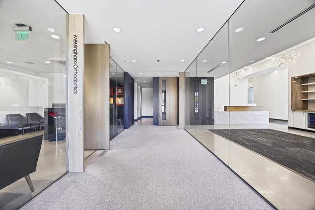
This Property Is For Sale
Property Detail
7991 Vance Dr
29-351-03-019
SECTION 35 TOWNSHIP 02 RANGE 69 SUBDIVISIONCD 536300 SUBDIVISIONNAME MOUNTAIN DENTAL SPECIALISTS CONDOS UNIT 00A
Commercialcondominium
JEFFERSON
B and X Area of moderate flood hazard, usually the area between the limits of the 100-year and 500-year floods.
Colorado
2023
0.08 AC
2024
Northwest Denver
010208
Denver
3,142 SF
Denver-Aurora-Centennial, CO
NEARBY LISTINGS FOR SALE OR LEASE
-
-
View all Arvada listings for sale on LoopNet.com
DEMOGRAPHICS near 7991 Vance Dr
1 mile
3 mile
5 mile
2025 Total Population
13,902
121,030
313,949
2030 Population
13,678
121,168
317,986
Pop Growth 2025-2030
(1.61%)
+ 0.11%
+ 1.29%
Average Age
41
41
40
2025 Total Households
5,511
48,471
123,594
HH Growth 2025-2030
(1.74%)
+ 0.11%
+ 1.30%
Median Household Inc
$100,873
$95,789
$95,173
Avg Household Size
2.40
2.40
2.50
2025 Avg HH Vehicles
2.00
2.00
2.00
Median Home Value
$571,595
$599,885
$577,550
Median Year Built
1975
1976
1978
Nearby Places
Map Layers
Map Styles
 Street
 Aerial
Transit
 Traffic
 Biking
Places
Listings with unknown addresses are not visible on the map
- Restaurants
- Banks
- Shops
- Fitness
- Groceries
PUBLIC TRANSPORTATION
COMMUTER RAIL
Drive
Walk
Distance
6 min
3.2 mi
Drive
Walk
Distance
7 min
3.6 mi
AIRPORT
Denver International
Drive
Walk
Distance
Denver International
41 min
30.6 mi
Nearby Properties
Address
Land Use
TOTAL SIZE
Lot Size
Zoning
Address
Land Use
TOTAL SIZE
Lot Size
Zoning
208,500 SF
8.42 AC
Address
Land Use
TOTAL SIZE
Lot Size
Zoning
138,912 SF
8.71 AC
Address
Land Use
TOTAL SIZE
Lot Size
Zoning
113,385 SF
6.77 AC
Address
Land Use
TOTAL SIZE
Lot Size
Zoning
398,180 SF
33.31 AC
R1C
Address
Land Use
TOTAL SIZE
Lot Size
Zoning
69,537 SF
4.49 AC
Address
Land Use
TOTAL SIZE
Lot Size
Zoning
53,602 SF
2.37 AC
Address
Land Use
TOTAL SIZE
Lot Size
Zoning
674,481 SF
21.06 AC
Address
Land Use
TOTAL SIZE
Lot Size
Zoning
62,025 SF
2.49 AC
R4
Address
Land Use
TOTAL SIZE
Lot Size
Zoning
436,238 SF
13.94 AC
Address
Land Use
TOTAL SIZE
Lot Size
Zoning
70,338 SF
2.57 AC
Address
Land Use
TOTAL SIZE
Lot Size
Zoning
121,639 SF
25.99 AC
Address
Land Use
TOTAL SIZE
Lot Size
Zoning
114,230 SF
2.88 AC
Address
Land Use
TOTAL SIZE
Lot Size
Zoning
310,000 SF
26.51 AC
Address
Land Use
TOTAL SIZE
Lot Size
Zoning
155,081 SF
7.42 AC
Address
Land Use
TOTAL SIZE
Lot Size
Zoning
559,786 SF
26.52 AC
Address
Land Use
TOTAL SIZE
Lot Size
Zoning
115,054 SF
21.38 AC
Address
Land Use
TOTAL SIZE
Lot Size
Zoning
162,509 SF
11.84 AC
Address
Land Use
TOTAL SIZE
Lot Size
Zoning
149,115 SF
18 AC
Address
Land Use
TOTAL SIZE
Lot Size
Zoning
307,377 SF
15.12 AC
Address
Land Use
TOTAL SIZE
Lot Size
Zoning
30,474 SF
1.20 AC
Address
Land Use
TOTAL SIZE
Lot Size
Zoning
449,804 SF
15.22 AC
Address
Land Use
TOTAL SIZE
Lot Size
Zoning
264,405 SF
10.82 AC
Address
Land Use
TOTAL SIZE
Lot Size
Zoning
91,734 SF
9.69 AC
Address
Land Use
TOTAL SIZE
Lot Size
Zoning
116,262 SF
8.14 AC
Address
Land Use
TOTAL SIZE
Lot Size
Zoning
83,675 SF
13.43 AC
R2
Address
Land Use
TOTAL SIZE
Lot Size
Zoning
253,558 SF
10.26 AC
A2
Address
Land Use
TOTAL SIZE
Lot Size
Zoning
248,096 SF
19.67 AC
Address
Land Use
TOTAL SIZE
Lot Size
Zoning
232,893 SF
6.79 AC
A2
Address
Land Use
TOTAL SIZE
Lot Size
Zoning
150,962 SF
4.20 AC
Address
Land Use
TOTAL SIZE
Lot Size
Zoning
224,600 SF
6.22 AC
The World's #1 Commercial Real Estate Marketplace
Connect with us
© 2026 CoStar Group
The information above has been obtained from sources believed reliable. While we do not doubt its accuracy we have not verified it and make no guarantee, warranty or representation about it. It is your responsibility to independently confirm its accuracy and completeness. Any projections, opinions, assumptions, or estimates used are for example only and do not represent the current or future performance of the property. The value of this transaction to you depends on tax and other factors which should be evaluated by your tax, financial, and legal advisors. You and your advisors should conduct a careful, independent investigation of the property to determine to your satisfaction the suitability of the property for your needs.