Property Record
7N040 Medinah Rd, Roselle, IL 60172
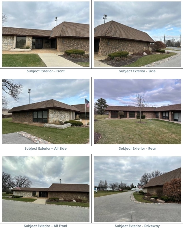
This Property Is For Sale
NEARBY LISTINGS FOR SALE OR LEASE
Property Detail
7N040 Medinah Rd
Chicago-Naperville-Elgin, IL-IN-WI
Medinah Rd
02-02-406-034
OWNERS ASSMT PLAT NO 1 /EX MEDINAH RD & IRVING PARK RD/ & /EX HWY DESC R2006-061849 & R2006-061848/
Commercialnec
DuPage
X
Illinois
17043C0056J
5
2024
0.87 AC
2024
North DuPage
841104
Chicago
8,107 SF
DEMOGRAPHICS near 7N040 Medinah Rd
1 Mile
3 Mile
5 Mile
2024 Total Population
5,586
86,318
236,264
2029 Population
5,427
83,799
229,815
Pop Growth 2024-2029
(2.85%)
(2.92%)
(2.73%)
Average Age
41
43
41
2024 Total Households
2,317
33,099
87,558
HH Growth 2024-2029
(3.06%)
(3.17%)
(2.99%)
Median Household Inc
$82,729
$92,222
$88,597
Avg Household Size
2.40
2.50
2.60
2024 Avg HH Vehicles
2.00
2.00
2.00
Median Home Value
$323,300
$333,369
$291,867
Median Year Built
1972
1976
1975
Nearby Places
Map Layers
Map Styles
 Street
 Aerial
- Restaurants
- Banks
- Shops
- Fitness
- Groceries
PUBLIC TRANSPORTATION
COMMUTER RAIL
Medinah Station (Milwaukee District West Line - Northeast Illinois Regional Commuter Railroad (Metra))
DRIVE
WALK
Distance
Medinah Station (Milwaukee District West Line - Northeast Illinois Regional Commuter Railroad (Metra))
0 min
0 min
0.0 mi
Roselle Station (Milwaukee District West Line - Northeast Illinois Regional Commuter Railroad (Metra))
DRIVE
WALK
Distance
Roselle Station (Milwaukee District West Line - Northeast Illinois Regional Commuter Railroad (Metra))
4 min
17 min
0.9 mi
AIRPORT
Chicago O'Hare International
DRIVE
WALK
Distance
Chicago O'Hare International
22 min
13.2 mi
Chicago Midway International
DRIVE
WALK
Distance
Chicago Midway International
37 min
25.0 mi
Freight Ports
Port Milwaukee
DRIVE
WALK
Distance
Port Milwaukee
105 min
85.4 mi
Nearby Properties
Address
Land Use
TOTAL SIZE
Lot Size
Zoning
Address
Land Use
TOTAL SIZE
Lot Size
Zoning
18.91 AC
Address
Land Use
TOTAL SIZE
Lot Size
Zoning
Address
Land Use
TOTAL SIZE
Lot Size
Zoning
457,762 SF
23 AC
M
Address
Land Use
TOTAL SIZE
Lot Size
Zoning
Address
Land Use
TOTAL SIZE
Lot Size
Zoning
525,422 SF
8.45 AC
C
Address
Land Use
TOTAL SIZE
Lot Size
Zoning
487,027 SF
8.36 AC
C
Address
Land Use
TOTAL SIZE
Lot Size
Zoning
16.91 AC
C
Address
Land Use
TOTAL SIZE
Lot Size
Zoning
450,614 SF
17.97 AC
C
Address
Land Use
TOTAL SIZE
Lot Size
Zoning
24.82 AC
Address
Land Use
TOTAL SIZE
Lot Size
Zoning
24.82 AC
Address
Land Use
TOTAL SIZE
Lot Size
Zoning
24.82 AC
Address
Land Use
TOTAL SIZE
Lot Size
Zoning
489,153 SF
18.90 AC
I
Address
Land Use
TOTAL SIZE
Lot Size
Zoning
288,000 SF
11.05 AC
C
Address
Land Use
TOTAL SIZE
Lot Size
Zoning
136,975 SF
1.90 AC
Address
Land Use
TOTAL SIZE
Lot Size
Zoning
345,881 SF
12.66 AC
I
Address
Land Use
TOTAL SIZE
Lot Size
Zoning
71,184 SF
22.49 AC
Address
Land Use
TOTAL SIZE
Lot Size
Zoning
4.08 AC
Address
Land Use
TOTAL SIZE
Lot Size
Zoning
11.13 AC
Address
Land Use
TOTAL SIZE
Lot Size
Zoning
Address
Land Use
TOTAL SIZE
Lot Size
Zoning
286,305 SF
12.29 AC
I
Address
Land Use
TOTAL SIZE
Lot Size
Zoning
211,392 SF
11.94 AC
R
Address
Land Use
TOTAL SIZE
Lot Size
Zoning
101,282 SF
2.34 AC
Address
Land Use
TOTAL SIZE
Lot Size
Zoning
357,241 SF
25.69 AC
Address
Land Use
TOTAL SIZE
Lot Size
Zoning
249,266 SF
15.05 AC
I
Address
Land Use
TOTAL SIZE
Lot Size
Zoning
346,165 SF
3.15 AC
Address
Land Use
TOTAL SIZE
Lot Size
Zoning
66,774 SF
3.46 AC
Address
Land Use
TOTAL SIZE
Lot Size
Zoning
60,372 SF
8.99 AC
I
Address
Land Use
TOTAL SIZE
Lot Size
Zoning
155,610 SF
4.83 AC
C
Address
Land Use
TOTAL SIZE
Lot Size
Zoning
196,090 SF
5.47 AC
C
Address
Land Use
TOTAL SIZE
Lot Size
Zoning
222,320 SF
7.77 AC
C
The World's #1 Commercial Real Estate Marketplace
Connect with us
© 2026 CoStar Group
The information above has been obtained from sources believed reliable. While we do not doubt its accuracy we have not verified it and make no guarantee, warranty or representation about it. It is your responsibility to independently confirm its accuracy and completeness. Any projections, opinions, assumptions, or estimates used are for example only and do not represent the current or future performance of the property. The value of this transaction to you depends on tax and other factors which should be evaluated by your tax, financial, and legal advisors. You and your advisors should conduct a careful, independent investigation of the property to determine to your satisfaction the suitability of the property for your needs.