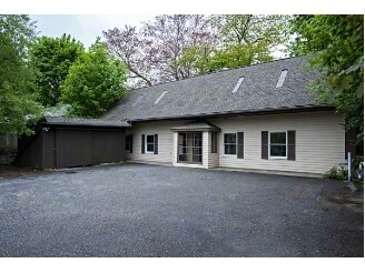
Property Record
8 Algonkin Rd, Shelton, CT 06484
Save to a Folder
{{folder.Name}}
{{folder.ListingIds.length}} Properties
{{folder.ListingIds.length}} Property
Create a New Folder
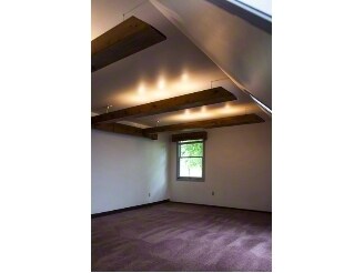
Property Detail
8 Algonkin Rd
SHEL-000005A-000000-000038
FAIRFIELD
Officebuilding
Connecticut
R-3
38
B and X Area of moderate flood hazard, usually the area between the limits of the 100-year and 500-year floods.
0.21 AC
2025
Shelton
2025
Westchester/So Connecticut
110202
Bridgeport-Stamford-Danbury, CT
3,254 SF
NEARBY LISTINGS FOR SALE OR LEASE
DEMOGRAPHICS near 8 Algonkin Rd
1 mile
3 mile
5 mile
2025 Total Population
4,508
36,160
145,646
2030 Population
4,764
37,444
149,674
Pop Growth 2025-2030
+ 5.68%
+ 3.55%
+ 2.77%
Average Age
52
47
44
2025 Total Households
1,999
14,881
58,833
HH Growth 2025-2030
+ 6.05%
+ 3.79%
+ 2.83%
Median Household Inc
$72,371
$113,417
$107,856
Avg Household Size
2.10
2.40
2.40
2025 Avg HH Vehicles
2.00
2.00
2.00
Median Home Value
$398,441
$443,909
$409,752
Median Year Built
1978
1979
1966
Nearby Places
Map Layers
Map Styles
 Street
 Aerial
Layers
 Traffic
 Biking
Places
Listings with unknown addresses are not visible on the map
- Restaurants
- Banks
- Shops
- Fitness
- Groceries
PUBLIC TRANSPORTATION
COMMUTER RAIL
Milford (New Haven - Metro-North Railroad)
Drive
Walk
Distance
Milford (New Haven - Metro-North Railroad)
9 min
5.0 mi
Derby-Shelton (Waterbury - Metro-North Railroad)
Drive
Walk
Distance
Derby-Shelton (Waterbury - Metro-North Railroad)
10 min
5.4 mi
AIRPORT
Tweed/New Haven
Drive
Walk
Distance
Tweed/New Haven
30 min
18.4 mi
Freight Ports
Port of New Haven
Drive
Walk
Distance
Port of New Haven
25 min
15.5 mi
SALE & LEASE HISTORY
LISTING DATE
SALE/LEASE

Sep 23, 2016
For Sale
Oct 12, 2016
For Lease
Oct 12, 2016
For Sale
May 04, 2023
For Lease
May 03, 2023
For Sale
Mar 17, 2017
For Sale
Apr 17, 2017
For Lease
Nearby Properties
Address
Land Use
TOTAL SIZE
Lot Size
Zoning
Address
Land Use
TOTAL SIZE
Lot Size
Zoning
8.24 AC
Address
Land Use
TOTAL SIZE
Lot Size
Zoning
187,983 SF
254.30 AC
H-3
Address
Land Use
TOTAL SIZE
Lot Size
Zoning
236,601 SF
12.85 AC
IA-3
Address
Land Use
TOTAL SIZE
Lot Size
Zoning
28.30 AC
HDD
Address
Land Use
TOTAL SIZE
Lot Size
Zoning
214,516 SF
35.88 AC
RA
Address
Land Use
TOTAL SIZE
Lot Size
Zoning
287,760 SF
4.98 AC
PDD6
Address
Land Use
TOTAL SIZE
Lot Size
Zoning
287,760 SF
6.32 AC
PDD6
Address
Land Use
TOTAL SIZE
Lot Size
Zoning
271,336 SF
11.45 AC
PDD2
Address
Land Use
TOTAL SIZE
Lot Size
Zoning
1,110 SF
6.76 AC
CDD1
Address
Land Use
TOTAL SIZE
Lot Size
Zoning
3,864 SF
26.06 AC
DO25
Address
Land Use
TOTAL SIZE
Lot Size
Zoning
168,139 SF
7.90 AC
LIP
Address
Land Use
TOTAL SIZE
Lot Size
Zoning
6.86 AC
RA
Address
Land Use
TOTAL SIZE
Lot Size
Zoning
249,462 SF
21.79 AC
IB-1
Address
Land Use
TOTAL SIZE
Lot Size
Zoning
177,799 SF
27.55 AC
RS-3
Address
Land Use
TOTAL SIZE
Lot Size
Zoning
79,739 SF
1.53 AC
PDD
Address
Land Use
TOTAL SIZE
Lot Size
Zoning
745,516 SF
32.74 AC
HDD
Address
Land Use
TOTAL SIZE
Lot Size
Zoning
11.73 AC
CB-1
Address
Land Use
TOTAL SIZE
Lot Size
Zoning
3,040 SF
7.07 AC
PDD5
Address
Land Use
TOTAL SIZE
Lot Size
Zoning
300,288 SF
12.50 AC
PDD2
Address
Land Use
TOTAL SIZE
Lot Size
Zoning
4,715 SF
20.76 AC
PDD2
Address
Land Use
TOTAL SIZE
Lot Size
Zoning
454,846 SF
36.10 AC
IA-3
Address
Land Use
TOTAL SIZE
Lot Size
Zoning
2,046 SF
625.72 AC
R-1
Address
Land Use
TOTAL SIZE
Lot Size
Zoning
158,266 SF
7.95 AC
PDD6
Address
Land Use
TOTAL SIZE
Lot Size
Zoning
22,560 SF
68.78 AC
PDD1
Address
Land Use
TOTAL SIZE
Lot Size
Zoning
2,966 SF
12.27 AC
E-6
Address
Land Use
TOTAL SIZE
Lot Size
Zoning
10,761 SF
11.72 AC
PDD
Address
Land Use
TOTAL SIZE
Lot Size
Zoning
54,475 SF
2.78 AC
1A-2
Address
Land Use
TOTAL SIZE
Lot Size
Zoning
33,880 SF
3 AC
LIP
Address
Land Use
TOTAL SIZE
Lot Size
Zoning
13,111 SF
6.49 AC
IA-2
Address
Land Use
TOTAL SIZE
Lot Size
Zoning
147,168 SF
8.83 AC
R-1
The World's #1 Commercial Real Estate Marketplace
Connect with us
© 2026 CoStar Group
The information above has been obtained from sources believed reliable. While we do not doubt its accuracy we have not verified it and make no guarantee, warranty or representation about it. It is your responsibility to independently confirm its accuracy and completeness. Any projections, opinions, assumptions, or estimates used are for example only and do not represent the current or future performance of the property. The value of this transaction to you depends on tax and other factors which should be evaluated by your tax, financial, and legal advisors. You and your advisors should conduct a careful, independent investigation of the property to determine to your satisfaction the suitability of the property for your needs.