Property Record
800 E La Cadena Dr, Riverside, CA 92507
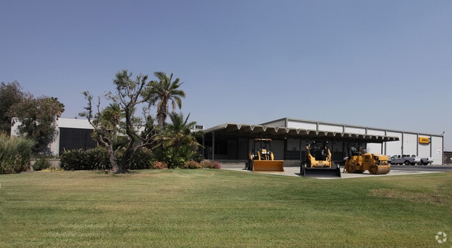

Property Detail
800 E La Cadena Dr
Riverside-San Bernardino-Ontario, CA
10.10 ACRES M/L IN PAR 2 PM 211/043 PM 32001
247-140-033
Riverside
Lightindustrial
California
B and X Area of moderate flood hazard, usually the area between the limits of the 100-year and 500-year floods.
2
2024
10.10 AC
2025
Riverside
042209
Inland Empire (California)
68,000 SF
NEARBY LISTINGS FOR SALE OR LEASE
DEMOGRAPHICS near 800 E La Cadena Dr
1 mile
3 mile
5 mile
2024 Total Population
9,173
85,980
212,643
2029 Population
9,384
88,102
216,970
Pop Growth 2024-2029
+ 2.30%
+ 2.47%
+ 2.03%
Average Age
35
34
36
2024 Total Households
2,571
25,587
64,170
HH Growth 2024-2029
+ 1.91%
+ 2.08%
+ 1.77%
Median Household Inc
$86,889
$77,891
$83,507
Avg Household Size
3.50
2.90
3.10
2024 Avg HH Vehicles
2.00
2.00
2.00
Median Home Value
$457,320
$532,312
$577,128
Median Year Built
1970
1975
1975
Nearby Places
Map Layers
Map Styles
 Street
 Aerial
Transit
 Traffic
 Biking
Places
Listings with unknown addresses are not visible on the map
- Restaurants
- Banks
- Shops
- Fitness
- Groceries
PUBLIC TRANSPORTATION
COMMUTER RAIL
Riverside-Downtown (91 Line - Southern California Regional Rail Authority (Metrolink), Inland Empire-Orange County Line - Southern California Regional Rail Authority (Metrolink), Riverside Line - Southern California Regional Rail Authority (Metrolink))
Drive
Walk
Distance
Riverside-Downtown (91 Line - Southern California Regional Rail Authority (Metrolink), Inland Empire-Orange County Line - Southern California Regional Rail Authority (Metrolink), Riverside Line - Southern California Regional Rail Authority (Metrolink))
8 min
3.4 mi
Rialto (San Bernardino Line - Southern California Regional Rail Authority (Metrolink))
Drive
Walk
Distance
Rialto (San Bernardino Line - Southern California Regional Rail Authority (Metrolink))
17 min
7.9 mi
AIRPORT
Ontario International
Drive
Walk
Distance
Ontario International
22 min
17.2 mi
Freight Ports
Port of Long Beach
Drive
Walk
Distance
Port of Long Beach
1 min
51.0 mi
The World's #1 Commercial Real Estate Marketplace
Connect with us
© 2026 CoStar Group
The information above has been obtained from sources believed reliable. While we do not doubt its accuracy we have not verified it and make no guarantee, warranty or representation about it. It is your responsibility to independently confirm its accuracy and completeness. Any projections, opinions, assumptions, or estimates used are for example only and do not represent the current or future performance of the property. The value of this transaction to you depends on tax and other factors which should be evaluated by your tax, financial, and legal advisors. You and your advisors should conduct a careful, independent investigation of the property to determine to your satisfaction the suitability of the property for your needs.