Property Record
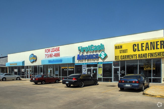
8001 Main St, Houston, TX 77025


NEARBY LISTINGS FOR SALE OR LEASE
Property Detail
8001 Main St
0440920000952
Abst 645 P W Rose
Outdoorrecreationbeachmountaindesert
TRS 2K-2 9C & 11B ABST 645 P W ROSE
X
Harris
48201C0860L
Texas
2024
0.83 AC
2025
Inner Loop University
314302
Houston
6,510 SF
Houston-The Woodlands-Sugar Land, TX
DEMOGRAPHICS near 8001 Main St
1 Mile
3 Mile
5 Mile
2024 Total Population
26,311
155,903
485,372
2029 Population
27,349
161,041
502,603
Pop Growth 2024-2029
+ 3.95%
+ 3.30%
+ 3.55%
Average Age
36
38
37
2024 Total Households
14,118
72,290
216,178
HH Growth 2024-2029
+ 3.90%
+ 3.39%
+ 3.71%
Median Household Inc
$58,528
$75,690
$70,292
Avg Household Size
1.80
2.10
2.10
2024 Avg HH Vehicles
1.00
1.00
1.00
Median Home Value
$417,536
$617,060
$426,064
Median Year Built
1990
1993
1990
Nearby Places
Map Layers
Map Styles
 Street
 Aerial
- Restaurants
- Banks
- Shops
- Fitness
- Groceries
PUBLIC TRANSPORTATION
COMMUTER RAIL
DRIVE
WALK
Distance
14 min
6.5 mi
AIRPORT
William P Hobby
DRIVE
WALK
Distance
William P Hobby
26 min
13.5 mi
George Bush Intcntl/Houston
DRIVE
WALK
Distance
George Bush Intcntl/Houston
35 min
24.5 mi
Freight Ports
Port of Houston
DRIVE
WALK
Distance
Port of Houston
22 min
13.8 mi
Nearby Properties
Address
Land Use
TOTAL SIZE
Lot Size
Zoning
Address
Land Use
TOTAL SIZE
Lot Size
Zoning
519,409 SF
1.52 AC
Address
Land Use
TOTAL SIZE
Lot Size
Zoning
1,252,274 SF
2.02 AC
Address
Land Use
TOTAL SIZE
Lot Size
Zoning
1,880,742 SF
20.77 AC
Address
Land Use
TOTAL SIZE
Lot Size
Zoning
704,249 SF
2.34 AC
Address
Land Use
TOTAL SIZE
Lot Size
Zoning
1,044,305 SF
3.16 AC
Address
Land Use
TOTAL SIZE
Lot Size
Zoning
1,359,194 SF
Address
Land Use
TOTAL SIZE
Lot Size
Zoning
402,467 SF
28.30 AC
Address
Land Use
TOTAL SIZE
Lot Size
Zoning
1,009,859 SF
28.73 AC
Address
Land Use
TOTAL SIZE
Lot Size
Zoning
464,134 SF
3.57 AC
Address
Land Use
TOTAL SIZE
Lot Size
Zoning
701,043 SF
4.69 AC
Address
Land Use
TOTAL SIZE
Lot Size
Zoning
777,791 SF
47.90 AC
Address
Land Use
TOTAL SIZE
Lot Size
Zoning
958,147 SF
16.60 AC
Address
Land Use
TOTAL SIZE
Lot Size
Zoning
507,499 SF
7.66 AC
Address
Land Use
TOTAL SIZE
Lot Size
Zoning
310,967 SF
1.38 AC
Address
Land Use
TOTAL SIZE
Lot Size
Zoning
444,589 SF
11 AC
Address
Land Use
TOTAL SIZE
Lot Size
Zoning
577,327 SF
28.80 AC
Address
Land Use
TOTAL SIZE
Lot Size
Zoning
828,746 SF
7.76 AC
Address
Land Use
TOTAL SIZE
Lot Size
Zoning
396,888 SF
2.02 AC
Address
Land Use
TOTAL SIZE
Lot Size
Zoning
840,388 SF
0.91 AC
Address
Land Use
TOTAL SIZE
Lot Size
Zoning
1,279,489 SF
2.83 AC
Address
Land Use
TOTAL SIZE
Lot Size
Zoning
1,098,342 SF
8.81 AC
Address
Land Use
TOTAL SIZE
Lot Size
Zoning
261,388 SF
1.56 AC
Address
Land Use
TOTAL SIZE
Lot Size
Zoning
171,997 SF
1.15 AC
Address
Land Use
TOTAL SIZE
Lot Size
Zoning
486,076 SF
3.79 AC
Address
Land Use
TOTAL SIZE
Lot Size
Zoning
565,246 SF
1.14 AC
Address
Land Use
TOTAL SIZE
Lot Size
Zoning
552,795 SF
4.29 AC
Address
Land Use
TOTAL SIZE
Lot Size
Zoning
320,710 SF
1.19 AC
Address
Land Use
TOTAL SIZE
Lot Size
Zoning
517,548 SF
1.60 AC
Address
Land Use
TOTAL SIZE
Lot Size
Zoning
519,237 SF
1.73 AC
Address
Land Use
TOTAL SIZE
Lot Size
Zoning
316,101 SF
2.12 AC
The World's #1 Commercial Real Estate Marketplace
Connect with us
© 2025 CoStar Group
The information above has been obtained from sources believed reliable. While we do not doubt its accuracy we have not verified it and make no guarantee, warranty or representation about it. It is your responsibility to independently confirm its accuracy and completeness. Any projections, opinions, assumptions, or estimates used are for example only and do not represent the current or future performance of the property. The value of this transaction to you depends on tax and other factors which should be evaluated by your tax, financial, and legal advisors. You and your advisors should conduct a careful, independent investigation of the property to determine to your satisfaction the suitability of the property for your needs.