Property Record
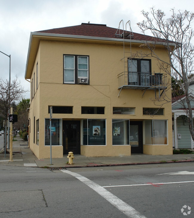
1400 2Nd St, San Rafael, CA 94901


Property Detail
1400 2Nd St
011-252-09
Marin
Commercialnec
California
AE The base floodplain where base flood elevations are provided. AE Zones are now used on new format FIRMs instead of A1-A30 Zones.
0.12 AC
2025
San Rafael/Larkspur
2025
North Bay/Santa Rosa
111002
San Rafael, CA
5,425 SF
NEARBY LISTINGS FOR SALE OR LEASE
DEMOGRAPHICS near 1400 2Nd St
1 mile
3 mile
5 mile
2025 Total Population
16,653
91,206
141,398
2030 Population
16,485
89,982
139,564
Pop Growth 2025-2030
(1.01%)
(1.34%)
(1.30%)
Average Age
44
44
45
2025 Total Households
7,186
35,824
55,983
HH Growth 2025-2030
(0.99%)
(1.26%)
(1.27%)
Median Household Inc
$101,828
$121,136
$140,119
Avg Household Size
2.20
2.40
2.40
2025 Avg HH Vehicles
2.00
2.00
2.00
Median Home Value
$1,112,766
$1,104,440
$1,109,002
Median Year Built
1959
1963
1963
Nearby Places
Map Layers
Map Styles
 Street
 Aerial
Layers
 Traffic
 Biking
Places
Listings with unknown addresses are not visible on the map
- Restaurants
- Banks
- Shops
- Fitness
- Groceries
PUBLIC TRANSPORTATION
COMMUTER RAIL
Drive
Walk
Distance
3 min
12 min
0.6 mi
Drive
Walk
Distance
7 min
3.2 mi
AIRPORT
San Francisco International
Drive
Walk
Distance
San Francisco International
51 min
31.3 mi
Metro Oakland International
Drive
Walk
Distance
Metro Oakland International
44 min
31.4 mi
Freight Ports
Port of Richmond
Drive
Walk
Distance
Port of Richmond
21 min
12.1 mi
SALE & LEASE HISTORY
LISTING DATE
SALE/LEASE

Oct 11, 2024
For Lease
Feb 24, 2025
For Lease
Feb 08, 2024
For Sale
Nearby Properties
Address
Land Use
TOTAL SIZE
Lot Size
Zoning
Address
Land Use
TOTAL SIZE
Lot Size
Zoning
217,791 SF
4.51 AC
Address
Land Use
TOTAL SIZE
Lot Size
Zoning
283,663 SF
27.98 AC
Address
Land Use
TOTAL SIZE
Lot Size
Zoning
23.79 AC
Address
Land Use
TOTAL SIZE
Lot Size
Zoning
87,058 SF
1.33 AC
Address
Land Use
TOTAL SIZE
Lot Size
Zoning
221,660 SF
9.69 AC
PC
Address
Land Use
TOTAL SIZE
Lot Size
Zoning
180,000 SF
15.92 AC
Address
Land Use
TOTAL SIZE
Lot Size
Zoning
132,969 SF
9.09 AC
Address
Land Use
TOTAL SIZE
Lot Size
Zoning
119,185 SF
4.31 AC
Address
Land Use
TOTAL SIZE
Lot Size
Zoning
109,944 SF
5.73 AC
Address
Land Use
TOTAL SIZE
Lot Size
Zoning
147,502 SF
1.02 AC
Address
Land Use
TOTAL SIZE
Lot Size
Zoning
132,040 SF
11.74 AC
Address
Land Use
TOTAL SIZE
Lot Size
Zoning
127,504 SF
8.49 AC
Address
Land Use
TOTAL SIZE
Lot Size
Zoning
12.57 AC
Address
Land Use
TOTAL SIZE
Lot Size
Zoning
11.63 AC
Address
Land Use
TOTAL SIZE
Lot Size
Zoning
91,158 SF
1.89 AC
Address
Land Use
TOTAL SIZE
Lot Size
Zoning
79,995 SF
3.15 AC
Address
Land Use
TOTAL SIZE
Lot Size
Zoning
119,061 SF
5.90 AC
Address
Land Use
TOTAL SIZE
Lot Size
Zoning
15.91 AC
SPD
Address
Land Use
TOTAL SIZE
Lot Size
Zoning
72,870 SF
3.51 AC
Address
Land Use
TOTAL SIZE
Lot Size
Zoning
94,745 SF
1.46 AC
Address
Land Use
TOTAL SIZE
Lot Size
Zoning
234,922 SF
6 AC
Address
Land Use
TOTAL SIZE
Lot Size
Zoning
81,894 SF
5.91 AC
Address
Land Use
TOTAL SIZE
Lot Size
Zoning
75,888 SF
10.99 AC
Address
Land Use
TOTAL SIZE
Lot Size
Zoning
195,460 SF
6.10 AC
Address
Land Use
TOTAL SIZE
Lot Size
Zoning
71,527 SF
1.86 AC
Address
Land Use
TOTAL SIZE
Lot Size
Zoning
Address
Land Use
TOTAL SIZE
Lot Size
Zoning
84,245 SF
2.62 AC
Address
Land Use
TOTAL SIZE
Lot Size
Zoning
177,460 SF
13 AC
Address
Land Use
TOTAL SIZE
Lot Size
Zoning
11,830 SF
0.65 AC
Address
Land Use
TOTAL SIZE
Lot Size
Zoning
138,861 SF
15.83 AC
The World's #1 Commercial Real Estate Marketplace
Connect with us
© 2026 CoStar Group
The information above has been obtained from sources believed reliable. While we do not doubt its accuracy we have not verified it and make no guarantee, warranty or representation about it. It is your responsibility to independently confirm its accuracy and completeness. Any projections, opinions, assumptions, or estimates used are for example only and do not represent the current or future performance of the property. The value of this transaction to you depends on tax and other factors which should be evaluated by your tax, financial, and legal advisors. You and your advisors should conduct a careful, independent investigation of the property to determine to your satisfaction the suitability of the property for your needs.