Property Record
8012 N 10Th St, Mcallen, TX 78504
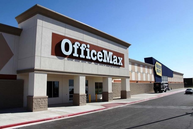

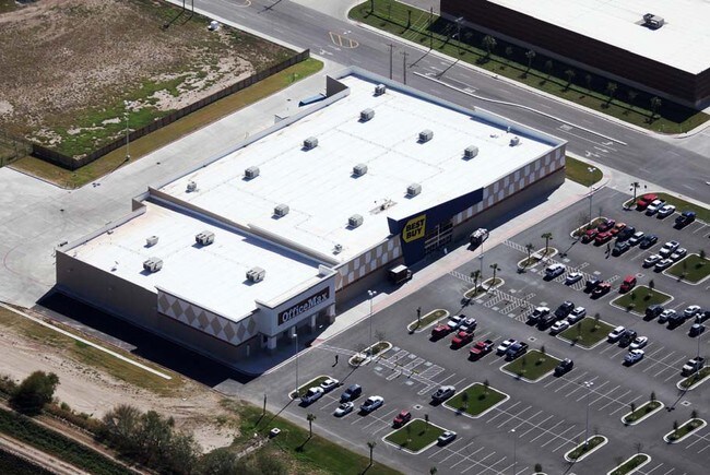
Property Detail
8012 N 10Th St
McAllen-Edinburg-Mission, TX
TRENTON CROSSING SHOPPING CENTER PH 3 LOT 1
T6835-03-000-0001-00
Hidalgo
Commercialnec
Texas
2024
1
2025
8.80 AC
023536
Greater McAllen
62,624 SF
McAllen/Edinburg/Pharr
NEARBY LISTINGS FOR SALE OR LEASE
DEMOGRAPHICS near 8012 N 10Th St
1 mile
3 mile
5 mile
2025 Total Population
7,575
93,932
233,033
2030 Population
7,871
97,802
243,096
Pop Growth 2025-2030
+ 3.91%
+ 4.12%
+ 4.32%
Average Age
36
35
35
2025 Total Households
2,471
32,122
76,694
HH Growth 2025-2030
+ 3.72%
+ 3.98%
+ 4.15%
Median Household Inc
$81,481
$75,569
$62,542
Avg Household Size
3.00
2.80
3.00
2025 Avg HH Vehicles
2.00
2.00
2.00
Median Home Value
$276,438
$238,141
$208,212
Median Year Built
1998
1999
1999
Nearby Places
Map Layers
Map Styles
 Street
 Aerial
Layers
 Traffic
 Biking
Places
Listings with unknown addresses are not visible on the map
- Restaurants
- Banks
- Shops
- Fitness
- Groceries
PUBLIC TRANSPORTATION
AIRPORT
McAllen International
Drive
Walk
Distance
McAllen International
13 min
7.3 mi
Freight Ports
Port of Brownsville
Drive
Walk
Distance
Port of Brownsville
75 min
63.3 mi
SALE & LEASE HISTORY
LISTING DATE
SALE/LEASE

Nov 01, 2016
For Lease
Apr 26, 2017
For Lease
Nearby Properties
Address
Land Use
TOTAL SIZE
Lot Size
Zoning
Address
Land Use
TOTAL SIZE
Lot Size
Zoning
543,452 SF
53.23 AC
CO
Address
Land Use
TOTAL SIZE
Lot Size
Zoning
407,190 SF
11.04 AC
CO
Address
Land Use
TOTAL SIZE
Lot Size
Zoning
357,818 SF
11.10 AC
Address
Land Use
TOTAL SIZE
Lot Size
Zoning
393,960 SF
60.24 AC
Address
Land Use
TOTAL SIZE
Lot Size
Zoning
251,423 SF
27.39 AC
CO
Address
Land Use
TOTAL SIZE
Lot Size
Zoning
128,076 SF
5.01 AC
Address
Land Use
TOTAL SIZE
Lot Size
Zoning
125,254 SF
15 AC
C
Address
Land Use
TOTAL SIZE
Lot Size
Zoning
208,113 SF
22.75 AC
Address
Land Use
TOTAL SIZE
Lot Size
Zoning
210,263 SF
37.52 AC
Address
Land Use
TOTAL SIZE
Lot Size
Zoning
173,217 SF
5.58 AC
Address
Land Use
TOTAL SIZE
Lot Size
Zoning
109,791 SF
8.82 AC
Address
Land Use
TOTAL SIZE
Lot Size
Zoning
40,248 SF
10.36 AC
Address
Land Use
TOTAL SIZE
Lot Size
Zoning
205,008 SF
22.13 AC
Address
Land Use
TOTAL SIZE
Lot Size
Zoning
16.83 AC
CO
Address
Land Use
TOTAL SIZE
Lot Size
Zoning
92,603 SF
7.10 AC
CO
Address
Land Use
TOTAL SIZE
Lot Size
Zoning
135,878 SF
15.45 AC
Address
Land Use
TOTAL SIZE
Lot Size
Zoning
90,172 SF
8.71 AC
Address
Land Use
TOTAL SIZE
Lot Size
Zoning
2.38 AC
RS
Address
Land Use
TOTAL SIZE
Lot Size
Zoning
82,724 SF
3.27 AC
Address
Land Use
TOTAL SIZE
Lot Size
Zoning
119,225 SF
23.30 AC
CO
Address
Land Use
TOTAL SIZE
Lot Size
Zoning
82,448 SF
4.36 AC
Address
Land Use
TOTAL SIZE
Lot Size
Zoning
138,653 SF
22.89 AC
Address
Land Use
TOTAL SIZE
Lot Size
Zoning
95,245 SF
8.92 AC
C-3
Address
Land Use
TOTAL SIZE
Lot Size
Zoning
5 SF
22.02 AC
Address
Land Use
TOTAL SIZE
Lot Size
Zoning
78,524 SF
3.83 AC
Address
Land Use
TOTAL SIZE
Lot Size
Zoning
85,927 SF
3.59 AC
Address
Land Use
TOTAL SIZE
Lot Size
Zoning
195,599 SF
21.46 AC
CO
Address
Land Use
TOTAL SIZE
Lot Size
Zoning
156,704 SF
7.06 AC
Address
Land Use
TOTAL SIZE
Lot Size
Zoning
3 SF
14.43 AC
Address
Land Use
TOTAL SIZE
Lot Size
Zoning
174,041 SF
14.66 AC
The World's #1 Commercial Real Estate Marketplace
Connect with us
© 2026 CoStar Group
The information above has been obtained from sources believed reliable. While we do not doubt its accuracy we have not verified it and make no guarantee, warranty or representation about it. It is your responsibility to independently confirm its accuracy and completeness. Any projections, opinions, assumptions, or estimates used are for example only and do not represent the current or future performance of the property. The value of this transaction to you depends on tax and other factors which should be evaluated by your tax, financial, and legal advisors. You and your advisors should conduct a careful, independent investigation of the property to determine to your satisfaction the suitability of the property for your needs.