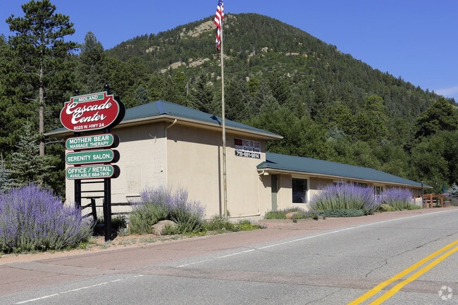
Property Record
8025 W Us Highway 24, Cascade, CO 80809


Property Detail
8025 W Us Highway 24
83262-00-079
THAT PORTION 100.0 FT WIDE STRIP OF FORMER R/W OF MIDLAND TERMINAL RAILWAY CO NW4NW4 SEC 26-13-68 DESC AS FOLS: BEG AT A PT 344.54 FT W FROM SE COR OF NW4 OF SEC 26, TH N 33<1500 W 1244.1 FT, A C/A OF 19<30 AN ARC DIST OF 325.0 FT, N 52<45 W 486.34 F
Multifamilydwelling
EL PASO
CC/C-2
Colorado
AE The base floodplain where base flood elevations are provided. AE Zones are now used on new format FIRMs instead of A1-A30 Zones.
4.74 AC
2024
Southwest
2025
Colorado Springs
003401
Colorado Springs, CO
4,084 SF
NEARBY LISTINGS FOR SALE OR LEASE
-
-
View all Cascade listings for sale on LoopNet.com
DEMOGRAPHICS near 8025 W Us Highway 24
1 mile
3 mile
5 mile
2025 Total Population
606
1,456
6,780
2030 Population
614
1,475
6,880
Pop Growth 2025-2030
+ 1.32%
+ 1.30%
+ 1.47%
Average Age
49
49
47
2025 Total Households
272
672
3,334
HH Growth 2025-2030
+ 1.47%
+ 1.64%
+ 1.83%
Median Household Inc
$163,095
$116,249
$87,888
Avg Household Size
2.20
2.20
2.00
2025 Avg HH Vehicles
3.00
2.00
2.00
Median Home Value
$740,000
$676,562
$645,978
Median Year Built
1987
1975
1956
Nearby Places
Map Layers
Map Styles
 Street
 Aerial
Transit
 Traffic
 Biking
Places
Listings with unknown addresses are not visible on the map
- Restaurants
- Banks
- Shops
- Fitness
- Groceries
PUBLIC TRANSPORTATION
AIRPORT
City of Colorado Springs Municipal
Drive
Walk
Distance
City of Colorado Springs Municipal
35 min
20.3 mi
Freight Ports
Tulsa Port Of Catoosa
Drive
Walk
Distance
Tulsa Port Of Catoosa
758 min
704.4 mi
Nearby Properties
Address
Land Use
TOTAL SIZE
Lot Size
Zoning
Address
Land Use
TOTAL SIZE
Lot Size
Zoning
5,387.79 AC
R-T
Address
Land Use
TOTAL SIZE
Lot Size
Zoning
4.78 AC
R-T
Address
Land Use
TOTAL SIZE
Lot Size
Zoning
17,645 SF
50 AC
R-T
Address
Land Use
TOTAL SIZE
Lot Size
Zoning
400 AC
R-T
Address
Land Use
TOTAL SIZE
Lot Size
Zoning
640 AC
R-T
Address
Land Use
TOTAL SIZE
Lot Size
Zoning
103.14 AC
R-T
Address
Land Use
TOTAL SIZE
Lot Size
Zoning
3,873 SF
0.93 AC
R-T
Address
Land Use
TOTAL SIZE
Lot Size
Zoning
625 SF
9.82 AC
R-T
Address
Land Use
TOTAL SIZE
Lot Size
Zoning
80 AC
R-T
Address
Land Use
TOTAL SIZE
Lot Size
Zoning
277.50 AC
R-T
Address
Land Use
TOTAL SIZE
Lot Size
Zoning
18,081 SF
27.69 AC
CR
Address
Land Use
TOTAL SIZE
Lot Size
Zoning
160 AC
R-T
Address
Land Use
TOTAL SIZE
Lot Size
Zoning
400 AC
R-T
Address
Land Use
TOTAL SIZE
Lot Size
Zoning
160 AC
R-T
Address
Land Use
TOTAL SIZE
Lot Size
Zoning
900 SF
3.16 AC
R-T
Address
Land Use
TOTAL SIZE
Lot Size
Zoning
120 AC
R-T
Address
Land Use
TOTAL SIZE
Lot Size
Zoning
374.74 AC
R-T
Address
Land Use
TOTAL SIZE
Lot Size
Zoning
19.93 AC
R-T
Address
Land Use
TOTAL SIZE
Lot Size
Zoning
2,574 SF
2.54 AC
R-T
Address
Land Use
TOTAL SIZE
Lot Size
Zoning
225 AC
R-T
Address
Land Use
TOTAL SIZE
Lot Size
Zoning
320 AC
R-T
Address
Land Use
TOTAL SIZE
Lot Size
Zoning
88.80 AC
R-T
Address
Land Use
TOTAL SIZE
Lot Size
Zoning
7,997 SF
0.92 AC
C-2
Address
Land Use
TOTAL SIZE
Lot Size
Zoning
2,273 SF
0.37 AC
Address
Land Use
TOTAL SIZE
Lot Size
Zoning
40 AC
R-T
Address
Land Use
TOTAL SIZE
Lot Size
Zoning
20 AC
F-5
Address
Land Use
TOTAL SIZE
Lot Size
Zoning
1,560 SF
36 AC
F-5
Address
Land Use
TOTAL SIZE
Lot Size
Zoning
6,096 SF
5.02 AC
CC
Address
Land Use
TOTAL SIZE
Lot Size
Zoning
10,225 SF
1.91 AC
CC R-T
Address
Land Use
TOTAL SIZE
Lot Size
Zoning
1,600 SF
0.56 AC
The World's #1 Commercial Real Estate Marketplace
Connect with us
© 2026 CoStar Group
The information above has been obtained from sources believed reliable. While we do not doubt its accuracy we have not verified it and make no guarantee, warranty or representation about it. It is your responsibility to independently confirm its accuracy and completeness. Any projections, opinions, assumptions, or estimates used are for example only and do not represent the current or future performance of the property. The value of this transaction to you depends on tax and other factors which should be evaluated by your tax, financial, and legal advisors. You and your advisors should conduct a careful, independent investigation of the property to determine to your satisfaction the suitability of the property for your needs.