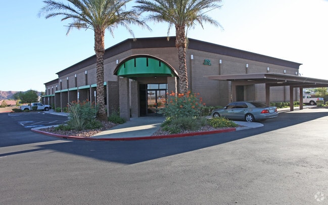
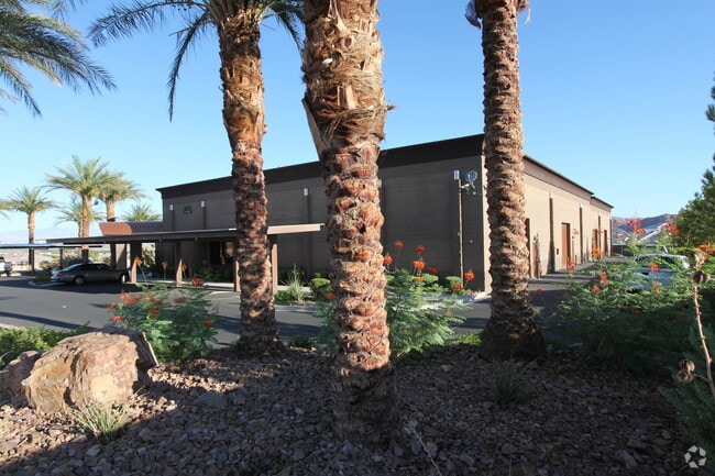
Property Record
810 Dusan Way, Henderson, NV 89011

Property Detail
810 Dusan Way
160-33-217-010
FOUR KIDS-INDST PARK PLAT BOOK 75 PAGE 28 PT LOT 3
Shipyard
Clark
IP
Nevada
B and X Area of moderate flood hazard, usually the area between the limits of the 100-year and 500-year floods.
3
2026
1.36 AC
2026
SE LV/Henderson
005437
Las Vegas
18,150 SF
Las Vegas-Henderson-North Las Vegas, NV
NEARBY LISTINGS FOR SALE OR LEASE
DEMOGRAPHICS near 810 Dusan Way
1 mile
3 mile
5 mile
2025 Total Population
5,399
47,829
121,693
2030 Population
5,864
52,034
129,941
Pop Growth 2025-2030
+ 8.61%
+ 8.79%
+ 6.78%
Average Age
45
43
41
2025 Total Households
2,116
18,208
46,536
HH Growth 2025-2030
+ 8.84%
+ 9.06%
+ 6.93%
Median Household Inc
$120,134
$97,169
$84,633
Avg Household Size
2.50
2.60
2.50
2025 Avg HH Vehicles
2.00
2.00
2.00
Median Home Value
$603,968
$518,069
$441,019
Median Year Built
2010
2008
2001
Nearby Places
Map Layers
Map Styles
 Street
 Aerial
Layers
 Traffic
 Biking
Places
Listings with unknown addresses are not visible on the map
- Restaurants
- Banks
- Shops
- Fitness
- Groceries
PUBLIC TRANSPORTATION
AIRPORT
Boulder City Municipal
Drive
Walk
Distance
Boulder City Municipal
24 min
14.4 mi
Harry Reid International
Drive
Walk
Distance
Harry Reid International
24 min
16.5 mi
Freight Ports
Port of Long Beach
Drive
Walk
Distance
Port of Long Beach
321 min
285.2 mi
Nearby Properties
Address
Land Use
TOTAL SIZE
Lot Size
Zoning
Address
Land Use
TOTAL SIZE
Lot Size
Zoning
31,463 SF
191.46 AC
PS
Address
Land Use
TOTAL SIZE
Lot Size
Zoning
135,690 SF
21.58 AC
CT
Address
Land Use
TOTAL SIZE
Lot Size
Zoning
9,493 SF
15.37 AC
Address
Land Use
TOTAL SIZE
Lot Size
Zoning
350.47 AC
PS
Address
Land Use
TOTAL SIZE
Lot Size
Zoning
10.50 AC
Address
Land Use
TOTAL SIZE
Lot Size
Zoning
1,635 SF
13.84 AC
CT
Address
Land Use
TOTAL SIZE
Lot Size
Zoning
387,990 SF
22.04 AC
Address
Land Use
TOTAL SIZE
Lot Size
Zoning
9,000 SF
96.81 AC
RE
Address
Land Use
TOTAL SIZE
Lot Size
Zoning
40,031 SF
21.25 AC
Address
Land Use
TOTAL SIZE
Lot Size
Zoning
3,664 SF
16.09 AC
RH20
Address
Land Use
TOTAL SIZE
Lot Size
Zoning
14,463 SF
19.48 AC
Address
Land Use
TOTAL SIZE
Lot Size
Zoning
136,465 SF
34.67 AC
Address
Land Use
TOTAL SIZE
Lot Size
Zoning
170,646 SF
18.16 AC
H:IG-RD
Address
Land Use
TOTAL SIZE
Lot Size
Zoning
124,900 SF
5.45 AC
Address
Land Use
TOTAL SIZE
Lot Size
Zoning
83,313 SF
7.79 AC
Address
Land Use
TOTAL SIZE
Lot Size
Zoning
2,540 SF
3.82 AC
CT-G-MP
Address
Land Use
TOTAL SIZE
Lot Size
Zoning
45.08 AC
Address
Land Use
TOTAL SIZE
Lot Size
Zoning
16,240 SF
28.09 AC
Address
Land Use
TOTAL SIZE
Lot Size
Zoning
320 AC
DH
Address
Land Use
TOTAL SIZE
Lot Size
Zoning
123,673 SF
12.23 AC
Address
Land Use
TOTAL SIZE
Lot Size
Zoning
48,511 SF
13.98 AC
Address
Land Use
TOTAL SIZE
Lot Size
Zoning
254,758 SF
10.21 AC
RH36
Address
Land Use
TOTAL SIZE
Lot Size
Zoning
92,070 SF
6.51 AC
Address
Land Use
TOTAL SIZE
Lot Size
Zoning
89.77 AC
DH
Address
Land Use
TOTAL SIZE
Lot Size
Zoning
23.97 AC
Address
Land Use
TOTAL SIZE
Lot Size
Zoning
2,989 SF
4.98 AC
PS
Address
Land Use
TOTAL SIZE
Lot Size
Zoning
16,430 SF
1.01 AC
Address
Land Use
TOTAL SIZE
Lot Size
Zoning
66,420 SF
5.46 AC
The World's #1 Commercial Real Estate Marketplace
Connect with us
© 2026 CoStar Group
The information above has been obtained from sources believed reliable. While we do not doubt its accuracy we have not verified it and make no guarantee, warranty or representation about it. It is your responsibility to independently confirm its accuracy and completeness. Any projections, opinions, assumptions, or estimates used are for example only and do not represent the current or future performance of the property. The value of this transaction to you depends on tax and other factors which should be evaluated by your tax, financial, and legal advisors. You and your advisors should conduct a careful, independent investigation of the property to determine to your satisfaction the suitability of the property for your needs.