Property Record
810 Jamacha Rd, El Cajon, CA 92019
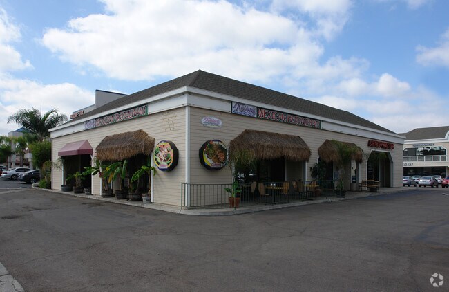

Property Detail
810 Jamacha Rd
514-022-26
TCT A (EX WLY 36.77 FT&RD)PAR 2 PER PM 11422 IN TR CC000262
Storesoffices
San Diego
C-N
California
B and X Area of moderate flood hazard, usually the area between the limits of the 100-year and 500-year floods.
37
2024
1.55 AC
2025
El Cajon
015408
San Diego
19,545 SF
San Diego-Chula Vista-Carlsbad, CA
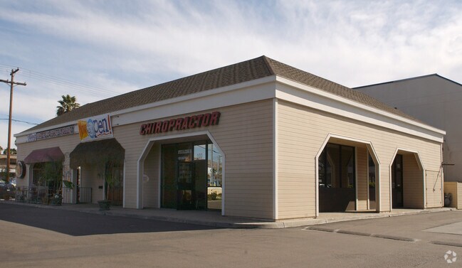
NEARBY LISTINGS FOR SALE OR LEASE
DEMOGRAPHICS near 810 Jamacha Rd
1 mile
3 mile
5 mile
2025 Total Population
18,509
138,968
252,697
2030 Population
18,532
138,717
252,415
Pop Growth 2025-2030
+ 0.12%
(0.18%)
(0.11%)
Average Age
40
39
40
2025 Total Households
6,104
46,048
86,978
HH Growth 2025-2030
(0.08%)
(0.39%)
(0.30%)
Median Household Inc
$85,275
$77,645
$91,452
Avg Household Size
3.00
2.90
2.80
2025 Avg HH Vehicles
2.00
2.00
2.00
Median Home Value
$698,159
$732,989
$738,780
Median Year Built
1973
1976
1975
Nearby Places
Map Layers
Map Styles
 Street
 Aerial
Layers
 Traffic
 Biking
Places
Listings with unknown addresses are not visible on the map
- Restaurants
- Banks
- Shops
- Fitness
- Groceries
PUBLIC TRANSPORTATION
AIRPORT
San Diego International
Drive
Walk
Distance
San Diego International
27 min
20.7 mi
Nearby Properties
Address
Land Use
TOTAL SIZE
Lot Size
Zoning
Address
Land Use
TOTAL SIZE
Lot Size
Zoning
15.64 AC
RU
Address
Land Use
TOTAL SIZE
Lot Size
Zoning
13.49 AC
RU
Address
Land Use
TOTAL SIZE
Lot Size
Zoning
10.98 AC
RV
Address
Land Use
TOTAL SIZE
Lot Size
Zoning
8.24 AC
RU
Address
Land Use
TOTAL SIZE
Lot Size
Zoning
39.17 AC
C-R
Address
Land Use
TOTAL SIZE
Lot Size
Zoning
8.82 AC
RM-2200
Address
Land Use
TOTAL SIZE
Lot Size
Zoning
6.12 AC
RM-2200
Address
Land Use
TOTAL SIZE
Lot Size
Zoning
5.83 AC
RM-2200
Address
Land Use
TOTAL SIZE
Lot Size
Zoning
9.38 AC
RU
Address
Land Use
TOTAL SIZE
Lot Size
Zoning
5.77 AC
RM-2200
Address
Land Use
TOTAL SIZE
Lot Size
Zoning
64,900 SF
4.55 AC
RM-2200
Address
Land Use
TOTAL SIZE
Lot Size
Zoning
4.39 AC
RM-2200
Address
Land Use
TOTAL SIZE
Lot Size
Zoning
4.69 AC
RU
Address
Land Use
TOTAL SIZE
Lot Size
Zoning
81,896 SF
3.74 AC
RM-2200
Address
Land Use
TOTAL SIZE
Lot Size
Zoning
95,024 SF
2.89 AC
RM-2200
Address
Land Use
TOTAL SIZE
Lot Size
Zoning
3.51 AC
RM-2200
Address
Land Use
TOTAL SIZE
Lot Size
Zoning
77,930 SF
2.34 AC
O-P
Address
Land Use
TOTAL SIZE
Lot Size
Zoning
16.33 AC
C-R
Address
Land Use
TOTAL SIZE
Lot Size
Zoning
1.89 AC
C-R
Address
Land Use
TOTAL SIZE
Lot Size
Zoning
8.81 AC
C-R
Address
Land Use
TOTAL SIZE
Lot Size
Zoning
82,752 SF
4.24 AC
RM-2200
Address
Land Use
TOTAL SIZE
Lot Size
Zoning
70,656 SF
2.67 AC
RM-2200
Address
Land Use
TOTAL SIZE
Lot Size
Zoning
4.76 AC
RM-1450
Address
Land Use
TOTAL SIZE
Lot Size
Zoning
5.62 AC
C31
Address
Land Use
TOTAL SIZE
Lot Size
Zoning
15.71 AC
RV
Address
Land Use
TOTAL SIZE
Lot Size
Zoning
67,722 SF
3.57 AC
RM-2500
Address
Land Use
TOTAL SIZE
Lot Size
Zoning
2,736 SF
32.31 AC
RS-20
Address
Land Use
TOTAL SIZE
Lot Size
Zoning
5.78 AC
RM-2200
Address
Land Use
TOTAL SIZE
Lot Size
Zoning
77,650 SF
1.90 AC
C-R
Address
Land Use
TOTAL SIZE
Lot Size
Zoning
10.14 AC
C36
The World's #1 Commercial Real Estate Marketplace
Connect with us
© 2026 CoStar Group
The information above has been obtained from sources believed reliable. While we do not doubt its accuracy we have not verified it and make no guarantee, warranty or representation about it. It is your responsibility to independently confirm its accuracy and completeness. Any projections, opinions, assumptions, or estimates used are for example only and do not represent the current or future performance of the property. The value of this transaction to you depends on tax and other factors which should be evaluated by your tax, financial, and legal advisors. You and your advisors should conduct a careful, independent investigation of the property to determine to your satisfaction the suitability of the property for your needs.