Property Record
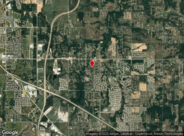
8102 E Highway 51 Dr, Broken Arrow, OK 74014

NEARBY LISTINGS FOR SALE OR LEASE
Property Detail
8102 E Highway 51 Dr
Tulsa, OK
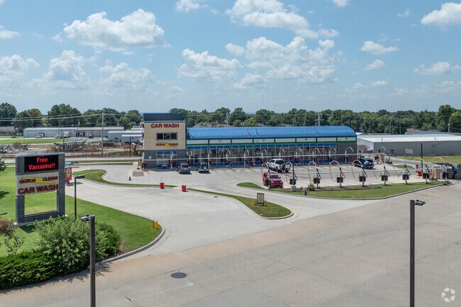
Quiktrip Cm Ctr #50
730068346
QUIKTRIP COMMERCIAL CTR #50 LOT 3 BLK 1
Carwashautomated
Wagoner
X
Oklahoma
40143C0392L
3
2024
1.38 AC
2025
Wagoner County
030508
Tulsa
4,928 SF
DEMOGRAPHICS near 8102 E Highway 51 Dr
1 Mile
3 Mile
5 Mile
2024 Total Population
2,406
37,027
117,698
2029 Population
2,796
40,529
126,851
Pop Growth 2024-2029
+ 16.21%
+ 9.46%
+ 7.78%
Average Age
40
39
38
2024 Total Households
884
14,371
43,987
HH Growth 2024-2029
+ 16.06%
+ 9.18%
+ 7.58%
Median Household Inc
$81,193
$69,148
$78,479
Avg Household Size
2.70
2.50
2.60
2024 Avg HH Vehicles
2.00
2.00
2.00
Median Home Value
$172,764
$206,398
$206,563
Median Year Built
1984
1989
1994
Nearby Places
Map Layers
Map Styles
 Street
 Aerial
- Restaurants
- Banks
- Shops
- Fitness
- Groceries
PUBLIC TRANSPORTATION
AIRPORT
Tulsa International
DRIVE
WALK
Distance
Tulsa International
30 min
20.1 mi
Freight Ports
Tulsa Port of Inola
DRIVE
WALK
Distance
Tulsa Port of Inola
31 min
24.0 mi
Nearby Properties
Address
Land Use
TOTAL SIZE
Lot Size
Zoning
Address
Land Use
TOTAL SIZE
Lot Size
Zoning
5,920 SF
26.29 AC
Address
Land Use
TOTAL SIZE
Lot Size
Zoning
7,200 SF
24.37 AC
Address
Land Use
TOTAL SIZE
Lot Size
Zoning
11,220 SF
8.57 AC
Address
Land Use
TOTAL SIZE
Lot Size
Zoning
319 SF
8.23 AC
Address
Land Use
TOTAL SIZE
Lot Size
Zoning
810 SF
56.23 AC
Address
Land Use
TOTAL SIZE
Lot Size
Zoning
1,080 SF
19.80 AC
Address
Land Use
TOTAL SIZE
Lot Size
Zoning
5,924 SF
135.96 AC
Address
Land Use
TOTAL SIZE
Lot Size
Zoning
16,790 SF
2.82 AC
Address
Land Use
TOTAL SIZE
Lot Size
Zoning
10,000 SF
3 AC
Address
Land Use
TOTAL SIZE
Lot Size
Zoning
9,250 SF
7.46 AC
Address
Land Use
TOTAL SIZE
Lot Size
Zoning
15,111 SF
2.54 AC
CH
Address
Land Use
TOTAL SIZE
Lot Size
Zoning
45,092 SF
6.33 AC
Address
Land Use
TOTAL SIZE
Lot Size
Zoning
106,487 SF
8.17 AC
CH
Address
Land Use
TOTAL SIZE
Lot Size
Zoning
12,600 SF
6.96 AC
Address
Land Use
TOTAL SIZE
Lot Size
Zoning
8,000 SF
6.94 AC
Address
Land Use
TOTAL SIZE
Lot Size
Zoning
18.24 AC
IH
Address
Land Use
TOTAL SIZE
Lot Size
Zoning
1,446 SF
17.60 AC
Address
Land Use
TOTAL SIZE
Lot Size
Zoning
55,482 SF
5.54 AC
CG
Address
Land Use
TOTAL SIZE
Lot Size
Zoning
23,865 SF
2.50 AC
Address
Land Use
TOTAL SIZE
Lot Size
Zoning
6,336 SF
3.21 AC
Address
Land Use
TOTAL SIZE
Lot Size
Zoning
168 SF
17.77 AC
Address
Land Use
TOTAL SIZE
Lot Size
Zoning
5,931 SF
1.29 AC
Address
Land Use
TOTAL SIZE
Lot Size
Zoning
27,966 SF
4.66 AC
Address
Land Use
TOTAL SIZE
Lot Size
Zoning
4,514 SF
1.82 AC
Address
Land Use
TOTAL SIZE
Lot Size
Zoning
7,245 SF
0.91 AC
A1
Address
Land Use
TOTAL SIZE
Lot Size
Zoning
18,900 SF
3.41 AC
Address
Land Use
TOTAL SIZE
Lot Size
Zoning
10,948 SF
1.94 AC
Address
Land Use
TOTAL SIZE
Lot Size
Zoning
Address
Land Use
TOTAL SIZE
Lot Size
Zoning
12,155 SF
3.97 AC
The World's #1 Commercial Real Estate Marketplace
Connect with us
© 2026 CoStar Group
The information above has been obtained from sources believed reliable. While we do not doubt its accuracy we have not verified it and make no guarantee, warranty or representation about it. It is your responsibility to independently confirm its accuracy and completeness. Any projections, opinions, assumptions, or estimates used are for example only and do not represent the current or future performance of the property. The value of this transaction to you depends on tax and other factors which should be evaluated by your tax, financial, and legal advisors. You and your advisors should conduct a careful, independent investigation of the property to determine to your satisfaction the suitability of the property for your needs.