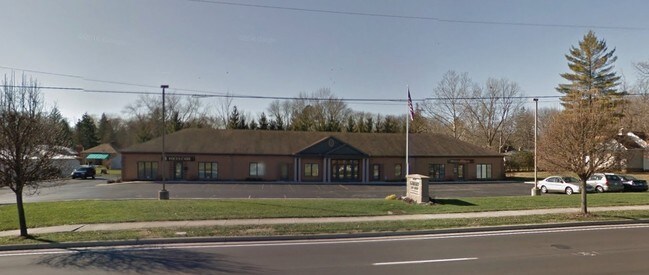
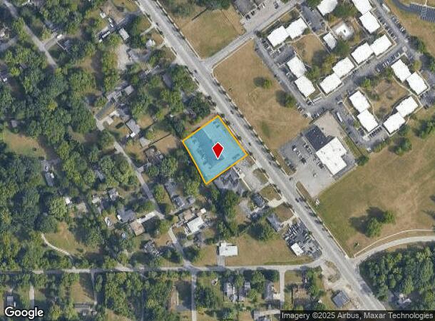
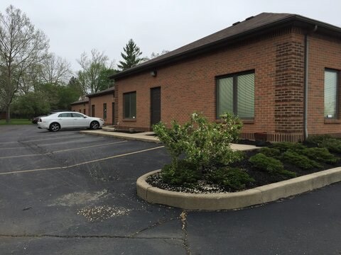
Property Record
8143 N Main St, Dayton, OH 45415
NEARBY LISTINGS FOR SALE OR LEASE
Property Detail
8143 N Main St
M60-03210-0056
5-5-36
Officebuilding
Montgomery
X
Ohio
39113C0134E
1.18 AC
2023
North Dayton
2024
Cincinnati/Dayton
120103
Dayton, OH
7,500 SF
DEMOGRAPHICS near 8143 N Main St
1 Mile
3 Mile
5 Mile
2024 Total Population
4,588
42,131
112,435
2029 Population
4,484
41,426
111,761
Pop Growth 2024-2029
(2.27%)
(1.67%)
(0.60%)
Average Age
42
43
41
2024 Total Households
1,852
18,076
48,634
HH Growth 2024-2029
(2.38%)
(1.70%)
(0.65%)
Median Household Inc
$73,945
$61,472
$51,452
Avg Household Size
2.30
2.20
2.20
2024 Avg HH Vehicles
2.00
2.00
2.00
Median Home Value
$170,850
$160,108
$137,907
Median Year Built
1965
1968
1964
Nearby Places
Map Layers
Map Styles
 Street
 Aerial
- Restaurants
- Banks
- Shops
- Fitness
- Groceries
PUBLIC TRANSPORTATION
AIRPORT
James M Cox Dayton International
DRIVE
WALK
Distance
James M Cox Dayton International
13 min
6.6 mi
Freight Ports
Port of Toledo
DRIVE
WALK
Distance
Port of Toledo
176 min
151.9 mi
SALE & LEASE HISTORY
LISTING DATE
SALE/LEASE

Sep 25, 2016
For Lease
Aug 06, 2018
For Lease
Nearby Properties
Address
Land Use
TOTAL SIZE
Lot Size
Zoning
Address
Land Use
TOTAL SIZE
Lot Size
Zoning
177,309 SF
41.46 AC
Address
Land Use
TOTAL SIZE
Lot Size
Zoning
177,309 SF
41.46 AC
Address
Land Use
TOTAL SIZE
Lot Size
Zoning
20.16 AC
Address
Land Use
TOTAL SIZE
Lot Size
Zoning
100,716 SF
4.31 AC
Address
Land Use
TOTAL SIZE
Lot Size
Zoning
12,660 SF
20.22 AC
Address
Land Use
TOTAL SIZE
Lot Size
Zoning
558,933 SF
19.55 AC
Address
Land Use
TOTAL SIZE
Lot Size
Zoning
200,716 SF
32.06 AC
Address
Land Use
TOTAL SIZE
Lot Size
Zoning
0.45 AC
Address
Land Use
TOTAL SIZE
Lot Size
Zoning
12,924 SF
51.33 AC
Address
Land Use
TOTAL SIZE
Lot Size
Zoning
92,440 SF
3.01 AC
Address
Land Use
TOTAL SIZE
Lot Size
Zoning
23.29 AC
Address
Land Use
TOTAL SIZE
Lot Size
Zoning
46,592 SF
5.32 AC
Address
Land Use
TOTAL SIZE
Lot Size
Zoning
92,782 SF
12.44 AC
Address
Land Use
TOTAL SIZE
Lot Size
Zoning
10.06 AC
Address
Land Use
TOTAL SIZE
Lot Size
Zoning
12.89 AC
Address
Land Use
TOTAL SIZE
Lot Size
Zoning
13 AC
Address
Land Use
TOTAL SIZE
Lot Size
Zoning
8.82 AC
Address
Land Use
TOTAL SIZE
Lot Size
Zoning
115,800 SF
14.51 AC
Address
Land Use
TOTAL SIZE
Lot Size
Zoning
2,520 SF
11.66 AC
Address
Land Use
TOTAL SIZE
Lot Size
Zoning
88,642 SF
11.85 AC
Address
Land Use
TOTAL SIZE
Lot Size
Zoning
23,776 SF
12.39 AC
Address
Land Use
TOTAL SIZE
Lot Size
Zoning
6.25 AC
Address
Land Use
TOTAL SIZE
Lot Size
Zoning
9.11 AC
Address
Land Use
TOTAL SIZE
Lot Size
Zoning
24,264 SF
5.72 AC
Address
Land Use
TOTAL SIZE
Lot Size
Zoning
36,350 SF
12.26 AC
Address
Land Use
TOTAL SIZE
Lot Size
Zoning
8.45 AC
Address
Land Use
TOTAL SIZE
Lot Size
Zoning
88,882 SF
4.75 AC
Address
Land Use
TOTAL SIZE
Lot Size
Zoning
61,323 SF
4.33 AC
Address
Land Use
TOTAL SIZE
Lot Size
Zoning
70,388 SF
6 AC
Address
Land Use
TOTAL SIZE
Lot Size
Zoning
56,102 SF
7.77 AC
The World's #1 Commercial Real Estate Marketplace
Connect with us
© 2025 CoStar Group
The information above has been obtained from sources believed reliable. While we do not doubt its accuracy we have not verified it and make no guarantee, warranty or representation about it. It is your responsibility to independently confirm its accuracy and completeness. Any projections, opinions, assumptions, or estimates used are for example only and do not represent the current or future performance of the property. The value of this transaction to you depends on tax and other factors which should be evaluated by your tax, financial, and legal advisors. You and your advisors should conduct a careful, independent investigation of the property to determine to your satisfaction the suitability of the property for your needs.