Property Record
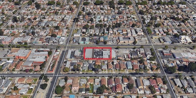
818 E Manchester Ave, Los Angeles, CA 90001


NEARBY LISTINGS FOR SALE OR LEASE
Property Detail
818 E Manchester Ave
Los Angeles-Long Beach-Glendale, CA
6631
6042-022-004
TRACT # 6631 E 25 FT OF LOT 3 AND ALL OF LOT 4
Autorepair
Los Angeles
X
California
06037C1785G
3,4
2024
0.20 AC
2025
South LA
535002
Los Angeles
5,850 SF
DEMOGRAPHICS near 818 E Manchester Ave
1 Mile
3 Mile
5 Mile
2024 Total Population
60,759
458,851
1,000,592
2029 Population
58,393
439,422
956,588
Pop Growth 2024-2029
(3.89%)
(4.23%)
(4.40%)
Average Age
34
35
36
2024 Total Households
14,352
117,081
265,969
HH Growth 2024-2029
(4.17%)
(4.53%)
(4.64%)
Median Household Inc
$52,335
$49,312
$53,671
Avg Household Size
4.00
3.70
3.50
2024 Avg HH Vehicles
2.00
2.00
2.00
Median Home Value
$483,192
$531,475
$590,736
Median Year Built
1949
1951
1952
Nearby Places
Map Layers
Map Styles
 Street
 Aerial
- Restaurants
- Banks
- Shops
- Fitness
- Groceries
PUBLIC TRANSPORTATION
TRANSIT/SUBWAY
Firestone Station (Blue Line - Los Angeles County Metropolitan Transportation Authority (Metro))
DRIVE
WALK
Distance
Firestone Station (Blue Line - Los Angeles County Metropolitan Transportation Authority (Metro))
1 min
19 min
1.0 mi
COMMUTER RAIL
Los Angeles (Coast Starlight - Amtrak, Pacific Surfliner - Amtrak, Southwest Chief - Amtrak, Texas Eagle - Amtrak)
DRIVE
WALK
Distance
Los Angeles (Coast Starlight - Amtrak, Pacific Surfliner - Amtrak, Southwest Chief - Amtrak, Texas Eagle - Amtrak)
14 min
9.7 mi
Union Station (91 Line - Southern California Regional Rail Authority (Metrolink), Antelope Valley Line - Southern California Regional Rail Authority (Metrolink), Orange County Line - Southern California Regional Rail Authority (Metrolink), Riverside Line - Southern California Regional Rail Authority (Metrolink), San Bernardino Line - Southern California Regional Rail Authority (Metrolink), Ventura County Line - Southern California Regional Rail Authority (Metrolink))
DRIVE
WALK
Distance
Union Station (91 Line - Southern California Regional Rail Authority (Metrolink), Antelope Valley Line - Southern California Regional Rail Authority (Metrolink), Orange County Line - Southern California Regional Rail Authority (Metrolink), Riverside Line - Southern California Regional Rail Authority (Metrolink), San Bernardino Line - Southern California Regional Rail Authority (Metrolink), Ventura County Line - Southern California Regional Rail Authority (Metrolink))
16 min
9.9 mi
AIRPORT
Los Angeles International
DRIVE
WALK
Distance
Los Angeles International
18 min
9.6 mi
Long Beach (Daugherty Field)
DRIVE
WALK
Distance
Long Beach (Daugherty Field)
24 min
17.3 mi
Bob Hope
DRIVE
WALK
Distance
Bob Hope
33 min
24.9 mi
Freight Ports
Port of Long Beach
DRIVE
WALK
Distance
Port of Long Beach
26 min
18.3 mi
SALE & LEASE HISTORY
LISTING DATE
SALE/LEASE

Jun 16, 2025
For Lease
Jul 02, 2018
For Lease
Dec 30, 2022
For Sale
Aug 04, 2022
For Lease
Apr 07, 2017
For Sale
Nearby Properties
Address
Land Use
TOTAL SIZE
Lot Size
Zoning
Address
Land Use
TOTAL SIZE
Lot Size
Zoning
108,598 SF
15.93 AC
LCC3*
Address
Land Use
TOTAL SIZE
Lot Size
Zoning
Address
Land Use
TOTAL SIZE
Lot Size
Zoning
116,728 SF
0.86 AC
HPCP*
Address
Land Use
TOTAL SIZE
Lot Size
Zoning
63,922 SF
1.82 AC
LCA16000*
Address
Land Use
TOTAL SIZE
Lot Size
Zoning
261,540 SF
10.85 AC
VEM*
Address
Land Use
TOTAL SIZE
Lot Size
Zoning
127,484 SF
7.33 AC
LAM2
Address
Land Use
TOTAL SIZE
Lot Size
Zoning
81,735 SF
4.10 AC
LAR4
Address
Land Use
TOTAL SIZE
Lot Size
Zoning
320,526 SF
7.92 AC
VEM*
Address
Land Use
TOTAL SIZE
Lot Size
Zoning
104,291 SF
7.35 AC
LAR3
Address
Land Use
TOTAL SIZE
Lot Size
Zoning
134,514 SF
1.94 AC
LCM2*
Address
Land Use
TOTAL SIZE
Lot Size
Zoning
103,656 SF
6.98 AC
LCM1
Address
Land Use
TOTAL SIZE
Lot Size
Zoning
121,632 SF
1.09 AC
HPCN*
Address
Land Use
TOTAL SIZE
Lot Size
Zoning
293,886 SF
4.98 AC
SGM3
Address
Land Use
TOTAL SIZE
Lot Size
Zoning
102,719 SF
5.50 AC
LARD2
Address
Land Use
TOTAL SIZE
Lot Size
Zoning
402,118 SF
9.39 AC
LAC2
Address
Land Use
TOTAL SIZE
Lot Size
Zoning
111,213 SF
12.04 AC
LAR4
Address
Land Use
TOTAL SIZE
Lot Size
Zoning
188,030 SF
3.09 AC
LAR5
Address
Land Use
TOTAL SIZE
Lot Size
Zoning
103,896 SF
5.06 AC
VEM*
Address
Land Use
TOTAL SIZE
Lot Size
Zoning
101,562 SF
7.53 AC
LAR3
Address
Land Use
TOTAL SIZE
Lot Size
Zoning
331,030 SF
6.69 AC
LAM2
Address
Land Use
TOTAL SIZE
Lot Size
Zoning
52,331 SF
4.17 AC
SG
Address
Land Use
TOTAL SIZE
Lot Size
Zoning
102,260 SF
16.84 AC
LAR4
Address
Land Use
TOTAL SIZE
Lot Size
Zoning
90,887 SF
0.94 AC
LCR320U*
Address
Land Use
TOTAL SIZE
Lot Size
Zoning
152,151 SF
3.59 AC
LCM2*
Address
Land Use
TOTAL SIZE
Lot Size
Zoning
86,905 SF
4.63 AC
VEM*
Address
Land Use
TOTAL SIZE
Lot Size
Zoning
589,061 SF
19.32 AC
SGM3
Address
Land Use
TOTAL SIZE
Lot Size
Zoning
112,578 SF
4.64 AC
VEM*
Address
Land Use
TOTAL SIZE
Lot Size
Zoning
184,500 SF
3 AC
COML*
Address
Land Use
TOTAL SIZE
Lot Size
Zoning
165,404 SF
1.12 AC
HPDTSP
Address
Land Use
TOTAL SIZE
Lot Size
Zoning
113,733 SF
1.59 AC
LAM2
The World's #1 Commercial Real Estate Marketplace
Connect with us
© 2025 CoStar Group
The information above has been obtained from sources believed reliable. While we do not doubt its accuracy we have not verified it and make no guarantee, warranty or representation about it. It is your responsibility to independently confirm its accuracy and completeness. Any projections, opinions, assumptions, or estimates used are for example only and do not represent the current or future performance of the property. The value of this transaction to you depends on tax and other factors which should be evaluated by your tax, financial, and legal advisors. You and your advisors should conduct a careful, independent investigation of the property to determine to your satisfaction the suitability of the property for your needs.