Property Record
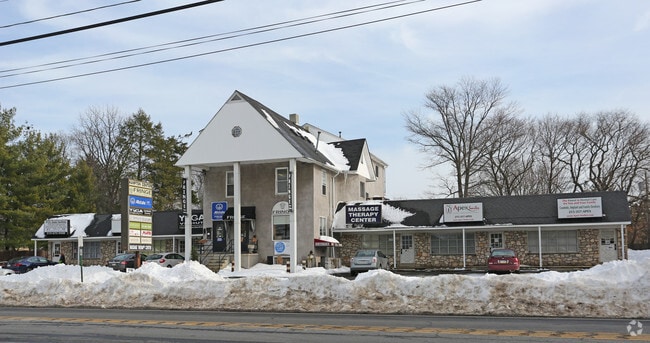
819 2Nd Street Pike, Southampton, PA 18966

NEARBY LISTINGS FOR SALE OR LEASE
Property Detail
819 2Nd Street Pike
48-013-189
Plan Of Building Lots Along Street Road
Regionalshoppingcenterormallwithanchorstore
E S SR233 515 FT S PINEWOOD RD 198X221
X
Bucks
42091C0316G
Pennsylvania
2024
0.80 AC
2025
Lower Bucks County
101506
Philadelphia
7,760 SF
Philadelphia-Camden-Wilmington, PA-NJ-DE-MD
DEMOGRAPHICS near 819 2Nd Street Pike
1 Mile
3 Mile
5 Mile
2024 Total Population
9,503
65,157
206,030
2029 Population
9,674
65,851
205,706
Pop Growth 2024-2029
+ 1.80%
+ 1.07%
(0.16%)
Average Age
47
45
44
2024 Total Households
4,034
25,185
78,760
HH Growth 2024-2029
+ 2.08%
+ 1.25%
(0.15%)
Median Household Inc
$78,967
$94,470
$92,613
Avg Household Size
2.30
2.50
2.50
2024 Avg HH Vehicles
2.00
2.00
2.00
Median Home Value
$354,130
$389,969
$364,336
Median Year Built
1968
1970
1969
Nearby Places
Map Layers
Map Styles
 Street
 Aerial
- Restaurants
- Banks
- Shops
- Fitness
- Groceries
PUBLIC TRANSPORTATION
COMMUTER RAIL
Warminster (R2 - Southeastern Pennsylvania Transportation Authority Regional Rail (SEPTA Regional Rail))
DRIVE
WALK
Distance
Warminster (R2 - Southeastern Pennsylvania Transportation Authority Regional Rail (SEPTA Regional Rail))
7 min
3.3 mi
Hatboro (R2 - Southeastern Pennsylvania Transportation Authority Regional Rail (SEPTA Regional Rail))
DRIVE
WALK
Distance
Hatboro (R2 - Southeastern Pennsylvania Transportation Authority Regional Rail (SEPTA Regional Rail))
9 min
4.6 mi
AIRPORT
Trenton Mercer
DRIVE
WALK
Distance
Trenton Mercer
30 min
17.3 mi
Philadelphia International
DRIVE
WALK
Distance
Philadelphia International
52 min
34.1 mi
Lehigh Valley International
DRIVE
WALK
Distance
Lehigh Valley International
77 min
45.5 mi
Freight Ports
Port of Philadelphia
DRIVE
WALK
Distance
Port of Philadelphia
32 min
16.6 mi
SALE & LEASE HISTORY
LISTING DATE
SALE/LEASE

Feb 01, 2023
For Lease
Apr 11, 2017
For Lease
Nearby Properties
Address
Land Use
TOTAL SIZE
Lot Size
Zoning
Address
Land Use
TOTAL SIZE
Lot Size
Zoning
377,044 SF
58.73 AC
INST
Address
Land Use
TOTAL SIZE
Lot Size
Zoning
251,655 SF
48.95 AC
SC
Address
Land Use
TOTAL SIZE
Lot Size
Zoning
256,679 SF
14 AC
MI
Address
Land Use
TOTAL SIZE
Lot Size
Zoning
273,531 SF
11.11 AC
INST
Address
Land Use
TOTAL SIZE
Lot Size
Zoning
127,251 SF
17.55 AC
L
Address
Land Use
TOTAL SIZE
Lot Size
Zoning
60,945 SF
74.12 AC
Address
Land Use
TOTAL SIZE
Lot Size
Zoning
84,000 SF
14.17 AC
LI
Address
Land Use
TOTAL SIZE
Lot Size
Zoning
162,363 SF
2.72 AC
HI
Address
Land Use
TOTAL SIZE
Lot Size
Zoning
69,680 SF
19 AC
LI
Address
Land Use
TOTAL SIZE
Lot Size
Zoning
64,000 SF
11.94 AC
LI
Address
Land Use
TOTAL SIZE
Lot Size
Zoning
74,764 SF
10.17 AC
SC
Address
Land Use
TOTAL SIZE
Lot Size
Zoning
29,308 SF
15.96 AC
I
Address
Land Use
TOTAL SIZE
Lot Size
Zoning
56,595 SF
3.89 AC
Address
Land Use
TOTAL SIZE
Lot Size
Zoning
44,144 SF
7.30 AC
L
Address
Land Use
TOTAL SIZE
Lot Size
Zoning
44,309 SF
6.15 AC
IN
Address
Land Use
TOTAL SIZE
Lot Size
Zoning
85,060 SF
8.63 AC
I
Address
Land Use
TOTAL SIZE
Lot Size
Zoning
64,685 SF
7.91 AC
IN
Address
Land Use
TOTAL SIZE
Lot Size
Zoning
22,386 SF
15.52 AC
INST
Address
Land Use
TOTAL SIZE
Lot Size
Zoning
89,071 SF
8.13 AC
I
Address
Land Use
TOTAL SIZE
Lot Size
Zoning
30,921 SF
2.15 AC
L
Address
Land Use
TOTAL SIZE
Lot Size
Zoning
148,715 SF
16.76 AC
RS
Address
Land Use
TOTAL SIZE
Lot Size
Zoning
135,233 SF
13 AC
CS
Address
Land Use
TOTAL SIZE
Lot Size
Zoning
37,806 SF
21.50 AC
R5
Address
Land Use
TOTAL SIZE
Lot Size
Zoning
25,021 SF
10.82 AC
I
Address
Land Use
TOTAL SIZE
Lot Size
Zoning
9,999 SF
2.55 AC
INST
Address
Land Use
TOTAL SIZE
Lot Size
Zoning
79,705 SF
4.70 AC
I
Address
Land Use
TOTAL SIZE
Lot Size
Zoning
44,230 SF
3.74 AC
S
Address
Land Use
TOTAL SIZE
Lot Size
Zoning
56,440 SF
11.55 AC
R2
Address
Land Use
TOTAL SIZE
Lot Size
Zoning
30,134 SF
5.44 AC
L
Address
Land Use
TOTAL SIZE
Lot Size
Zoning
The World's #1 Commercial Real Estate Marketplace
Connect with us
© 2026 CoStar Group
The information above has been obtained from sources believed reliable. While we do not doubt its accuracy we have not verified it and make no guarantee, warranty or representation about it. It is your responsibility to independently confirm its accuracy and completeness. Any projections, opinions, assumptions, or estimates used are for example only and do not represent the current or future performance of the property. The value of this transaction to you depends on tax and other factors which should be evaluated by your tax, financial, and legal advisors. You and your advisors should conduct a careful, independent investigation of the property to determine to your satisfaction the suitability of the property for your needs.