Property Record
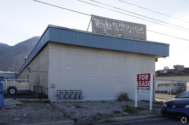
819 S 100 E, Provo, UT 84606


Property Detail
819 S 100 E
Provo-Orem-Lehi, UT
COM S 530.74 FT & E 49.65 FT FR E 1/4 COR SEC 12, T7S, R2E, SLMT S 55 W 100 FT; N 89 09 W 247.58 FT; N 51 E 100 FT; S 89 09 E 247.58 FT TO BEG. LESS SOLD TO PROVO CITY. SUBJ TO R/W. .51 ACRE.
21-050-0044
Utah
Autorepair
Utah
2024
0.51 AC
2025
Utah County
980300
Salt Lake City
8,271 SF
NEARBY LISTINGS FOR SALE OR LEASE
DEMOGRAPHICS near 819 S 100 E
1 mile
3 mile
5 mile
2024 Total Population
18,102
112,389
180,222
2029 Population
19,832
123,905
198,222
Pop Growth 2024-2029
+ 9.56%
+ 10.25%
+ 9.99%
Average Age
30
28
30
2024 Total Households
6,537
34,666
55,431
HH Growth 2024-2029
+ 10.37%
+ 11.56%
+ 11.06%
Median Household Inc
$55,877
$59,178
$70,260
Avg Household Size
2.70
2.90
3.00
2024 Avg HH Vehicles
2.00
2.00
2.00
Median Home Value
$424,026
$472,165
$497,042
Median Year Built
1983
1987
1989
Nearby Places
Map Layers
Map Styles
 Street
 Aerial
Transit
 Traffic
 Biking
Places
Listings with unknown addresses are not visible on the map
- Restaurants
- Banks
- Shops
- Fitness
- Groceries
PUBLIC TRANSPORTATION
COMMUTER RAIL
Provo Central Station (FrontRunner - Utah Transit Authority (UTA))
Drive
Walk
Distance
Provo Central Station (FrontRunner - Utah Transit Authority (UTA))
1 min
6 min
0.4 mi
Provo Amtrak (California Zephyr - Amtrak)
Drive
Walk
Distance
Provo Amtrak (California Zephyr - Amtrak)
2 min
10 min
0.6 mi
AIRPORT
Provo Municipal
Drive
Walk
Distance
Provo Municipal
8 min
4.7 mi
Freight Ports
Port of Stockton
Drive
Walk
Distance
Port of Stockton
758 min
740.9 mi
SALE & LEASE HISTORY
LISTING DATE
SALE/LEASE

May 01, 2017
For Lease
Dec 17, 2025
For Lease
Nearby Properties
Address
Land Use
TOTAL SIZE
Lot Size
Zoning
Address
Land Use
TOTAL SIZE
Lot Size
Zoning
1,744,846 SF
19.25 AC
Address
Land Use
TOTAL SIZE
Lot Size
Zoning
442,598 SF
22.94 AC
Address
Land Use
TOTAL SIZE
Lot Size
Zoning
347,829 SF
5.26 AC
Address
Land Use
TOTAL SIZE
Lot Size
Zoning
222,763 SF
10.71 AC
Address
Land Use
TOTAL SIZE
Lot Size
Zoning
366,509 SF
2.83 AC
Address
Land Use
TOTAL SIZE
Lot Size
Zoning
138,990 SF
2.87 AC
Address
Land Use
TOTAL SIZE
Lot Size
Zoning
297,467 SF
16.87 AC
Address
Land Use
TOTAL SIZE
Lot Size
Zoning
371,881 SF
4.91 AC
Address
Land Use
TOTAL SIZE
Lot Size
Zoning
323,674 SF
13.81 AC
Address
Land Use
TOTAL SIZE
Lot Size
Zoning
286,188 SF
13.63 AC
Address
Land Use
TOTAL SIZE
Lot Size
Zoning
269,742 SF
16.30 AC
Address
Land Use
TOTAL SIZE
Lot Size
Zoning
671,002 SF
59.02 AC
Address
Land Use
TOTAL SIZE
Lot Size
Zoning
370,735 SF
18.54 AC
Address
Land Use
TOTAL SIZE
Lot Size
Zoning
107,840 SF
0.98 AC
Address
Land Use
TOTAL SIZE
Lot Size
Zoning
222,848 SF
11.14 AC
Address
Land Use
TOTAL SIZE
Lot Size
Zoning
266,387 SF
1.76 AC
Address
Land Use
TOTAL SIZE
Lot Size
Zoning
174,883 SF
17.42 AC
Address
Land Use
TOTAL SIZE
Lot Size
Zoning
269,652 SF
3.65 AC
Address
Land Use
TOTAL SIZE
Lot Size
Zoning
155,726 SF
13.64 AC
Address
Land Use
TOTAL SIZE
Lot Size
Zoning
300,810 SF
7.32 AC
Address
Land Use
TOTAL SIZE
Lot Size
Zoning
208,492 SF
12.49 AC
Address
Land Use
TOTAL SIZE
Lot Size
Zoning
176,127 SF
9.29 AC
Address
Land Use
TOTAL SIZE
Lot Size
Zoning
233,451 SF
1.73 AC
Address
Land Use
TOTAL SIZE
Lot Size
Zoning
386,576 SF
128.19 AC
Address
Land Use
TOTAL SIZE
Lot Size
Zoning
240,674 SF
19.41 AC
Address
Land Use
TOTAL SIZE
Lot Size
Zoning
9,326 SF
5.19 AC
Address
Land Use
TOTAL SIZE
Lot Size
Zoning
124,986 SF
8.67 AC
Address
Land Use
TOTAL SIZE
Lot Size
Zoning
151,447 SF
16.14 AC
Address
Land Use
TOTAL SIZE
Lot Size
Zoning
151,447 SF
8.61 AC
Address
Land Use
TOTAL SIZE
Lot Size
Zoning
195,248 SF
13.20 AC
The World's #1 Commercial Real Estate Marketplace
Connect with us
© 2026 CoStar Group
The information above has been obtained from sources believed reliable. While we do not doubt its accuracy we have not verified it and make no guarantee, warranty or representation about it. It is your responsibility to independently confirm its accuracy and completeness. Any projections, opinions, assumptions, or estimates used are for example only and do not represent the current or future performance of the property. The value of this transaction to you depends on tax and other factors which should be evaluated by your tax, financial, and legal advisors. You and your advisors should conduct a careful, independent investigation of the property to determine to your satisfaction the suitability of the property for your needs.