No Photo
Property Record
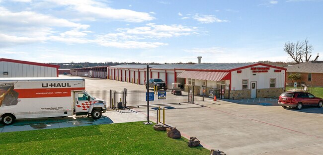
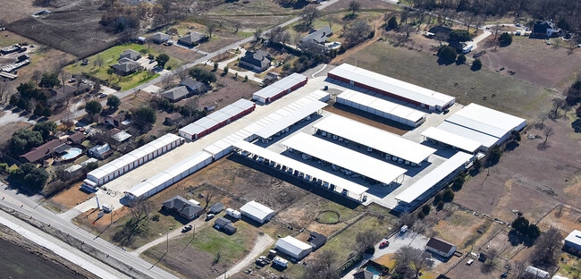
8318 E Parker Rd, Wylie, TX 75098

Property Detail
8318 E Parker Rd
Dallas-Fort Worth-Arlington, TX
CROSSROADS DAVIS STORAGE ADDITION, BLK A, LOT 1R
R-11684-00A-0010-1
COLLIN
Commercialnec
Texas
B and X Area of moderate flood hazard, usually the area between the limits of the 100-year and 500-year floods.
1r
2025
7.14 AC
2025
Plano
031330
Dallas/Ft Worth
124,899 SF
NEARBY LISTINGS FOR SALE OR LEASE
-
-
View all Wylie listings for sale on LoopNet.com
DEMOGRAPHICS near 8318 E Parker Rd
1 mile
3 mile
5 mile
2025 Total Population
5,882
53,603
153,469
2030 Population
6,659
60,954
174,947
Pop Growth 2025-2030
+ 13.21%
+ 13.71%
+ 14.00%
Average Age
38
37
38
2025 Total Households
1,778
15,953
48,013
HH Growth 2025-2030
+ 13.33%
+ 13.95%
+ 14.28%
Median Household Inc
$122,899
$132,965
$135,070
Avg Household Size
3.30
3.30
3.20
2025 Avg HH Vehicles
2.00
2.00
2.00
Median Home Value
$511,144
$498,189
$487,302
Median Year Built
2004
2006
2005
Nearby Places
Map Layers
Map Styles
 Street
 Aerial
Layers
 Traffic
 Biking
Places
Listings with unknown addresses are not visible on the map
- Restaurants
- Banks
- Shops
- Fitness
- Groceries
PUBLIC TRANSPORTATION
AIRPORT
Dallas Love Field
Drive
Walk
Distance
Dallas Love Field
44 min
29.7 mi
Dallas-Fort Worth International
Drive
Walk
Distance
Dallas-Fort Worth International
51 min
38.6 mi
Freight Ports
Port of Shreveport
Drive
Walk
Distance
Port of Shreveport
231 min
204.9 mi
SALE & LEASE HISTORY
LISTING DATE
SALE/LEASE

Jul 23, 2020
For Sale
Jan 28, 2020
For Sale
Nearby Properties
Address
Land Use
TOTAL SIZE
Lot Size
Zoning
Address
Land Use
TOTAL SIZE
Lot Size
Zoning
418,520 SF
103.29 AC
Address
Land Use
TOTAL SIZE
Lot Size
Zoning
339,663 SF
95.04 AC
Address
Land Use
TOTAL SIZE
Lot Size
Zoning
332,047 SF
18.48 AC
MF-L
Address
Land Use
TOTAL SIZE
Lot Size
Zoning
257,718 SF
13.10 AC
RESIDENTIA
Address
Land Use
TOTAL SIZE
Lot Size
Zoning
203,383 SF
11.91 AC
MF-M
Address
Land Use
TOTAL SIZE
Lot Size
Zoning
274,329 SF
44.89 AC
Address
Land Use
TOTAL SIZE
Lot Size
Zoning
746 SF
115.14 AC
Address
Land Use
TOTAL SIZE
Lot Size
Zoning
140,130 SF
19.67 AC
Address
Land Use
TOTAL SIZE
Lot Size
Zoning
85,393 SF
10 AC
Address
Land Use
TOTAL SIZE
Lot Size
Zoning
110,005 SF
20 AC
C
Address
Land Use
TOTAL SIZE
Lot Size
Zoning
78,708 SF
9.55 AC
Address
Land Use
TOTAL SIZE
Lot Size
Zoning
77,225 SF
9.59 AC
Address
Land Use
TOTAL SIZE
Lot Size
Zoning
141,396 SF
8.40 AC
NS
Address
Land Use
TOTAL SIZE
Lot Size
Zoning
71,636 SF
16.56 AC
Address
Land Use
TOTAL SIZE
Lot Size
Zoning
79,636 SF
10.16 AC
Address
Land Use
TOTAL SIZE
Lot Size
Zoning
80,496 SF
12 AC
Address
Land Use
TOTAL SIZE
Lot Size
Zoning
41,834 SF
15.88 AC
C
Address
Land Use
TOTAL SIZE
Lot Size
Zoning
267,312 SF
10.05 AC
Address
Land Use
TOTAL SIZE
Lot Size
Zoning
59,818 SF
6 AC
Address
Land Use
TOTAL SIZE
Lot Size
Zoning
153,740 SF
6.46 AC
Address
Land Use
TOTAL SIZE
Lot Size
Zoning
41,374 SF
12.42 AC
Address
Land Use
TOTAL SIZE
Lot Size
Zoning
74,124 SF
14.57 AC
Address
Land Use
TOTAL SIZE
Lot Size
Zoning
70,900 SF
13.16 AC
Address
Land Use
TOTAL SIZE
Lot Size
Zoning
15,980 SF
1.75 AC
Address
Land Use
TOTAL SIZE
Lot Size
Zoning
806 SF
164.22 AC
Address
Land Use
TOTAL SIZE
Lot Size
Zoning
42,544 SF
5.25 AC
Address
Land Use
TOTAL SIZE
Lot Size
Zoning
60,025 SF
2.64 AC
R
Address
Land Use
TOTAL SIZE
Lot Size
Zoning
23,596 SF
10 AC
Address
Land Use
TOTAL SIZE
Lot Size
Zoning
11,991 SF
5.75 AC
The World's #1 Commercial Real Estate Marketplace
Connect with us
© 2026 CoStar Group
The information above has been obtained from sources believed reliable. While we do not doubt its accuracy we have not verified it and make no guarantee, warranty or representation about it. It is your responsibility to independently confirm its accuracy and completeness. Any projections, opinions, assumptions, or estimates used are for example only and do not represent the current or future performance of the property. The value of this transaction to you depends on tax and other factors which should be evaluated by your tax, financial, and legal advisors. You and your advisors should conduct a careful, independent investigation of the property to determine to your satisfaction the suitability of the property for your needs.