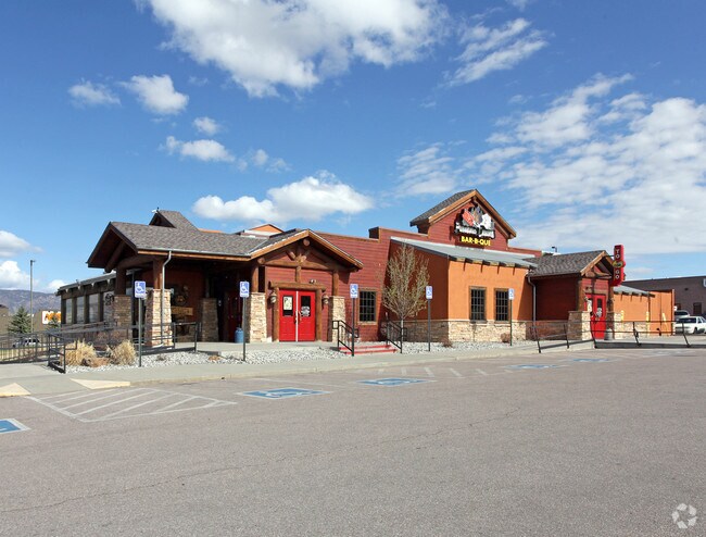
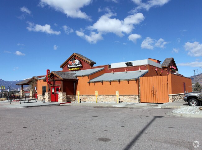
Property Record
8330 Razorback Rd, Colorado Springs, CO 80920


NEARBY LISTINGS FOR SALE OR LEASE
Property Detail
8330 Razorback Rd
Colorado Springs, CO
Towne North Centre Sub Fil No 4
63051-04-007
LOT 1 TOWNE NORTH CENTRE SUB FIL NO 4 CO SPGS
Commercialnec
El Paso
X
Colorado
08041C0508G
1
2024
1.90 AC
2025
Northeast
003906
Colorado Springs
6,283 SF
DEMOGRAPHICS near 8330 Razorback Rd
1 Mile
3 Mile
5 Mile
2024 Total Population
4,904
64,254
182,280
2029 Population
5,157
66,894
190,802
Pop Growth 2024-2029
+ 5.16%
+ 4.11%
+ 4.68%
Average Age
39
39
38
2024 Total Households
2,188
25,061
69,640
HH Growth 2024-2029
+ 5.53%
+ 4.30%
+ 4.85%
Median Household Inc
$81,009
$95,489
$94,912
Avg Household Size
2.20
2.50
2.50
2024 Avg HH Vehicles
2.00
2.00
2.00
Median Home Value
$415,043
$431,926
$442,945
Median Year Built
1990
1987
1991
Nearby Places
Map Layers
Map Styles
 Street
 Aerial
- Restaurants
- Banks
- Shops
- Fitness
- Groceries
PUBLIC TRANSPORTATION
AIRPORT
City of Colorado Springs Municipal
DRIVE
WALK
Distance
City of Colorado Springs Municipal
29 min
14.4 mi
SALE & LEASE HISTORY
LISTING DATE
SALE/LEASE

Oct 29, 2020
For Sale
Jan 24, 2018
For Sale
Nearby Properties
Address
Land Use
TOTAL SIZE
Lot Size
Zoning
Address
Land Use
TOTAL SIZE
Lot Size
Zoning
361,165 SF
59.11 AC
PDZ
Address
Land Use
TOTAL SIZE
Lot Size
Zoning
625 SF
7.15 AC
RR-5
Address
Land Use
TOTAL SIZE
Lot Size
Zoning
177,966 SF
57.81 AC
PDZ HR
Address
Land Use
TOTAL SIZE
Lot Size
Zoning
261,339 SF
10.42 AC
MX-M CU
Address
Land Use
TOTAL SIZE
Lot Size
Zoning
257,140 SF
30.17 AC
MX-N/CR MX
Address
Land Use
TOTAL SIZE
Lot Size
Zoning
62,201 SF
5.68 AC
MX-N
Address
Land Use
TOTAL SIZE
Lot Size
Zoning
121,820 SF
14.73 AC
BP
Address
Land Use
TOTAL SIZE
Lot Size
Zoning
409,164 SF
19.26 AC
PUD
Address
Land Use
TOTAL SIZE
Lot Size
Zoning
117,227 SF
12.28 AC
PDZ HS
Address
Land Use
TOTAL SIZE
Lot Size
Zoning
95,337 SF
49.29 AC
BP
Address
Land Use
TOTAL SIZE
Lot Size
Zoning
103,166 SF
8.88 AC
BP
Address
Land Use
TOTAL SIZE
Lot Size
Zoning
56,290 SF
6.55 AC
A/CR
Address
Land Use
TOTAL SIZE
Lot Size
Zoning
80,110 SF
2.61 AC
OR CU
Address
Land Use
TOTAL SIZE
Lot Size
Zoning
114,474 SF
12.95 AC
BP
Address
Land Use
TOTAL SIZE
Lot Size
Zoning
77,655 SF
8.39 AC
MX-N MX-N/
Address
Land Use
TOTAL SIZE
Lot Size
Zoning
1,251,233 SF
17.63 AC
BP/CR HR
Address
Land Use
TOTAL SIZE
Lot Size
Zoning
58,774 SF
5 AC
BP
Address
Land Use
TOTAL SIZE
Lot Size
Zoning
391,914 SF
3.13 AC
PDZ
Address
Land Use
TOTAL SIZE
Lot Size
Zoning
71,542 SF
10.11 AC
PF
Address
Land Use
TOTAL SIZE
Lot Size
Zoning
35,862 SF
5.95 AC
MX-N
Address
Land Use
TOTAL SIZE
Lot Size
Zoning
211,974 SF
25.15 AC
BP CU
Address
Land Use
TOTAL SIZE
Lot Size
Zoning
76,138 SF
4.84 AC
BP
Address
Land Use
TOTAL SIZE
Lot Size
Zoning
48,673 SF
5.51 AC
R-5 P
Address
Land Use
TOTAL SIZE
Lot Size
Zoning
45,141 SF
6.97 AC
R-5/CR
Address
Land Use
TOTAL SIZE
Lot Size
Zoning
50,471 SF
7.28 AC
BP
Address
Land Use
TOTAL SIZE
Lot Size
Zoning
47,313 SF
11.15 AC
MX-N
Address
Land Use
TOTAL SIZE
Lot Size
Zoning
151,287 SF
9.40 AC
PDZ HR
Address
Land Use
TOTAL SIZE
Lot Size
Zoning
25,194 SF
4 AC
R-5 P
Address
Land Use
TOTAL SIZE
Lot Size
Zoning
23,324 SF
7.84 AC
MX-N CU
Address
Land Use
TOTAL SIZE
Lot Size
Zoning
121,372 SF
59.10 AC
The World's #1 Commercial Real Estate Marketplace
Connect with us
© 2026 CoStar Group
The information above has been obtained from sources believed reliable. While we do not doubt its accuracy we have not verified it and make no guarantee, warranty or representation about it. It is your responsibility to independently confirm its accuracy and completeness. Any projections, opinions, assumptions, or estimates used are for example only and do not represent the current or future performance of the property. The value of this transaction to you depends on tax and other factors which should be evaluated by your tax, financial, and legal advisors. You and your advisors should conduct a careful, independent investigation of the property to determine to your satisfaction the suitability of the property for your needs.