Property Record
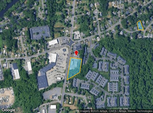
835-841 Suffield St, Agawam, MA 01001


NEARBY LISTINGS FOR SALE OR LEASE
Property Detail
835-841 Suffield St
AGAW-000008J-000001-000034
Hampden
Commercialnec
Massachusetts
X
34
25013C0392E
2.47 AC
2025
Hampden County
2025
Hartford
813209
Springfield, MA
4,512 SF
DEMOGRAPHICS near 835-841 Suffield St
1 mile
3 mile
5 mile
2024 Total Population
3,985
33,715
155,207
2029 Population
3,825
32,993
152,499
Pop Growth 2024-2029
(4.02%)
(2.14%)
(1.74%)
Average Age
47
42
39
2024 Total Households
1,642
13,749
60,988
HH Growth 2024-2029
(4.26%)
(2.26%)
(1.80%)
Median Household Inc
$76,577
$76,432
$59,177
Avg Household Size
2.20
2.40
2.40
2024 Avg HH Vehicles
2.00
2.00
2.00
Median Home Value
$279,564
$281,791
$268,733
Median Year Built
1973
1961
1955
Nearby Places
Map Layers
Map Styles
 Street
 Aerial
Transit
 Traffic
 Biking
Places
Listings with unknown addresses are not visible on the map
- Restaurants
- Banks
- Shops
- Fitness
- Groceries
PUBLIC TRANSPORTATION
COMMUTER RAIL
Drive
Walk
Distance
9 min
4.9 mi
AIRPORT
Bradley International
Drive
Walk
Distance
Bradley International
21 min
9.5 mi
Nearby Properties
Address
Land Use
TOTAL SIZE
Lot Size
Zoning
Address
Land Use
TOTAL SIZE
Lot Size
Zoning
36.53 AC
IB
Address
Land Use
TOTAL SIZE
Lot Size
Zoning
236,032 SF
41.65 AC
RA2
Address
Land Use
TOTAL SIZE
Lot Size
Zoning
8,712 SF
25.08 AC
RA1
Address
Land Use
TOTAL SIZE
Lot Size
Zoning
1,840 SF
148.78 AC
BB
Address
Land Use
TOTAL SIZE
Lot Size
Zoning
137,450 SF
16 AC
Address
Land Use
TOTAL SIZE
Lot Size
Zoning
133,822 SF
40.51 AC
RA2
Address
Land Use
TOTAL SIZE
Lot Size
Zoning
171,105 SF
14.21 AC
Address
Land Use
TOTAL SIZE
Lot Size
Zoning
18.51 AC
BA
Address
Land Use
TOTAL SIZE
Lot Size
Zoning
51,555 SF
4.11 AC
Address
Land Use
TOTAL SIZE
Lot Size
Zoning
15,696 SF
0.47 AC
Address
Land Use
TOTAL SIZE
Lot Size
Zoning
91,224 SF
4.54 AC
Address
Land Use
TOTAL SIZE
Lot Size
Zoning
811.20 AC
RA2
Address
Land Use
TOTAL SIZE
Lot Size
Zoning
241,663 SF
13.59 AC
IA
Address
Land Use
TOTAL SIZE
Lot Size
Zoning
63,891 SF
3.50 AC
RA2
Address
Land Use
TOTAL SIZE
Lot Size
Zoning
36,890 SF
158.16 AC
Address
Land Use
TOTAL SIZE
Lot Size
Zoning
148,820 SF
15.17 AC
Address
Land Use
TOTAL SIZE
Lot Size
Zoning
78,732 SF
16.72 AC
BA
Address
Land Use
TOTAL SIZE
Lot Size
Zoning
73,356 SF
18.20 AC
RA2
Address
Land Use
TOTAL SIZE
Lot Size
Zoning
205,380 SF
15.41 AC
IA
Address
Land Use
TOTAL SIZE
Lot Size
Zoning
11.51 AC
RA1
Address
Land Use
TOTAL SIZE
Lot Size
Zoning
186,125 SF
14.69 AC
IA
Address
Land Use
TOTAL SIZE
Lot Size
Zoning
6.73 AC
BA
Address
Land Use
TOTAL SIZE
Lot Size
Zoning
5.14 AC
IA
Address
Land Use
TOTAL SIZE
Lot Size
Zoning
16.74 AC
IA
Address
Land Use
TOTAL SIZE
Lot Size
Zoning
97,410 SF
26.59 AC
IA
Address
Land Use
TOTAL SIZE
Lot Size
Zoning
125,000 SF
15.35 AC
IA
Address
Land Use
TOTAL SIZE
Lot Size
Zoning
67,046 SF
11.63 AC
BA
Address
Land Use
TOTAL SIZE
Lot Size
Zoning
12.26 AC
IB
Address
Land Use
TOTAL SIZE
Lot Size
Zoning
553,495 SF
19.94 AC
Address
Land Use
TOTAL SIZE
Lot Size
Zoning
68,644 SF
5.20 AC
RA2
The World's #1 Commercial Real Estate Marketplace
Connect with us
© 2026 CoStar Group
The information above has been obtained from sources believed reliable. While we do not doubt its accuracy we have not verified it and make no guarantee, warranty or representation about it. It is your responsibility to independently confirm its accuracy and completeness. Any projections, opinions, assumptions, or estimates used are for example only and do not represent the current or future performance of the property. The value of this transaction to you depends on tax and other factors which should be evaluated by your tax, financial, and legal advisors. You and your advisors should conduct a careful, independent investigation of the property to determine to your satisfaction the suitability of the property for your needs.