Property Record
839 N Summit Ave, Pasadena, CA 91103
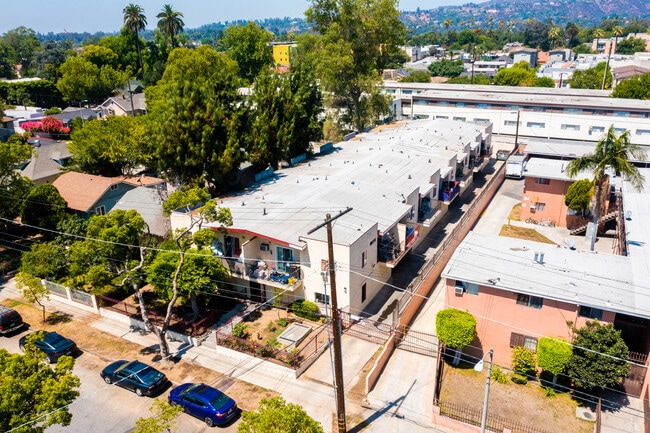

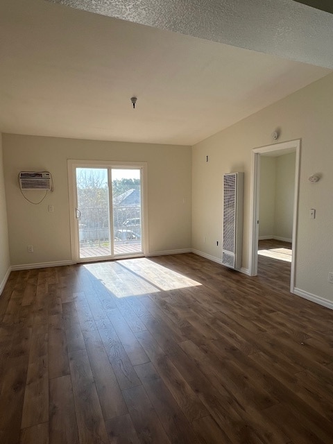

Property Detail
839 N Summit Ave
5725-011-017
L H MICHENERS SUB OF THE N 38.86 ACS BLK U PAINTER AND BALLS ADD TO PASADENA LOT 54
Multifamilydwelling
Los Angeles
PSR1
California
B and X Area of moderate flood hazard, usually the area between the limits of the 100-year and 500-year floods.
54
2024
0.34 AC
2025
Villa Parke
462002
Los Angeles
8,902 SF
Los Angeles-Long Beach-Glendale, CA
NEARBY LISTINGS FOR SALE OR LEASE
DEMOGRAPHICS near 839 N Summit Ave
1 mile
3 mile
5 mile
2025 Total Population
35,873
172,161
405,701
2030 Population
35,795
171,172
402,125
Pop Growth 2025-2030
(0.22%)
(0.57%)
(0.88%)
Average Age
40
42
42
2025 Total Households
13,234
69,365
154,314
HH Growth 2025-2030
(0.12%)
(0.66%)
(1.04%)
Median Household Inc
$72,973
$110,750
$113,009
Avg Household Size
2.50
2.40
2.50
2025 Avg HH Vehicles
2.00
2.00
2.00
Median Home Value
$876,807
$1,050,159
$1,065,557
Median Year Built
1962
1956
1955
Nearby Places
Map Layers
Map Styles
 Street
 Aerial
Transit
 Traffic
 Biking
Places
Listings with unknown addresses are not visible on the map
- Restaurants
- Banks
- Shops
- Fitness
- Groceries
PUBLIC TRANSPORTATION
COMMUTER RAIL
Glendale (Antelope Valley Line - Southern California Regional Rail Authority (Metrolink), Ventura County Line - Southern California Regional Rail Authority (Metrolink))
Drive
Walk
Distance
Glendale (Antelope Valley Line - Southern California Regional Rail Authority (Metrolink), Ventura County Line - Southern California Regional Rail Authority (Metrolink))
13 min
9.5 mi
AIRPORT
Bob Hope
Drive
Walk
Distance
Bob Hope
24 min
17.0 mi
Los Angeles International
Drive
Walk
Distance
Los Angeles International
41 min
25.5 mi
Long Beach (Daugherty Field)
Drive
Walk
Distance
Long Beach (Daugherty Field)
43 min
27.0 mi
Freight Ports
Port of Long Beach
Drive
Walk
Distance
Port of Long Beach
45 min
29.8 mi
SALE & LEASE HISTORY
LISTING DATE
SALE/LEASE

Jan 12, 2022
For Sale
Aug 10, 2021
For Sale
Nearby Properties
Address
Land Use
TOTAL SIZE
Lot Size
Zoning
Address
Land Use
TOTAL SIZE
Lot Size
Zoning
874,871 SF
25.01 AC
PSC*
Address
Land Use
TOTAL SIZE
Lot Size
Zoning
327,804 SF
17.76 AC
PSR*
Address
Land Use
TOTAL SIZE
Lot Size
Zoning
643,699 SF
9.73 AC
PSC-
Address
Land Use
TOTAL SIZE
Lot Size
Zoning
1,067,590 SF
7.22 AC
PSC-
Address
Land Use
TOTAL SIZE
Lot Size
Zoning
346,537 SF
3.33 AC
PSC-
Address
Land Use
TOTAL SIZE
Lot Size
Zoning
11,590 SF
14.43 AC
PSC*
Address
Land Use
TOTAL SIZE
Lot Size
Zoning
262,988 SF
1.42 AC
PSR*
Address
Land Use
TOTAL SIZE
Lot Size
Zoning
278,741 SF
1.21 AC
PSC*
Address
Land Use
TOTAL SIZE
Lot Size
Zoning
407,027 SF
3.91 AC
PSC-
Address
Land Use
TOTAL SIZE
Lot Size
Zoning
385,765 SF
4.41 AC
PSC-
Address
Land Use
TOTAL SIZE
Lot Size
Zoning
291,667 SF
0.83 AC
PSC-
Address
Land Use
TOTAL SIZE
Lot Size
Zoning
255,411 SF
0.81 AC
PSC-
Address
Land Use
TOTAL SIZE
Lot Size
Zoning
231,187 SF
1.47 AC
PSC-
Address
Land Use
TOTAL SIZE
Lot Size
Zoning
192,792 SF
14.52 AC
PSR
Address
Land Use
TOTAL SIZE
Lot Size
Zoning
588,972 SF
2.59 AC
PSC-
Address
Land Use
TOTAL SIZE
Lot Size
Zoning
372,451 SF
3.24 AC
PSC*
Address
Land Use
TOTAL SIZE
Lot Size
Zoning
236,801 SF
1.67 AC
PSC-
Address
Land Use
TOTAL SIZE
Lot Size
Zoning
246,000 SF
5.67 AC
PSC-
Address
Land Use
TOTAL SIZE
Lot Size
Zoning
749,874 SF
4.74 AC
PSC-
Address
Land Use
TOTAL SIZE
Lot Size
Zoning
233,424 SF
1.67 AC
PSC-
Address
Land Use
TOTAL SIZE
Lot Size
Zoning
335,753 SF
8.19 AC
LCA1
Address
Land Use
TOTAL SIZE
Lot Size
Zoning
255,343 SF
0.80 AC
PSC-
Address
Land Use
TOTAL SIZE
Lot Size
Zoning
266,947 SF
10.91 AC
PSC2
Address
Land Use
TOTAL SIZE
Lot Size
Zoning
91,145 SF
1.21 AC
PSC-
Address
Land Use
TOTAL SIZE
Lot Size
Zoning
100,653 SF
1.41 AC
PSC-
Address
Land Use
TOTAL SIZE
Lot Size
Zoning
139,416 SF
10.27 AC
PSR*
Address
Land Use
TOTAL SIZE
Lot Size
Zoning
220,402 SF
1.35 AC
PSC-
Address
Land Use
TOTAL SIZE
Lot Size
Zoning
203,067 SF
0.62 AC
PSC-
Address
Land Use
TOTAL SIZE
Lot Size
Zoning
452,713 SF
28.21 AC
PSC*
The World's #1 Commercial Real Estate Marketplace
Connect with us
© 2026 CoStar Group
The information above has been obtained from sources believed reliable. While we do not doubt its accuracy we have not verified it and make no guarantee, warranty or representation about it. It is your responsibility to independently confirm its accuracy and completeness. Any projections, opinions, assumptions, or estimates used are for example only and do not represent the current or future performance of the property. The value of this transaction to you depends on tax and other factors which should be evaluated by your tax, financial, and legal advisors. You and your advisors should conduct a careful, independent investigation of the property to determine to your satisfaction the suitability of the property for your needs.