Property Record
8451 Brighton Rd, Commerce City, CO 80022


Property Detail
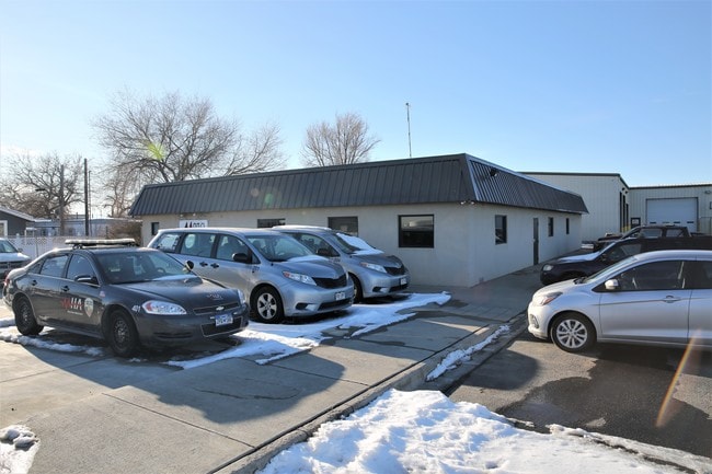
8451 Brighton Rd
1721-29-2-00-027
SECT,TWN,RNG:29-2-67 DESC: BEG AT A PT ON NWLY LN OF BRIGHTON BLVD WHICH IS 30 FT N AND 295/7 FT W OF SE COR SW4 NW4 SEC 29 TH N 26D 30M E ALG NWLY LN OF SD BLVD 420 FT TO TRUE POB TH N 26D 30M E ALG SD NWLY LN 130 FT TH N 63D 54M W 288/35 FT TO A PT
Miscellaneous
Adams
I1
Colorado
B and X Area of moderate flood hazard, usually the area between the limits of the 100-year and 500-year floods.
0.90 AC
2024
Commerce City
2025
Denver
008802
Denver-Aurora-Centennial, CO
13,600 SF
NEARBY LISTINGS FOR SALE OR LEASE
DEMOGRAPHICS near 8451 Brighton Rd
1 mile
3 mile
5 mile
2024 Total Population
5,749
67,668
198,774
2029 Population
5,878
69,860
205,873
Pop Growth 2024-2029
+ 2.24%
+ 3.24%
+ 3.57%
Average Age
35
36
36
2024 Total Households
1,606
21,690
66,740
HH Growth 2024-2029
+ 2.43%
+ 3.51%
+ 3.85%
Median Household Inc
$73,168
$81,523
$89,050
Avg Household Size
3.40
3.00
2.90
2024 Avg HH Vehicles
3.00
2.00
2.00
Median Home Value
$327,728
$394,776
$444,572
Median Year Built
1969
1978
1985
Nearby Places
Map Layers
Map Styles
 Street
 Aerial
Transit
 Traffic
 Biking
Places
Listings with unknown addresses are not visible on the map
- Restaurants
- Banks
- Shops
- Fitness
- Groceries
PUBLIC TRANSPORTATION
COMMUTER RAIL
Commerce City - 72Nd Station Track 1 (Union Station to Eastlake & 124th Station - Regional Transportation District)
Drive
Walk
Distance
Commerce City - 72Nd Station Track 1 (Union Station to Eastlake & 124th Station - Regional Transportation District)
6 min
2.6 mi
Original Thornton - 88Th Station Track 1 (Union Station to Eastlake & 124th Station - Regional Transportation District)
Drive
Walk
Distance
Original Thornton - 88Th Station Track 1 (Union Station to Eastlake & 124th Station - Regional Transportation District)
7 min
3.2 mi
AIRPORT
Denver International
Drive
Walk
Distance
Denver International
28 min
17.9 mi
Freight Ports
Tulsa Port Of Catoosa
Drive
Walk
Distance
Tulsa Port Of Catoosa
729 min
709.2 mi
SALE & LEASE HISTORY
LISTING DATE
SALE/LEASE

Nov 10, 2016
For Lease
Jun 12, 2017
For Sale
Dec 04, 2019
For Sale
Nearby Properties
Address
Land Use
TOTAL SIZE
Lot Size
Zoning
Address
Land Use
TOTAL SIZE
Lot Size
Zoning
295,558 SF
13.41 AC
Address
Land Use
TOTAL SIZE
Lot Size
Zoning
256,155 SF
3.84 AC
Address
Land Use
TOTAL SIZE
Lot Size
Zoning
106,680 SF
17.39 AC
Address
Land Use
TOTAL SIZE
Lot Size
Zoning
140,328 SF
6.54 AC
PUD
Address
Land Use
TOTAL SIZE
Lot Size
Zoning
17,063 SF
2.01 AC
Address
Land Use
TOTAL SIZE
Lot Size
Zoning
649,540 SF
33.65 AC
Address
Land Use
TOTAL SIZE
Lot Size
Zoning
134,729 SF
5.57 AC
Address
Land Use
TOTAL SIZE
Lot Size
Zoning
74,106 SF
3.95 AC
PUD
Address
Land Use
TOTAL SIZE
Lot Size
Zoning
296,000 SF
52.44 AC
A3
Address
Land Use
TOTAL SIZE
Lot Size
Zoning
549,866 SF
33.82 AC
Address
Land Use
TOTAL SIZE
Lot Size
Zoning
91,326 SF
5.09 AC
Address
Land Use
TOTAL SIZE
Lot Size
Zoning
94,213 SF
3.84 AC
A1
Address
Land Use
TOTAL SIZE
Lot Size
Zoning
85,738 SF
4.43 AC
Address
Land Use
TOTAL SIZE
Lot Size
Zoning
282,144 SF
4.01 AC
Address
Land Use
TOTAL SIZE
Lot Size
Zoning
616.10 AC
A3
Address
Land Use
TOTAL SIZE
Lot Size
Zoning
328,674 SF
47.13 AC
Address
Land Use
TOTAL SIZE
Lot Size
Zoning
329,940 SF
10.31 AC
Address
Land Use
TOTAL SIZE
Lot Size
Zoning
11,200 SF
36.45 AC
A1
Address
Land Use
TOTAL SIZE
Lot Size
Zoning
250,523 SF
70.73 AC
I1
Address
Land Use
TOTAL SIZE
Lot Size
Zoning
109,372 SF
13.18 AC
Address
Land Use
TOTAL SIZE
Lot Size
Zoning
172,816 SF
59.89 AC
Address
Land Use
TOTAL SIZE
Lot Size
Zoning
459,283 SF
16.88 AC
Address
Land Use
TOTAL SIZE
Lot Size
Zoning
258,279 SF
70.11 AC
I2
Address
Land Use
TOTAL SIZE
Lot Size
Zoning
219,959 SF
10 AC
Address
Land Use
TOTAL SIZE
Lot Size
Zoning
208,864 SF
19.26 AC
Address
Land Use
TOTAL SIZE
Lot Size
Zoning
312,218 SF
31.14 AC
Address
Land Use
TOTAL SIZE
Lot Size
Zoning
2,240 SF
128.54 AC
A1
Address
Land Use
TOTAL SIZE
Lot Size
Zoning
199,500 SF
15.03 AC
Address
Land Use
TOTAL SIZE
Lot Size
Zoning
204,000 SF
9.96 AC
Address
Land Use
TOTAL SIZE
Lot Size
Zoning
71,966 SF
11.65 AC
R1C
The World's #1 Commercial Real Estate Marketplace
Connect with us
© 2026 CoStar Group
The information above has been obtained from sources believed reliable. While we do not doubt its accuracy we have not verified it and make no guarantee, warranty or representation about it. It is your responsibility to independently confirm its accuracy and completeness. Any projections, opinions, assumptions, or estimates used are for example only and do not represent the current or future performance of the property. The value of this transaction to you depends on tax and other factors which should be evaluated by your tax, financial, and legal advisors. You and your advisors should conduct a careful, independent investigation of the property to determine to your satisfaction the suitability of the property for your needs.