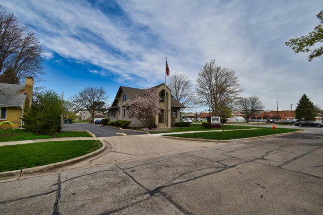
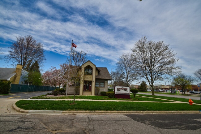
Property Record
849 N Ellsworth St, Naperville, IL 60563

This Property Is For Sale
Current Lease Availabilities
Property Detail
849 N Ellsworth St
Chicago-Naperville-Elgin, IL-IN
PARK ADD
08-07-314-009
DuPage
Commercialnec
Illinois
C
1
B and X Area of moderate flood hazard, usually the area between the limits of the 100-year and 500-year floods.
0.31 AC
2024
Western East/West Corr
2024
Chicago
846105
NEARBY LISTINGS FOR SALE OR LEASE
DEMOGRAPHICS near 849 N Ellsworth St
1 mile
3 mile
5 mile
2025 Total Population
14,633
86,116
213,352
2030 Population
14,939
87,721
216,281
Pop Growth 2025-2030
+ 2.09%
+ 1.86%
+ 1.37%
Average Age
41
41
41
2025 Total Households
5,573
32,768
82,308
HH Growth 2025-2030
+ 2.17%
+ 1.95%
+ 1.43%
Median Household Inc
$129,723
$125,829
$121,585
Avg Household Size
2.40
2.50
2.50
2025 Avg HH Vehicles
2.00
2.00
2.00
Median Home Value
$554,479
$498,157
$456,183
Median Year Built
1976
1982
1983
Nearby Places
Map Layers
Map Styles
 Street
 Aerial
Layers
 Traffic
 Biking
Places
Listings with unknown addresses are not visible on the map
- Restaurants
- Banks
- Shops
- Fitness
- Groceries
PUBLIC TRANSPORTATION
COMMUTER RAIL
Naperville Station (Burlington Northern-Santa Fe Railway Line - Northeast Illinois Regional Commuter Railroad (Metra))
Drive
Walk
Distance
Naperville Station (Burlington Northern-Santa Fe Railway Line - Northeast Illinois Regional Commuter Railroad (Metra))
2 min
8 min
0.4 mi
Route 59 Station (Burlington Northern-Santa Fe Railway Line - Northeast Illinois Regional Commuter Railroad (Metra))
Drive
Walk
Distance
Route 59 Station (Burlington Northern-Santa Fe Railway Line - Northeast Illinois Regional Commuter Railroad (Metra))
8 min
3.8 mi
AIRPORT
Chicago Midway International
Drive
Walk
Distance
Chicago Midway International
41 min
26.1 mi
Chicago O'Hare International
Drive
Walk
Distance
Chicago O'Hare International
41 min
27.0 mi
Freight Ports
Port Milwaukee
Drive
Walk
Distance
Port Milwaukee
122 min
98.7 mi
Nearby Properties
Address
Land Use
TOTAL SIZE
Lot Size
Zoning
Address
Land Use
TOTAL SIZE
Lot Size
Zoning
83.99 AC
Address
Land Use
TOTAL SIZE
Lot Size
Zoning
29.20 AC
C
Address
Land Use
TOTAL SIZE
Lot Size
Zoning
Address
Land Use
TOTAL SIZE
Lot Size
Zoning
17.59 AC
Address
Land Use
TOTAL SIZE
Lot Size
Zoning
31.66 AC
C
Address
Land Use
TOTAL SIZE
Lot Size
Zoning
6.03 AC
M
Address
Land Use
TOTAL SIZE
Lot Size
Zoning
Address
Land Use
TOTAL SIZE
Lot Size
Zoning
Address
Land Use
TOTAL SIZE
Lot Size
Zoning
797,399 SF
52.38 AC
C
Address
Land Use
TOTAL SIZE
Lot Size
Zoning
272,400 SF
20.94 AC
C
Address
Land Use
TOTAL SIZE
Lot Size
Zoning
20.05 AC
C
Address
Land Use
TOTAL SIZE
Lot Size
Zoning
25 AC
M
Address
Land Use
TOTAL SIZE
Lot Size
Zoning
9.18 AC
C
Address
Land Use
TOTAL SIZE
Lot Size
Zoning
15.33 AC
I
Address
Land Use
TOTAL SIZE
Lot Size
Zoning
5.43 AC
Address
Land Use
TOTAL SIZE
Lot Size
Zoning
8.36 AC
C
Address
Land Use
TOTAL SIZE
Lot Size
Zoning
266,118 SF
21.65 AC
C
Address
Land Use
TOTAL SIZE
Lot Size
Zoning
1,059,897 SF
122.10 AC
C
Address
Land Use
TOTAL SIZE
Lot Size
Zoning
721,600 SF
34.74 AC
I
Address
Land Use
TOTAL SIZE
Lot Size
Zoning
16.15 AC
M
Address
Land Use
TOTAL SIZE
Lot Size
Zoning
166,222 SF
8.81 AC
C
Address
Land Use
TOTAL SIZE
Lot Size
Zoning
15.61 AC
M
Address
Land Use
TOTAL SIZE
Lot Size
Zoning
13.67 AC
M
Address
Land Use
TOTAL SIZE
Lot Size
Zoning
14.68 AC
I
Address
Land Use
TOTAL SIZE
Lot Size
Zoning
6.59 AC
Address
Land Use
TOTAL SIZE
Lot Size
Zoning
16.26 AC
C
Address
Land Use
TOTAL SIZE
Lot Size
Zoning
13.42 AC
Address
Land Use
TOTAL SIZE
Lot Size
Zoning
127,295 SF
1.44 AC
B
Address
Land Use
TOTAL SIZE
Lot Size
Zoning
13.27 AC
M
Address
Land Use
TOTAL SIZE
Lot Size
Zoning
14.34 AC
C
The World's #1 Commercial Real Estate Marketplace
Connect with us
© 2026 CoStar Group
The information above has been obtained from sources believed reliable. While we do not doubt its accuracy we have not verified it and make no guarantee, warranty or representation about it. It is your responsibility to independently confirm its accuracy and completeness. Any projections, opinions, assumptions, or estimates used are for example only and do not represent the current or future performance of the property. The value of this transaction to you depends on tax and other factors which should be evaluated by your tax, financial, and legal advisors. You and your advisors should conduct a careful, independent investigation of the property to determine to your satisfaction the suitability of the property for your needs.